Size of this preview: 800 × 480 pixels. Other resolutions: 320 × 192 pixels | 1,024 × 614 pixels | 1,500 × 900 pixels.
Original file (1,500 × 900 pixels, file size: 644 KB, MIME type: image/jpeg)
| This is a file from the Wikimedia Commons. Information from its description page there is shown below. Commons is a freely licensed media file repository. You can help. |
| Description |
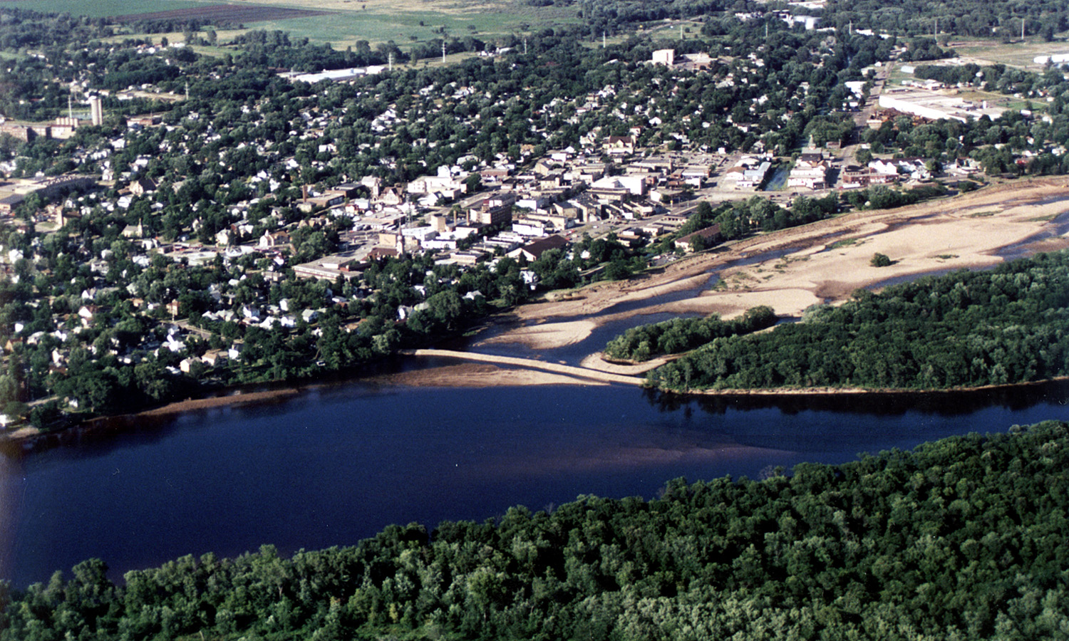
English: Aerial view of the City of Portage, Wisconsin, USA on the Wisconsin River. Upstream end of project showing cofferdam protecting river borrow area. Portage canal leading to the Fox River, visible on the right. |
|||
| Date | ||||
| Source |
U.S. Army Corps of Engineers Digital Visual Library Image page Image description page Digital Visual Library home page |
|||
| Author | Tom Crump, U.S. Army Corps of Engineers | |||
| Permission (Reusing this file) |
|
|||
| Location | Portage, Wisconsin, USA |
| Camera location | | View this and other nearby images on: OpenStreetMap |
|---|
File history
Click on a date/time to view the file as it appeared at that time.
| Date/Time | Thumbnail | Dimensions | User | Comment | |
|---|---|---|---|---|---|
| current | 03:15, 7 April 2007 | | 1,500 × 900 (644 KB) | DanMS | {{Information | Description = {{en|Aerial view of the City of Portage, Wisconsin, USA on the Wisconsin River. Upstream end of project showing cofferdam protecting river borrow area. Portage canal leading to the Fox River, visible on the right.}} | |
File usage
The following pages on the English Wikipedia use this file (pages on other projects are not listed):
Global file usage
The following other wikis use this file:
- Usage on de.wikipedia.org
- Usage on eo.wikipedia.org
- Usage on es.wikipedia.org
- Usage on fr.wikipedia.org
- Usage on simple.wikipedia.org