
Size of this preview: 763 × 600 pixels. Other resolutions: 306 × 240 pixels | 611 × 480 pixels | 978 × 768 pixels | 1,280 × 1,006 pixels | 1,582 × 1,243 pixels.
Original file (1,582 × 1,243 pixels, file size: 360 KB, MIME type: image/jpeg)
| This is a file from the Wikimedia Commons. Information from its description page there is shown below. Commons is a freely licensed media file repository. You can help. |
Summary
| Description |
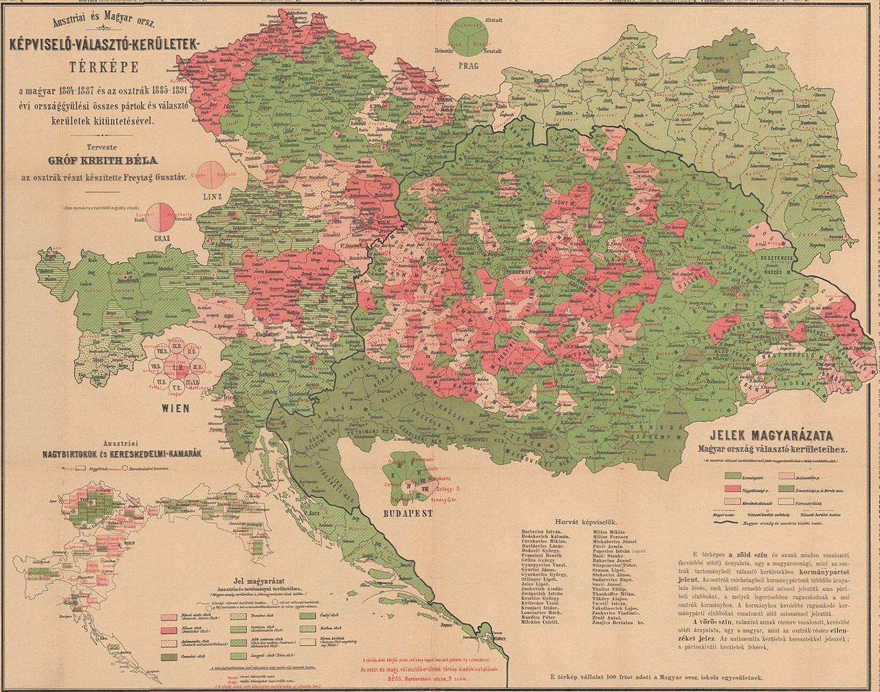
English: Political map of the Ausgleich. Electoral districts with majority of the A-H compromise supporter parties are in green. Electoral districts with majority against the A-H compromise are in red/purple. The map is based on the Austrian general elections between 1885-1889, and the Hungarian parliamentary elections between 1884-1887. |
| Date | |
| Source | https://m.blog.hu/pa/pangea/image/monarchia.jpg |
| Author | Count Béla Kreith and Gustav Freytag |
Licensing
|
This work is in the public domain in its country of origin and other countries and areas where the copyright term is the author's life plus 70 years or fewer. This work is in the public domain in the United States because it was published (or registered with the U.S. Copyright Office) before January 1, 1929. | |
| This file has been identified as being free of known restrictions under copyright law, including all related and neighboring rights. | |
File history
Click on a date/time to view the file as it appeared at that time.
| Date/Time | Thumbnail | Dimensions | User | Comment | |
|---|---|---|---|---|---|
| current | 13:52, 12 June 2019 | | 1,582 × 1,243 (360 KB) | Draguler | User created page with UploadWizard |
File usage
The following pages on the English Wikipedia use this file (pages on other projects are not listed):
Global file usage
The following other wikis use this file:
- Usage on id.wikipedia.org
- Usage on vi.wikipedia.org