Size of this preview: 776 × 600 pixels. Other resolutions: 311 × 240 pixels | 621 × 480 pixels | 994 × 768 pixels | 1,056 × 816 pixels.
Original file (1,056 × 816 pixels, file size: 21 KB, MIME type: image/png)
| This is a file from the Wikimedia Commons. Information from its description page there is shown below. Commons is a freely licensed media file repository. You can help. |
| Description |
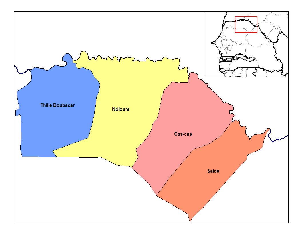
1989: Thillé Boubacar - Ndioum - Cas-Cas - Saldé 1990: Thillé Boubacar - Gamadji Saré - Cas-Cas - Saldé English: Map of the arrondissements of Podor department in Senegal.
Français : Carte des arrondissements du département de Podor au Sénégal. |
| Date | |
| Source | Own work |
| Author | Rarelibra, using MapInfo Professional v8.5 and various mapping resources. |
| I, the copyright holder of this work, release this work into the public domain. This applies worldwide. In some countries this may not be legally possible; if so: I grant anyone the right to use this work for any purpose, without any conditions, unless such conditions are required by law. |
File history
Click on a date/time to view the file as it appeared at that time.
| Date/Time | Thumbnail | Dimensions | User | Comment | |
|---|---|---|---|---|---|
| current | 17:50, 2 January 2007 | | 1,056 × 816 (21 KB) | Rarelibra | Map of the arrondissements of Podor department in Senegal. Created by ~~~~ for public domain use, using MapInfo Professional v8.5 and various mapping resources. |
File usage
The following pages on the English Wikipedia use this file (pages on other projects are not listed):
Global file usage
The following other wikis use this file:
- Usage on fr.wikipedia.org
- Usage on ha.wikipedia.org
- Usage on ig.wikipedia.org
- Usage on it.wikipedia.org
- Usage on ja.wikipedia.org
- Usage on pt.wikipedia.org
- Usage on ts.wikipedia.org
- Usage on www.wikidata.org
- Usage on wo.wikipedia.org
- Usage on yo.wikipedia.org