Size of this preview: 800 × 536 pixels. Other resolutions: 320 × 214 pixels | 640 × 428 pixels | 1,024 × 685 pixels | 1,280 × 857 pixels | 2,560 × 1,714 pixels | 3,872 × 2,592 pixels.
Original file (3,872 × 2,592 pixels, file size: 5.22 MB, MIME type: image/jpeg)
| This is a file from the Wikimedia Commons. Information from its description page there is shown below. Commons is a freely licensed media file repository. You can help. |
Summary
| Description |
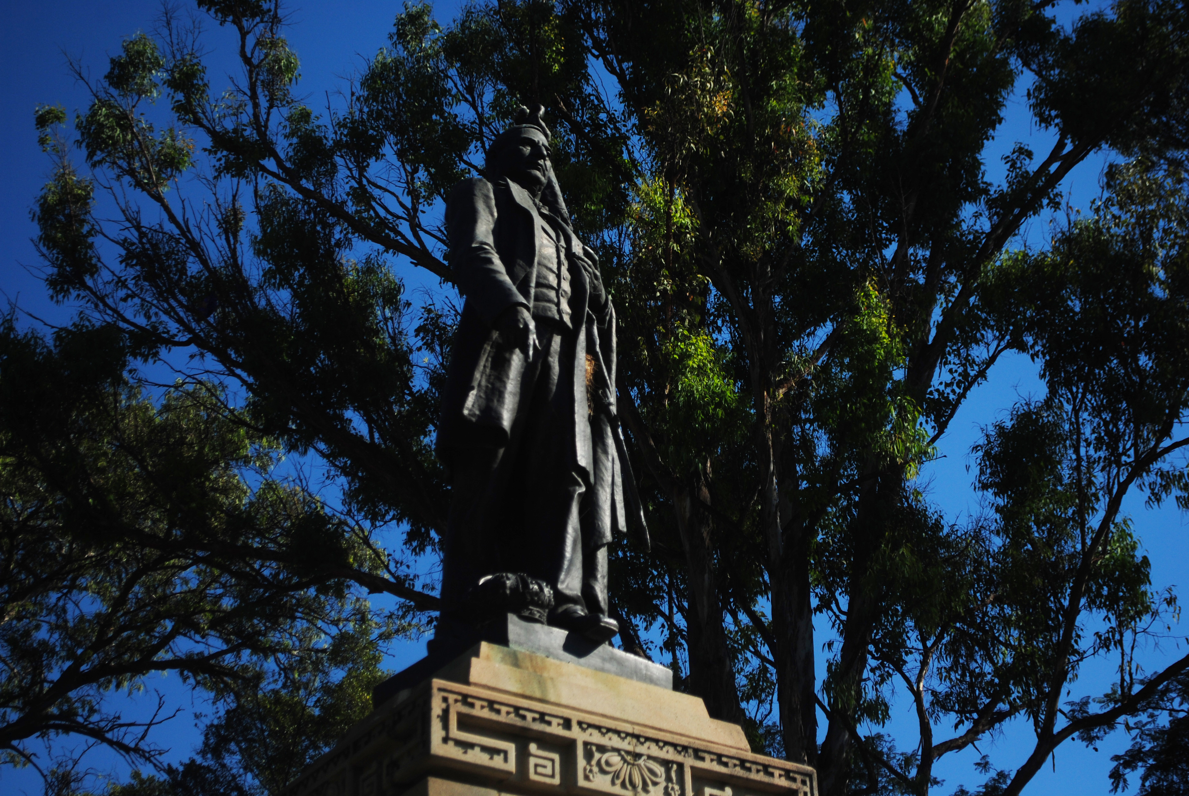
Español: Escultura de Benito Juárez hecha en 1894 en el Paseo Juárez "El Llano", un parque público del Centro histórico de Oaxaca de Juárez, uno de los más antiguos de dicha urbe. Juárez sostiene con una mano la bandera mexicana, y con la otra señala a la corona imperial de Maximiliano I de México, que permanece en el suelo representando la derrota del Segundo Imperio Mexicano. English: Sculpture of Benito Juárez made in 1894 at Paseo Juárez "El Llano" a public park in the Historic Centre of Oaxaca, one of the oldest of the city. Juárez holds a Mexican flag with one hand and with the other is pointing Maximilian's Imperial Crown of Mexico which remains in the soil, representing the defeat of the Second Mexican Empire. Deutsch: Skulptur von Benito Juárez 1894 bei Paseo Juárez "El Llano" einem öffentlichen Park in der Altstadt von Oaxaca, eine der ältesten der Stadt gemacht. Juárez hat einen mexikanischen Flagge mit einer Hand und mit der andere zeigt Maximilians Kaiserkrone von Mexiko, die in der Erde bleibt, als Vertreter der zerstörerisch des Kaiserreich Mexiko. |
||
| Date | |||
| Source | Own work | ||
| Author | ProtoplasmaKid | ||
| Permission (Reusing this file) |
|

| Camera location | | View this and other nearby images on: OpenStreetMap |
|---|
Licensing
I, the copyright holder of this work, hereby publish it under the following license:
This file is licensed under the Creative Commons Attribution-Share Alike 4.0 International license.
- You are free:
- to share – to copy, distribute and transmit the work
- to remix – to adapt the work
- Under the following conditions:
- attribution – You must give appropriate credit, provide a link to the license, and indicate if changes were made. You may do so in any reasonable manner, but not in any way that suggests the licensor endorses you or your use.
- share alike – If you remix, transform, or build upon the material, you must distribute your contributions under the same or compatible license as the original.
| Annotations | This image is annotated: View the annotations at Commons |
File history
Click on a date/time to view the file as it appeared at that time.
| Date/Time | Thumbnail | Dimensions | User | Comment | |
|---|---|---|---|---|---|
| current | 09:01, 5 April 2015 | | 3,872 × 2,592 (5.22 MB) | ProtoplasmaKid | User created page with UploadWizard |
File usage
The following pages on the English Wikipedia use this file (pages on other projects are not listed):
Global file usage
The following other wikis use this file:
- Usage on ast.wikipedia.org
- Usage on es.wikipedia.org