
Size of this PNG preview of this SVG file: 800 × 542 pixels. Other resolutions: 320 × 217 pixels | 640 × 434 pixels | 1,024 × 694 pixels | 1,280 × 868 pixels | 2,560 × 1,736 pixels | 1,000 × 678 pixels.
Original file (SVG file, nominally 1,000 × 678 pixels, file size: 73 KB)
| This is a file from the Wikimedia Commons. Information from its description page there is shown below. Commons is a freely licensed media file repository. You can help. |
Summary
| Description |
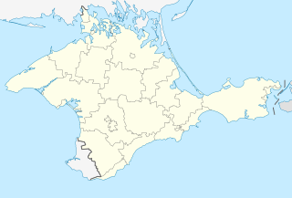
Русский: Позиционная карта Автономной Республики Крым (1993—2014/2023)
Равноугольная проекция, стандартная параллель — 45°15′с.ш. Параметры шаблона (координаты краёв): Українська: Позиційна мапа Автономної Республіки Крим (1993—2014/2023)
Рівнокутна проєкція, стандартна паралель — 45°15′с.ш. Параметри шаблона (координати країв): English: Location map of the Autonomous Republic of Crimea (1993—2014/2023)
Conformal projection, standard parallels — 45°15's.W. Template parameters (coordinates of the edges):
|
| Date | |
| Source |
|
| Author | Виктор В |
| Other versions |
Derivative works of this file: |
.svg)
.svg)
Licensing
| I, the copyright holder of this work, release this work into the public domain. This applies worldwide. In some countries this may not be legally possible; if so: I grant anyone the right to use this work for any purpose, without any conditions, unless such conditions are required by law. |
File history
Click on a date/time to view the file as it appeared at that time.
| Date/Time | Thumbnail | Dimensions | User | Comment | |
|---|---|---|---|---|---|
| current | 13:32, 4 June 2014 | | 1,000 × 678 (73 KB) | NordNordWest | Reverted to version as of 14:34, 5 April 2014; see talk page |
| 13:21, 4 June 2014 |  | 1,000 × 678 (82 KB) | RuEsMaxim | Reverted to version as of 14:00, 5 April 2014 | |
| 14:34, 5 April 2014 |  | 1,000 × 678 (73 KB) | Ahonc | Reverted to version as of 22:03, 21 March 2014: see talk page | |
| 14:00, 5 April 2014 |  | 1,000 × 678 (82 KB) | NoviSadGrad | Crimea is now a part of Russia | |
| 22:03, 21 March 2014 |  | 1,000 × 678 (73 KB) | Russavia | Reverted to version as of 17:45, 21 March 2014 | |
| 20:42, 21 March 2014 |  | 1,000 × 678 (82 KB) | Nicolay Sidorov | Crimea is a part of Russia. Ukraine is a failed state. | |
| 17:45, 21 March 2014 |  | 1,000 × 678 (73 KB) | Bobek | Reverted to version as of 19:49, 6 December 2010 | |
| 16:43, 21 March 2014 |  | 1,000 × 678 (55 KB) | NordNordWest | as Crimea is disputed neither Ukraine nor Russia is shown is dark grey | |
| 15:38, 21 March 2014 |  | 1,000 × 678 (82 KB) | Nicolay Sidorov | change colour (Russia <-> Ukraine) | |
| 19:49, 6 December 2010 |  | 1,000 × 678 (73 KB) | Виктор В | == {{int:filedesc}} == {{Information |Description={{ru|1=Позиционная карта Автономной Республики Крым<br>Равноугольная проекция, стандартная параллель — 45°15′с.ш.<br> |
File usage
The following pages on the English Wikipedia use this file (pages on other projects are not listed):
Global file usage
The following other wikis use this file:
- Usage on ar.wikipedia.org
- Usage on azb.wikipedia.org
- Usage on be.wikipedia.org
- Абрыкосавэ (Крым)
- Абрыкосіўка (Кіраўскі раён)
- Абрыкосіўка (Сакскі раён)
- Азоў (Крым)
- Азоўскэ (Лэнінскі раён)
- Айвазоўскэ
- Айвовэ
- Алмазнэ (Крым)
- Алэксееўка (Білагірскі раён)
- Амурскэ
- Анніўка
- Андрусавэ
- Антоніўка (Джанкойскі раён)
- Апрэліўка (Джанкойскі раён)
- Арамат
- Араматнэ (Бахчысарайскі раён)
- Араматнэ (Білагірскі раён)
- Арбузавэ
- Арбузіўка
- Аркадзііўка (Крым)
- Армійскэ
- Артэміўка (Чарнаморскі раён)
- Аўрора (Крым)
- Бабэнкавэ (Крым)
- Багата-Ушчэлына
- Багатыр (Крым)
- Багатэ (Білагірскі раён)
- Багаціўка (Крым)
- Багачыўка (Крым)
- Баланавэ (Крым)
- Балкы (Білагірскі раён)
- Балотнэ
- Бандарэнкавэ
- Барабанавэ
- Барадзіно (Крым)
- Барсавэ
- Барысіўка (Лэнінскі раён)
- Батальнэ
- Батанічнэ
- Бахчыўка
- Баштаніўка
- Білаглынка
- Білакам’янэ
- Біла-Скэля
- Бэрэгавэ (Бахчысарайскі раён)
- Бэрэгавэ (Феадосія)
- Благадатнэ (Крым)
- Блыжнёгародскэ
View more global usage of this file.