
Size of this PNG preview of this SVG file: 800 × 438 pixels. Other resolutions: 320 × 175 pixels | 640 × 351 pixels | 1,024 × 561 pixels | 1,280 × 701 pixels | 2,560 × 1,403 pixels | 7,893 × 4,325 pixels.
Original file (SVG file, nominally 7,893 × 4,325 pixels, file size: 168 KB)
| This is a file from the Wikimedia Commons. Information from its description page there is shown below. Commons is a freely licensed media file repository. You can help. |
Summary
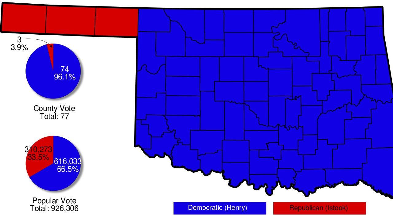
| Description | A map of Oklahoma with pie charts and counties shaded to indicate voting in the 2006 gubernatorial election. |
| Date | |
| Source | Based on Image:Map of Oklahoma highlighting Alfalfa County.svg by David Benbennick |
| Author | Scott Nazelrod |
| Permission (Reusing this file) |
PD |
Licensing
| I, the copyright holder of this work, release this work into the public domain. This applies worldwide. In some countries this may not be legally possible; if so: I grant anyone the right to use this work for any purpose, without any conditions, unless such conditions are required by law. |
File history
Click on a date/time to view the file as it appeared at that time.
| Date/Time | Thumbnail | Dimensions | User | Comment | |
|---|---|---|---|---|---|
| current | 01:10, 19 April 2008 | | 7,893 × 4,325 (168 KB) | Scott5114 | {{Information |Description=A map of Oklahoma with pie charts and counties shaded to indicate voting in the 2006 gubernatorial election. |Source=Based on Image:Map of Oklahoma highlighting Alfalfa County.svg by [[User:David Benbennick|David Benbennick |
File usage
The following pages on the English Wikipedia use this file (pages on other projects are not listed):
Global file usage
The following other wikis use this file:
- Usage on pt.wikipedia.org