No higher resolution available.
OK_district_5.gif (635 × 379 pixels, file size: 27 KB, MIME type: image/gif)
| This is a file from the Wikimedia Commons. Information from its description page there is shown below. Commons is a freely licensed media file repository. You can help. |
| Description |
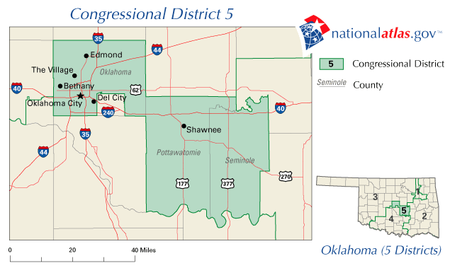
English: Oklahoma District Five. Image adapted from US fed gov't source nationalatlas.gov |
|||
| Source | http://nationalatlas.gov | |||
| Author | USGS | |||
| Permission (Reusing this file) |
|
Original upload log
The original description page was here. All following user names refer to en.wikipedia.
- 2006-11-02 05:46 Rougher07 635×379× (27670 bytes) {{PD-USGov}} Image adapted from US fed gov't source nationalatlas.gov
File history
Click on a date/time to view the file as it appeared at that time.
| Date/Time | Thumbnail | Dimensions | User | Comment | |
|---|---|---|---|---|---|
| current | 20:51, 12 January 2012 | | 635 × 379 (27 KB) | MGA73bot2 | {{BotMoveToCommons|en.wikipedia|year={{subst:CURRENTYEAR}}|month={{subst:CURRENTMONTHNAME}}|day={{subst:CURRENTDAY}}}} {{Information |Description={{en|Image adapted from US fed gov't source nationalatlas.gov}} |Source=Transferred from [http://en.wikiped |
File usage
The following pages on the English Wikipedia use this file (pages on other projects are not listed):