Size of this preview: 698 × 600 pixels. Other resolutions: 279 × 240 pixels | 559 × 480 pixels | 894 × 768 pixels | 1,192 × 1,024 pixels | 2,550 × 2,191 pixels.
Original file (2,550 × 2,191 pixels, file size: 126 KB, MIME type: image/png)
| This is a file from the Wikimedia Commons. Information from its description page there is shown below. Commons is a freely licensed media file repository. You can help. |
Summary
| Description |
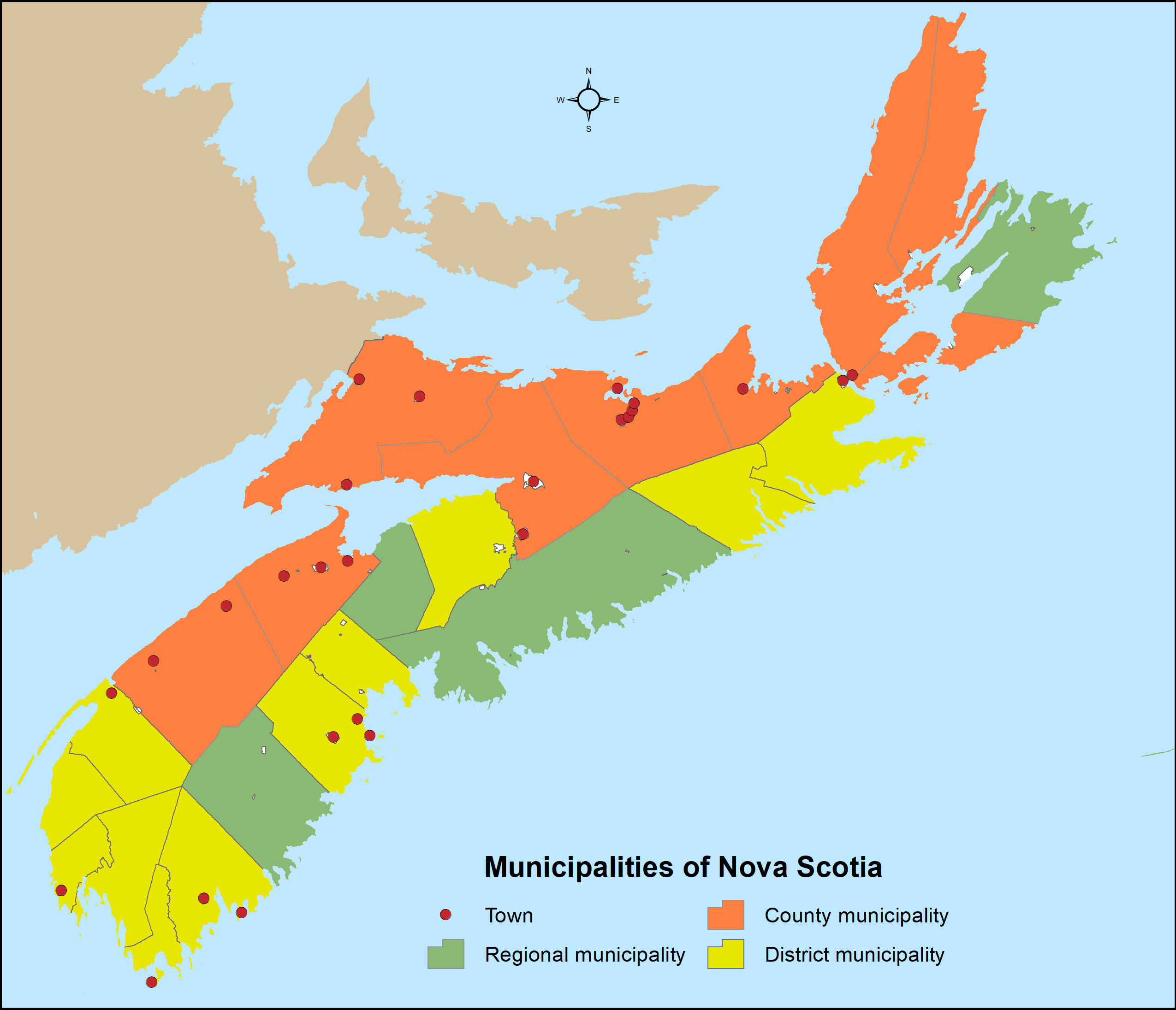
English: Distribution of Nova Scotia's 49 municipalities (4 regional municipalities, 9 county municipalities, 12 district municipalities and 25 towns) utilizing Statistics Canada's 2016 census subdivision boundaries. |
| Date | |
| Source | Own work |
| Author | Hwy43 |
Licensing
I, the copyright holder of this work, hereby publish it under the following license:
This file is licensed under the Creative Commons Attribution 3.0 Unported license.
- You are free:
- to share – to copy, distribute and transmit the work
- to remix – to adapt the work
- Under the following conditions:
- attribution – You must give appropriate credit, provide a link to the license, and indicate if changes were made. You may do so in any reasonable manner, but not in any way that suggests the licensor endorses you or your use.
File history
Click on a date/time to view the file as it appeared at that time.
| Date/Time | Thumbnail | Dimensions | User | Comment | |
|---|---|---|---|---|---|
| current | 19:20, 31 July 2021 | | 2,550 × 2,191 (126 KB) | Hwy43 | Revise to reflect the amalgamation of the Town of Windsor with the Municipality of the District of West Hants to form a new regional municipality named West Hants Regional Municipality.en |
| 09:00, 28 December 2016 |  | 816 × 701 (31 KB) | Hwy43 | Reflect the dissolution of the former Town of Parrsboro | |
| 08:05, 8 December 2016 |  | 816 × 701 (31 KB) | Hwy43 | return accidentally dissolved district municipality boundaries and fix background colour for Prince Edward Island | |
| 02:20, 7 December 2016 |  | 816 × 701 (30 KB) | Hwy43 | hide dissolved towns of Canso and Hantsport and reveal Indian reserves | |
| 03:22, 2 January 2016 |  | 3,400 × 2,921 (198 KB) | Hwy43 | remove towns dissolved since 2011 census | |
| 23:05, 1 January 2016 |  | 3,400 × 2,921 (201 KB) | Hwy43 | Display only those nine historical counties that are incorporated as county municipalities (with symbology changes). | |
| 20:00, 1 January 2016 |  | 3,400 × 2,921 (241 KB) | Hwy43 | User created page with UploadWizard |
File usage
The following pages on the English Wikipedia use this file (pages on other projects are not listed):