
Size of this preview: 511 × 599 pixels. Other resolutions: 205 × 240 pixels | 409 × 480 pixels | 988 × 1,159 pixels.
Original file (988 × 1,159 pixels, file size: 909 KB, MIME type: image/jpeg)
| This is a file from the Wikimedia Commons. Information from its description page there is shown below. Commons is a freely licensed media file repository. You can help. |
| Description |
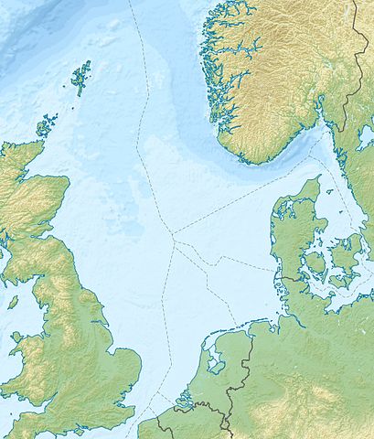
Deutsch: Positionskarte der Nordsee Quadratische Plattkarte, N-S-Streckung 180 %. Geographische Begrenzung der Karte: * N: 62.5° N * S: 50.5° N * W: 5.2° W * O: 13.2° O English: Location map of the North Sea Equirectangular projection, N/S stretching 180 %. Geographic limits of the map: * N: 62.5° N * S: 50.5° N * W: 5.2° W * E: 13.2° E |
| Date | (UTC) |
| Source | |
| Author |
|
| Other versions |
Derivative works of this file: Action of 28 January 1945 map.jpg
|

| This is a retouched picture, which means that it has been digitally altered from its original version. The original can be viewed here: North Sea location map.svg:
|
I, the copyright holder of this work, hereby publish it under the following license:
This file is licensed under the Creative Commons Attribution-Share Alike 3.0 Unported license.
- You are free:
- to share – to copy, distribute and transmit the work
- to remix – to adapt the work
- Under the following conditions:
- attribution – You must give appropriate credit, provide a link to the license, and indicate if changes were made. You may do so in any reasonable manner, but not in any way that suggests the licensor endorses you or your use.
- share alike – If you remix, transform, or build upon the material, you must distribute your contributions under the same or compatible license as the original.
Original upload log
This image is a derivative work of the following images:
- File:North_Sea_location_map.svg licensed with Cc-by-sa-3.0
- 2010-06-18T08:49:38Z NordNordWest 988x1159 (596438 Bytes) == {{int:filedesc}} == {{Information |Description= {{de|Positionskarte der [[:de:Nordsee|Nordsee]]}} Quadratische Plattkarte, N-S-Streckung 180 %. Geographische Begrenzung der Karte: * N: 62.5° N * S: 50.5° N * W: 5.2° W *
Uploaded with derivativeFX
File history
Click on a date/time to view the file as it appeared at that time.
| Date/Time | Thumbnail | Dimensions | User | Comment | |
|---|---|---|---|---|---|
| current | 19:11, 18 June 2010 | | 988 × 1,159 (909 KB) | Uwe Dedering | {{Information |Description={{de|Positionskarte der Nordsee}} Quadratische Plattkarte, N-S-Streckung 180 %. Geographische Begrenzung der Karte: * N: 62.5° N * S: 50.5° N * W: 5.2° W * O: 13.2° O {{en|Location map of the [[:en:North Sea| |
File usage
The following pages on the English Wikipedia use this file (pages on other projects are not listed):
- Alwyn North oil and gas field
- Amethyst gas field
- Amrum Bank
- Andrew oilfield
- Argyll oil field
- Auk oilfield
- Balmoral oil field
- Battle of Margate
- Battle of Ronas Voe
- Battle of Sluys
- Battle of Zutphen
- Battle of the Heligoland Bight (1939)
- Beatrice oil field
- Bentley Oil Field
- Beryl oil field
- Blane oil field
- Brae oilfield
- Brage oil field
- Buchan Oil Field
- Clair oilfield
- Clyde oil field
- Cormorant oilfield
- Douglas Complex
- Dunlin oilfield
- Eider oilfield
- Ekofisk oil field
- Elgin–Franklin fields
- Everest gasfield
- Forties Oil Field
- Fulmar Oil Field
- Gjøa oilfield
- Gorm Field
- Grane oil field
- Gullfaks oil field
- Gyda Oil Field
- Harding oilfield
- Heather oil field
- Heimdal gas field
- Heligoland Bight
- Hutton oilfield
- Johan Sverdrup oil field
- Kotter and Logger oil and gas fields
- Lancaster oilfield
- List of fossiliferous stratigraphic units in Norway
- Lunde Formation
- Magnus oilfield
- Mariner oilfield
- Maureen oil field
- Miller oilfield
- Mittelplate
- Montrose oil field
- Mulciber (volcano)
- Oseberg East
- Oseberg South
- Oseberg oil field
- Oselvar oil field
- Piper Alpha
- Piper oilfield
- SS Abukir
- SS Mount Ida
- Schiehallion oilfield
- Siege of Breda (1624)
- Siege of Breda (1793)
- Siege of Breda (1813)
- Siege of Grave (1586)
- Siege of Grave (1602)
- Siege of Groenlo (1595)
- Siege of Groenlo (1597)
- Siege of Oldenzaal (1597)
- Siege of Oldenzaal (1626)
- Siege of San Andreas (1600)
- Siege of Venlo (1637)
- Siege of Zierikzee
- Siege of Zutphen (1591)
- Skirne gas field
- Skjold oil field
- Sleipner gas field
- Snorre oil field
- Statfjord oil field
- Tambar oil field
- Tartan oil field
- Tern oilfield
- Troll gas field
- Ula oil field
- Vale gas field
- Valhall oil field
- Yme field
- User:Griceylipper/sandbox/Battle of Ronas Voe
- Module:Location map/data/North Sea
- Module:Location map/data/North Sea/doc
Global file usage
The following other wikis use this file:
- Usage on ar.wikipedia.org
- Usage on ast.wikipedia.org
- Usage on az.wikipedia.org
- Usage on be.wikipedia.org
- Usage on ca.wikipedia.org
- Usage on ceb.wikipedia.org
- Usage on cs.wikipedia.org
- Usage on da.wikipedia.org
- Usage on de.wikipedia.org
- Usage on de.wikivoyage.org
- Usage on eo.wikipedia.org
- Usage on es.wikipedia.org
- Usage on fa.wikipedia.org
- Usage on fi.wikipedia.org
- Usage on fr.wikipedia.org
View more global usage of this file.