
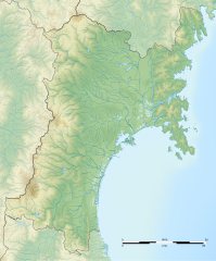
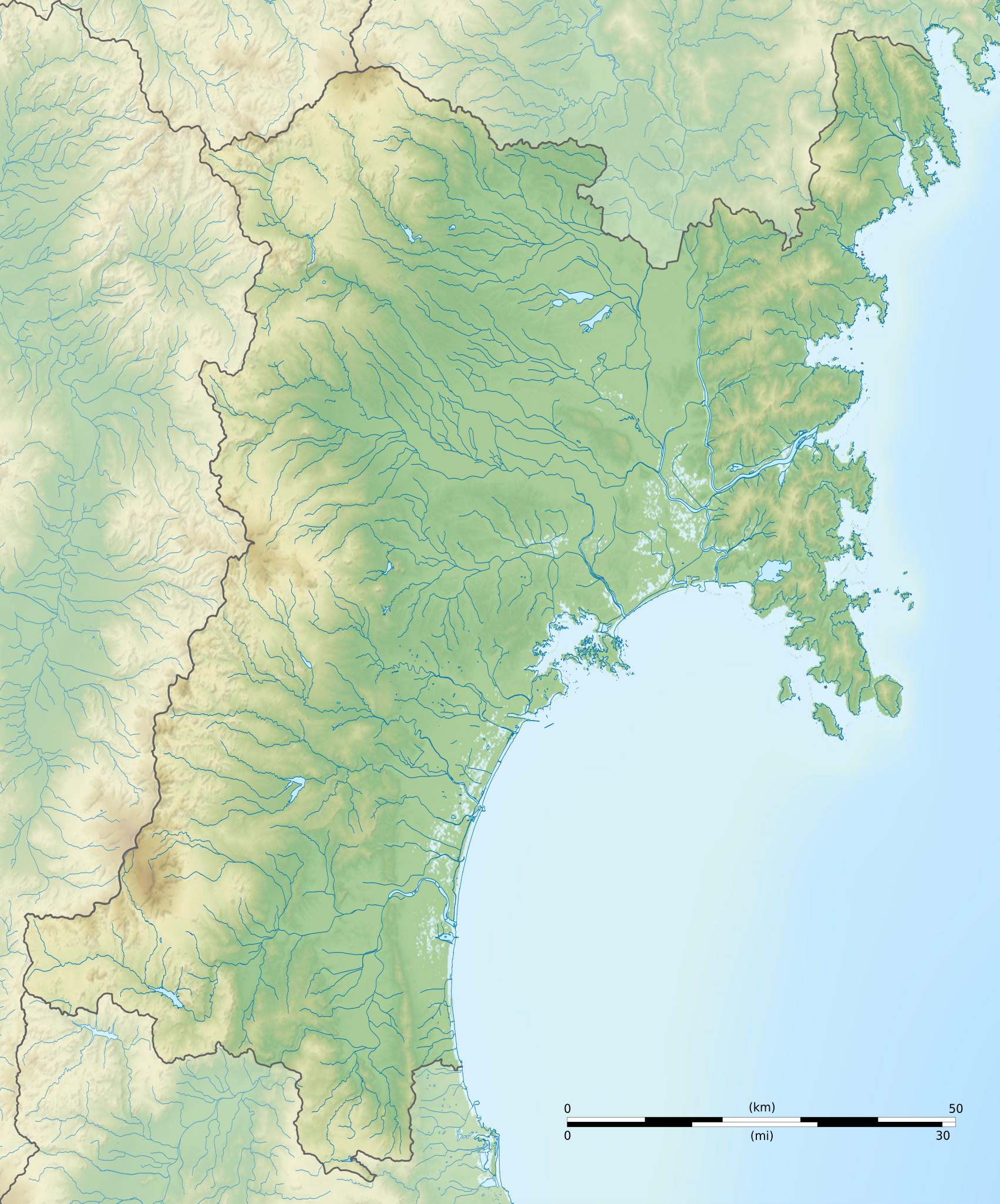
Size of this PNG preview of this SVG file: 498 × 599 pixels. Other resolutions: 199 × 240 pixels | 399 × 480 pixels | 638 × 768 pixels | 851 × 1,024 pixels | 1,702 × 2,048 pixels | 1,703 × 2,049 pixels.
Original file (SVG file, nominally 1,703 × 2,049 pixels, file size: 3.21 MB)
| This is a file from the Wikimedia Commons. Information from its description page there is shown below. Commons is a freely licensed media file repository. You can help. |
Summary
| Camera location | | View this and other nearby images on: OpenStreetMap |
|---|
| Description |
Français : Carte topographique vierge de la Préfecture de Miyagi, au Japon, destinée à la géolocalisation.
Deutsch: Topographische Karte der Präfektur Miyagi.
English: Topographic blank map of the Miyagi Prefecture, for geolocalisation purpose.
Español: Mapa topográfico de la Prefectura de Miyagi.
Italiano: Mappa topografica della Prefettura di Miyagi.
日本語: 宮城県の地図.
Português: Carta topográfica de la província de Miyagi.
|
||
| Date | (UTC) | ||
| Source |
Création personnelle ;
|
||
| Author | © Bourrichon (talk) - fr:Bourrichon | ||
| Permission (Reusing this file) |
|
||
| Other versions | File:Miyagi-ken géolocalisation.svg |
This W3C-unspecified vector image was created with Inkscape .
Licensing
I, the copyright holder of this work, hereby publish it under the following license:
This file is licensed under the Creative Commons Attribution-Share Alike 2.0 France license.
Attribution: Bourrichon (atelier graphique)
- You are free:
- to share – to copy, distribute and transmit the work
- to remix – to adapt the work
- Under the following conditions:
- attribution – You must give appropriate credit, provide a link to the license, and indicate if changes were made. You may do so in any reasonable manner, but not in any way that suggests the licensor endorses you or your use.
- share alike – If you remix, transform, or build upon the material, you must distribute your contributions under the same or compatible license as the original.

File history
Click on a date/time to view the file as it appeared at that time.
| Date/Time | Thumbnail | Dimensions | User | Comment | |
|---|---|---|---|---|---|
| current | 17:10, 10 July 2013 | | 1,703 × 2,049 (3.21 MB) | Bourrichon | erreur |
| 17:05, 10 July 2013 |  | 1,703 × 2,049 (2.9 MB) | Bourrichon | == {{int:filedesc}} == {{Location|38|30|00|N|141|00|00|E|scale:10000}} {{Information |Description= {{fr|Carte topographique vierge de la fr:Préfecture de Miyagi, au Japon, destinée à la géolocalisation.}} {{de|Topographische Ka... |
File usage
The following pages on the English Wikipedia use this file (pages on other projects are not listed):
- Akiu Great Falls
- Aoba Castle
- Aratozawa Dam
- Daigigakoi Shell Mound
- Daikichiyama Tile Kiln Site
- Entsū-in (Matsushima)
- Former Arikabe-juku Honjin
- Funagata Renpō Prefectural Natural Park
- Hanayama Dam
- Higashiyama Kanga ruins
- Hinodeyama Tile Kiln Site
- Iinozaka Kofun Cluster
- Iji Castle
- Irinosawa Site
- Iwadeyama Castle
- Iwakiri Castle
- JCB Classic
- Jō Palisade Site
- Kakuda Space Center
- Kamafusa Dam
- Kamei Arena Sendai
- Kejyonuma Dam
- Kenjōsan Mangokuura Prefectural Natural Park
- Kido Tile Kiln Site
- Koganeyama Shrine
- Kurikoma Dam
- Kurikoma Quasi-National Park
- Kōzō-ji (Kakuda)
- March 2021 Miyagi earthquake
- Matsushima Prefectural Natural Park
- Minamikawa Dam
- Miyatoko Dam
- Miyazawa Site
- Mount Funagata
- Mutsu Kami Kaidō
- Mutsu Kokubun-ji
- Mutsu Kokubun-niji
- Myōdate Kanga ruins
- Nagane Shell Mound
- Naganuma Dam
- Nakayamagoe Pass
- Nakazawame Shell Mound
- Nanakita Dam
- Naruko Dam
- Natori River
- Nishinohama Shell Mound
- Numazu Shell Mound
- Nuruyu Bansho Site
- Oshika Peninsula
- Raijinyama Kofun
- Saitō Garden (Ishinomaki)
- Sakunami Onsen
- Sanjūsangendō Kanga ruins
- Sankai Falls
- Sannō-Gakoi Site
- Satohama shell mound
- Sendai Bay
- Sendai Kōriyama Kanga ruins
- Shichikashuku Dam
- Shiroishi Castle
- Taga Castle
- Tōmizuka Kofun
- Urushizawa Dam
- Xebio Arena Sendai
- Yamahata Cave Tomb Cluster
- Yamamae Site
- Yanase-ura Site
- Yūbikan
- Zaō Kōgen Prefectural Natural Park
- Zaō Quasi-National Park
- Zuigan-ji
- User:Ty654/List of earthquakes from 1960-1964 exceeding magnitude 6+
- User:Ty654/List of earthquakes from 2000-2004 exceeding magnitude 6+
- User:Ty654/List of earthquakes from 2000-present exceeding magnitude 7+
- User:Ty654/List of earthquakes from 2015-2019 exceeding magnitude 6+
- Module:Location map/data/Japan Miyagi Prefecture
- Module:Location map/data/Japan Miyagi Prefecture/doc
Global file usage
The following other wikis use this file:
- Usage on ar.wikipedia.org
- Usage on ceb.wikipedia.org
- Usage on ce.wikipedia.org
- Usage on de.wikipedia.org
- Usage on fa.wikipedia.org
- Usage on fr.wikipedia.org
- Sendai
- Higashimatsushima
- Kurihara
- Tome (Miyagi)
- Ishinomaki
- Kesennuma
- Ōsaki (Miyagi)
- Iwanuma
- Kakuda
- Natori
- Shiroishi
- Tagajō
- Shiogama
- Mont Zaō
- Centrale nucléaire d'Onagawa
- Sportsland SUGO
- Minamisanriku
- Modèle:Géolocalisation/Préfecture de Miyagi
- Ōgawara
- Rifu
- Watari
- Yamamoto (Miyagi)
- Portail:Préfecture de Miyagi
- Portail:Préfecture de Miyagi/Présentation
- Marumori
- Matsushima (Miyagi)
- Shichigahama
- Onagawa
- Misato (Miyagi)
View more global usage of this file.