
Size of this preview: 467 × 600 pixels. Other resolutions: 187 × 240 pixels | 374 × 480 pixels | 598 × 768 pixels | 797 × 1,024 pixels | 2,405 × 3,089 pixels.
Original file (2,405 × 3,089 pixels, file size: 1.77 MB, MIME type: image/gif)
| This is a file from the Wikimedia Commons. Information from its description page there is shown below. Commons is a freely licensed media file repository. You can help. |
Summary
| Description |
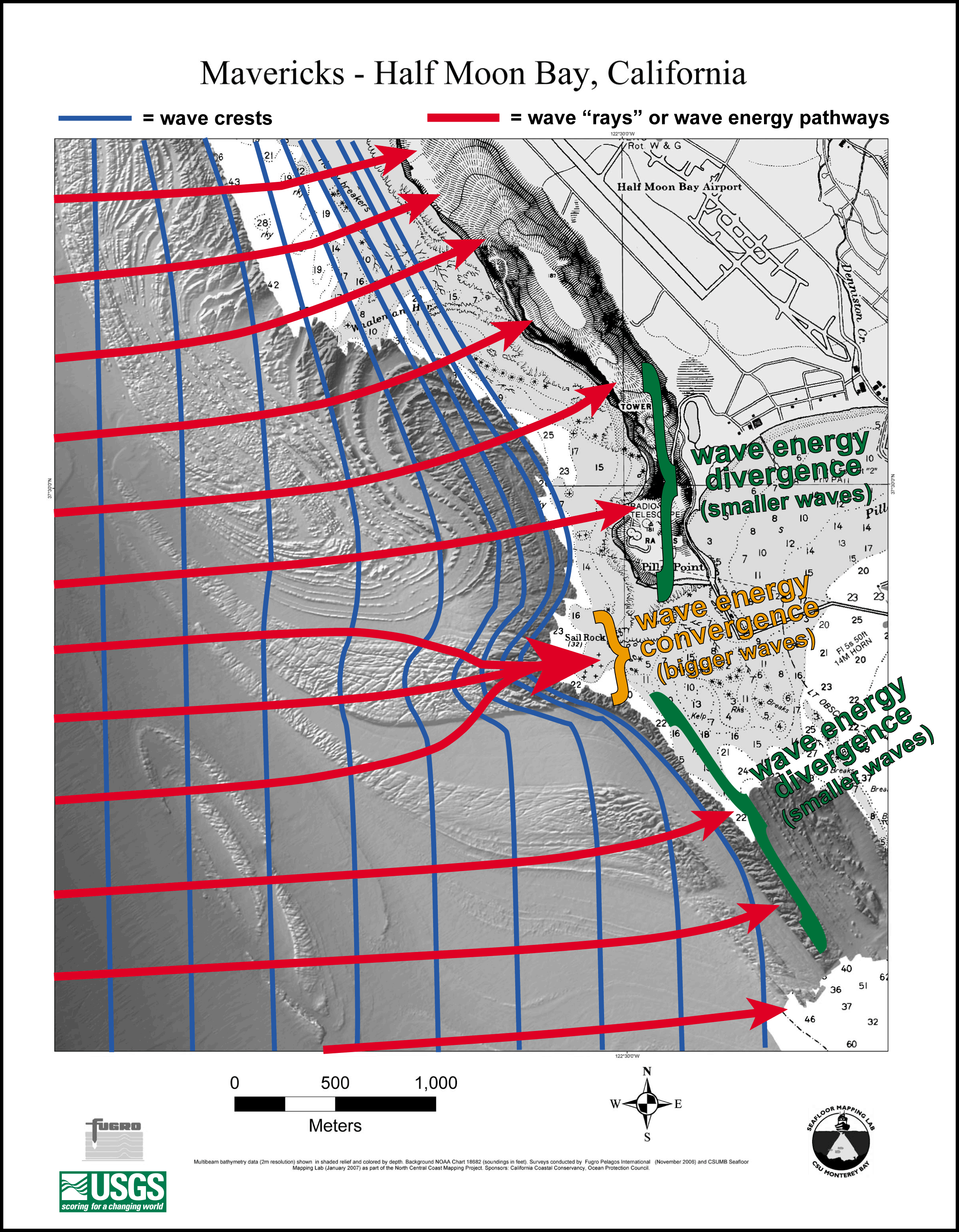
English: Diagram showing the effect of the bathymetry near the Mavericks surf break on the waves there. |
| Date | |
| Source | Diagram here, description here |
| Author | NOAA |
| Camera location | | View this and other nearby images on: OpenStreetMap |
|---|
Licensing
This image is in the public domain because it contains materials that originally came from the U.S. National Oceanic and Atmospheric Administration, taken or made as part of an employee's official duties.
|
File history
Click on a date/time to view the file as it appeared at that time.
| Date/Time | Thumbnail | Dimensions | User | Comment | |
|---|---|---|---|---|---|
| current | 01:37, 15 February 2010 | | 2,405 × 3,089 (1.77 MB) | Avenue | {{Information |Description={{en|1=Diagram showing the effect of the bathymetry near the Mavericks surf break on the waves there.}} |Source=Diagram [http://sanctuaries.noaa.gov/news/press/2007/images/fig3.gif here], description [http://sanctuaries.noaa.gov |
File usage
The following pages on the English Wikipedia use this file (pages on other projects are not listed):
Global file usage
The following other wikis use this file:
- Usage on de.wikipedia.org
- Usage on he.wikipedia.org
- Usage on it.wikipedia.org
- Usage on it.wikibooks.org
- Usage on it.wikiversity.org
- Usage on vi.wikipedia.org
- Usage on www.wikidata.org