No higher resolution available.
Markagunt_Plateau.jpg (640 × 431 pixels, file size: 96 KB, MIME type: image/jpeg)
| This is a file from the Wikimedia Commons. Information from its description page there is shown below. Commons is a freely licensed media file repository. You can help. |
| Description |
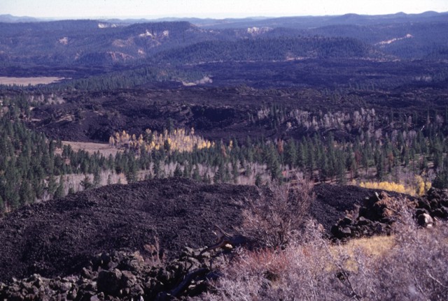
Black Rock Desert volcanic field — Markagunt Plateau.
|
|||
| Date | ||||
| Source | http://www.volcano.si.edu/world/volcano.cfm?vnum=1207-04-&volpage=photos&photo=045096 | |||
| Author | Lee Siebert (Smithsonian Institution) | |||
| Permission (Reusing this file) |
|
File history
Click on a date/time to view the file as it appeared at that time.
| Date/Time | Thumbnail | Dimensions | User | Comment | |
|---|---|---|---|---|---|
| current | 00:44, 29 January 2011 | | 640 × 431 (96 KB) | Michael Metzger | {{Information |Description=Blocky unvegetated lava flows known as the Black Rock Desert extend from near Miller Knoll to the SE. These flows, which also extend NE to near Panguitch Lake, are among the youngest features of the Markagunt Plateau volcanic fi |
File usage
The following pages on the English Wikipedia use this file (pages on other projects are not listed):
Global file usage
The following other wikis use this file:
- Usage on ceb.wikipedia.org
- Usage on de.wikipedia.org
- Usage on he.wikipedia.org
- Usage on ms.wikipedia.org
- Usage on no.wikipedia.org
- Usage on ru.wikipedia.org
- Usage on www.wikidata.org