File:Map of the western Florida Keys, from the Dry Tortugas to Little Torch Key, showing boundaries of National Marine Sanctuaries 2000.jpg

Size of this preview: 783 × 600 pixels. Other resolutions: 313 × 240 pixels | 627 × 480 pixels | 1,003 × 768 pixels | 1,280 × 980 pixels | 1,957 × 1,499 pixels.
Original file (1,957 × 1,499 pixels, file size: 484 KB, MIME type: image/jpeg)
| This is a file from the Wikimedia Commons. Information from its description page there is shown below. Commons is a freely licensed media file repository. You can help. |
Summary
| Description |
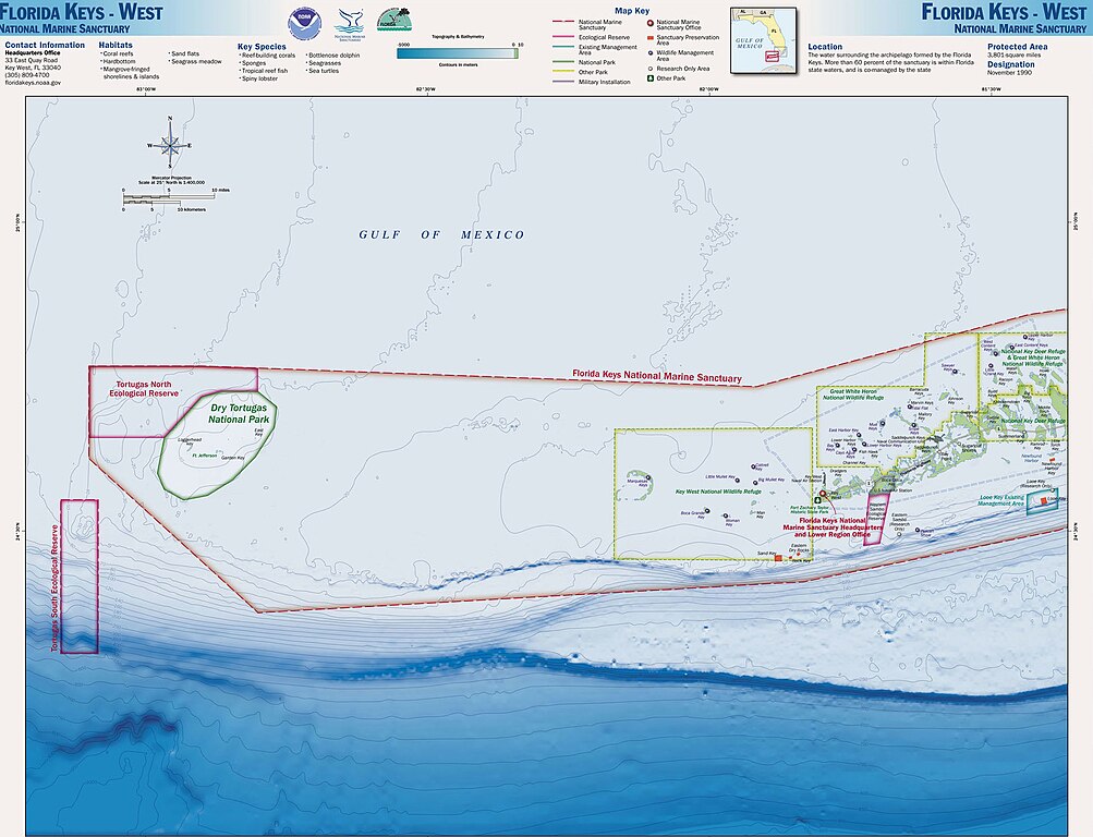
English: Map of the Florida Keys, showing National Marine Sanctuaries |
| Date | |
| Source | http://sanctuaries.noaa.gov/pgallery/atlasmaps/fkwest.html |
| Author | Sanctuaries Web Team of National Ocean Service of National Oceanic and Atmospheric Administration of U.S. Department of Commerce |
| Permission (Reusing this file) |
U.S. Federal Government work, therefore public domain |
Licensing
This image is in the public domain because it contains materials that originally came from the U.S. National Oceanic and Atmospheric Administration, taken or made as part of an employee's official duties.
|
Original upload log
The original description page was 2000.jpg here. All following user names refer to en.wikipedia.
- 2008-11-16 17:32 Nricardo 2000×1550× (406095 bytes) {{Information |Description=Map of the Florida Keys, showing National Marine Sanctuaries |Source=http://sanctuaries.noaa.gov/pgallery/atlasmaps/fkwest.html |Date=2008-11-16 |Author=Sanctuaries Web Team of National Ocean Service of National Oceanic and Atm
File history
Click on a date/time to view the file as it appeared at that time.
| Date/Time | Thumbnail | Dimensions | User | Comment | |
|---|---|---|---|---|---|
| current | 08:57, 29 July 2017 | | 1,957 × 1,499 (484 KB) | ديفيد عادل وهبة خليل 2 | Removed border by cropping 2 % horizontally and 3 % vertically using CropTool with precise mode. |
| 10:34, 26 April 2009 |  | 2,000 × 1,550 (397 KB) | Urdangaray | {{Information |Description={{en|Map of the Florida Keys, showing National Marine Sanctuaries}} |Source=Transferred from [http://en.wikipedia.org en.wikipedia]<br/> (Original text : ''http://sanctuaries.noaa.gov/pgallery/atlasmaps/fkwest.html'') |Date={{Da |
File usage
The following pages on the English Wikipedia use this file (pages on other projects are not listed):
Global file usage
The following other wikis use this file:
- Usage on de.wikipedia.org
- Usage on es.wikipedia.org
- Usage on pl.wikipedia.org
- Usage on ru.wikipedia.org
- Usage on uk.wikipedia.org