
Size of this preview: 800 × 549 pixels. Other resolutions: 320 × 220 pixels | 640 × 439 pixels | 1,024 × 702 pixels | 1,280 × 878 pixels.
Original file (1,280 × 878 pixels, file size: 134 KB, MIME type: image/png)
| This is a file from the Wikimedia Commons. Information from its description page there is shown below. Commons is a freely licensed media file repository. You can help. |
Summary
| Description |
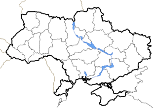
English: Political map of Ukraine, without marked Oblasts.
Українська: Політична карта України. |
|||||||||
| Date | ||||||||||
| Source | Image (Map) made by Sven Teschke, Germany --Steschke 20:18, 29 Nov 2004 (UTC) | |||||||||
| Author | Sven Teschke | |||||||||
| Other versions |
[]
|


Licensing

|
Permission is granted to copy, distribute and/or modify this document under the terms of the GNU Free Documentation License, Version 1.2 or any later version published by the Free Software Foundation; with no Invariant Sections, no Front-Cover Texts, and no Back-Cover Texts. A copy of the license is included in the section entitled GNU Free Documentation License. |
| This file is licensed under the Creative Commons Attribution-Share Alike 3.0 Unported license. | ||
| ||
| This licensing tag was added to this file as part of the GFDL licensing update. |
This file is licensed under the Creative Commons Attribution-Share Alike 1.0 Generic license.
- You are free:
- to share – to copy, distribute and transmit the work
- to remix – to adapt the work
- Under the following conditions:
- attribution – You must give appropriate credit, provide a link to the license, and indicate if changes were made. You may do so in any reasonable manner, but not in any way that suggests the licensor endorses you or your use.
- share alike – If you alter, transform, or build upon this work, you must distribute the resulting work under the same license as the original.
File history
Click on a date/time to view the file as it appeared at that time.
| Date/Time | Thumbnail | Dimensions | User | Comment | |
|---|---|---|---|---|---|
| current | 17:33, 1 September 2023 | | 1,280 × 878 (134 KB) | Keneris | correct map (Lyman Raion in Donet'sk Oblast, not in Kharkiv Oblast!) |
| 16:03, 20 October 2014 |  | 2,466 × 1,749 (192 KB) | Andrew J.Kurbiko | pp | |
| 01:03, 6 May 2012 |  | 2,466 × 1,749 (271 KB) | An678ko | redesigned by Aplusc Studio | |
| 13:06, 15 December 2011 |  | 1,181 × 825 (16 KB) | Mayhaymate | Optimized with PNGOUT | |
| 01:01, 26 November 2006 |  | 1,181 × 825 (19 KB) | Mzajac | pngcrushed with -brute to compress by a few bytes | |
| 00:57, 26 November 2006 |  | 1,181 × 825 (21 KB) | Mzajac | Added border, web-safe colours | |
| 14:29, 30 November 2004 |  | 1,181 × 825 (15 KB) | Ed g2s | Simplified, compressed. | |
| 20:17, 29 November 2004 |  | 1,181 × 825 (31 KB) | Steschke | Simple Ukrainian Map without marked Oblasts |
File usage
The following pages on the English Wikipedia use this file (pages on other projects are not listed):
Global file usage
The following other wikis use this file:
- Usage on be.wikipedia.org
- Usage on de.wikipedia.org
- Usage on eo.wikipedia.org
- Usage on lt.wikipedia.org
- Usage on uk.wikipedia.org