Size of this preview: 800 × 531 pixels. Other resolutions: 320 × 212 pixels | 640 × 425 pixels | 1,024 × 679 pixels | 1,280 × 849 pixels | 2,600 × 1,725 pixels.
Original file (2,600 × 1,725 pixels, file size: 2.66 MB, MIME type: image/png)
| This is a file from the Wikimedia Commons. Information from its description page there is shown below. Commons is a freely licensed media file repository. You can help. |
Summary
| Description |
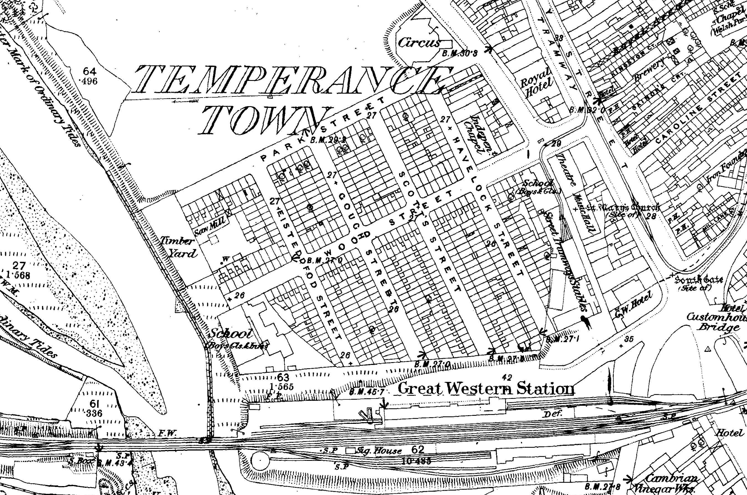
English: Map of Temperance Town, Cardiff c.1875 (cropped extract from Map of Cardiff and its Environs, OS Map name 043/15) |
| Date | |
| Source | File:Map of Cardiff and its Environs OS Map name 043-15, Ordnance Survey, 1875-1882.png |
| Author | Ordnance Survey |
Licensing
|
This is a faithful photographic reproduction of a two-dimensional, public domain work of art. The work of art itself is in the public domain for the following reason:
The official position taken by the Wikimedia Foundation is that "faithful reproductions of two-dimensional public domain works of art are public domain".
This photographic reproduction is therefore also considered to be in the public domain in the United States. In other jurisdictions, re-use of this content may be restricted; see Reuse of PD-Art photographs for details. | ||||
File history
Click on a date/time to view the file as it appeared at that time.
| Date/Time | Thumbnail | Dimensions | User | Comment | |
|---|---|---|---|---|---|
| current | 22:19, 12 February 2021 | | 2,600 × 1,725 (2.66 MB) | Sionk | Uploaded a work by Ordnance Survey from File:Map of Cardiff and its Environs OS Map name 043-15, Ordnance Survey, 1875-1882.png with UploadWizard |
File usage
The following pages on the English Wikipedia use this file (pages on other projects are not listed):
Global file usage
The following other wikis use this file:
- Usage on cy.wikipedia.org
- Usage on www.wikidata.org