Original file (1,715 × 1,920 pixels, file size: 1.19 MB, MIME type: image/jpeg)
| This is a file from the Wikimedia Commons. Information from its description page there is shown below. Commons is a freely licensed media file repository. You can help. |
Summary
| Description |
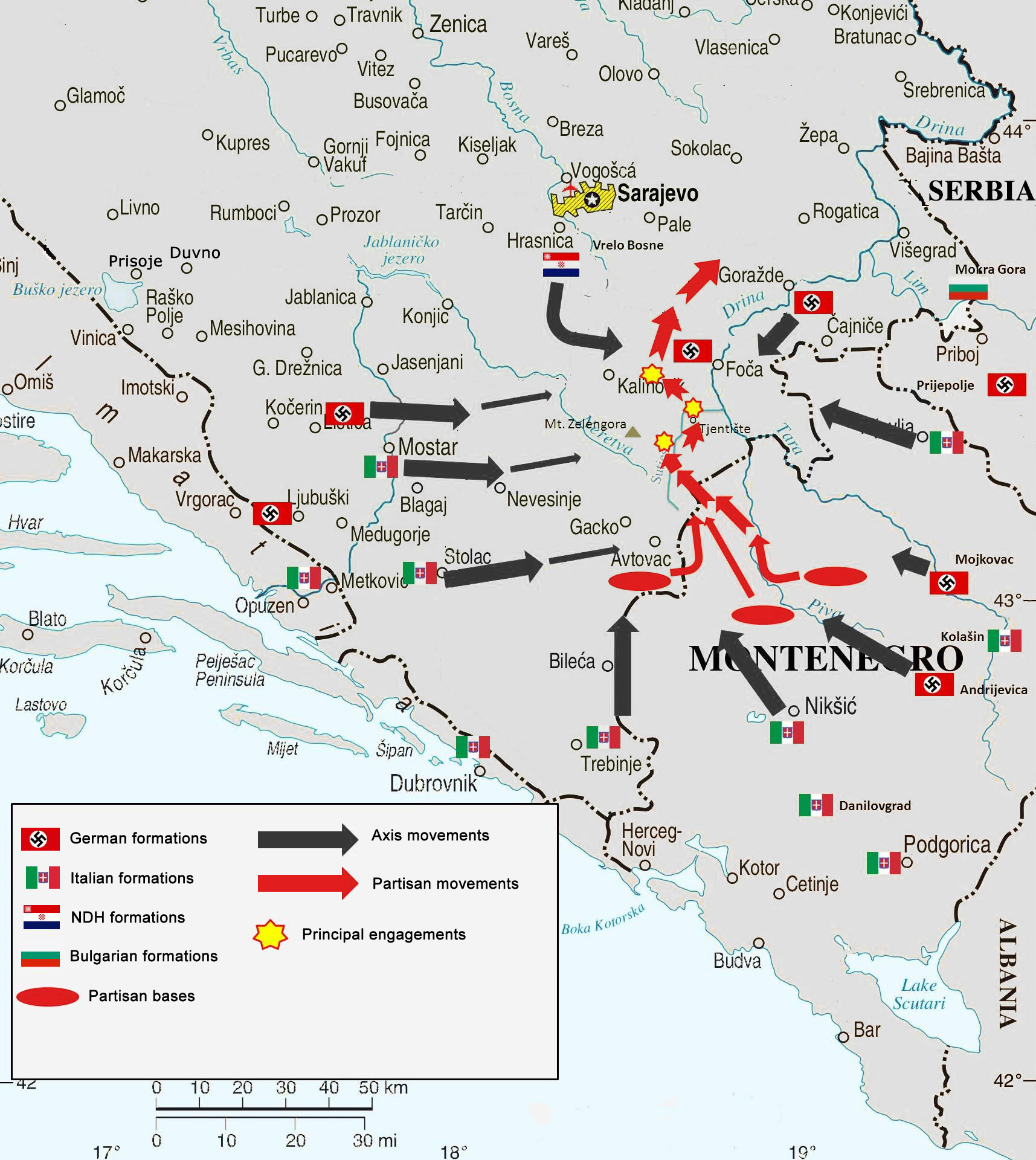
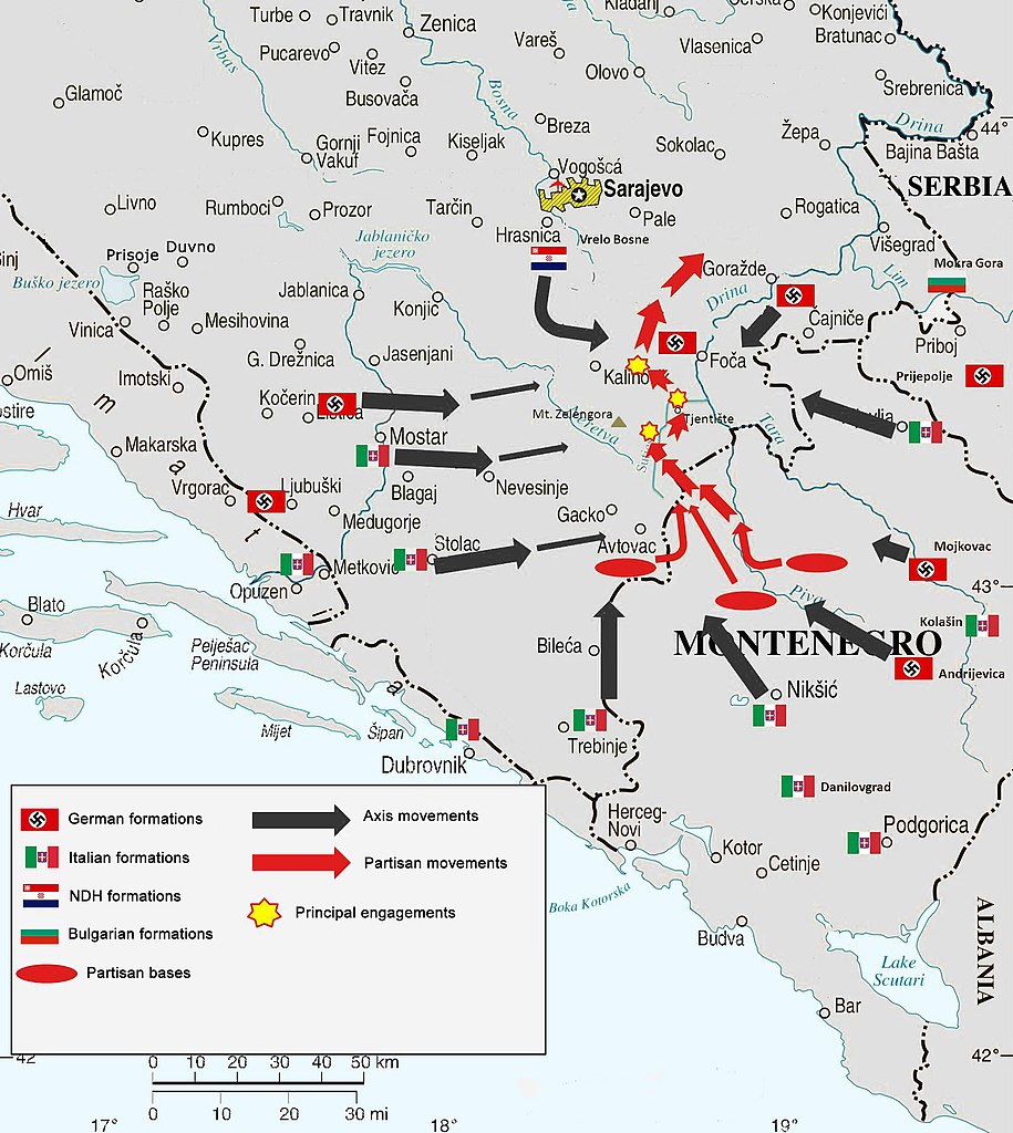
English: Map of Case Black, superimposed on modern-day country borders (entity borders did not exist in 1943). |
|||
| Date | ||||
| Source | Own work, based on File:Bosnia and Hercegovina map.png and this source of information. | |||
| Author | Cartographer of the United Nations | |||
| Permission (Reusing this file) |
|
|||
| Other versions |
|


Licensing
- You are free:
- to share – to copy, distribute and transmit the work
- to remix – to adapt the work
- Under the following conditions:
- attribution – You must give appropriate credit, provide a link to the license, and indicate if changes were made. You may do so in any reasonable manner, but not in any way that suggests the licensor endorses you or your use.
File history
Click on a date/time to view the file as it appeared at that time.
| Date/Time | Thumbnail | Dimensions | User | Comment | |
|---|---|---|---|---|---|
| current | 01:45, 9 July 2017 | | 1,715 × 1,920 (1.19 MB) | BiHVolim | Entity borders of Bosniak-Croat Federation an Republika Srpska entity did not exist in 1943. They are a product of signing of Dayton Agreements in 1995; therefore can not be part of this map. also moved Serbia caption to not cross into Bosnia-Herzegovi... |
| 07:47, 6 September 2014 |  | 1,715 × 1,920 (1.25 MB) | DIREKTOR | Small fix. | |
| 18:36, 12 December 2012 |  | 1,715 × 1,920 (1.25 MB) | DIREKTOR | Further | |
| 18:34, 12 December 2012 |  | 1,715 × 1,920 (1.26 MB) | DIREKTOR | Further | |
| 18:32, 12 December 2012 |  | 1,715 × 1,920 (1.25 MB) | DIREKTOR | Fix | |
| 18:21, 12 December 2012 |  | 1,715 × 1,920 (1.26 MB) | DIREKTOR | User created page with UploadWizard |
File usage
Global file usage
The following other wikis use this file:
- Usage on bs.wikipedia.org
- Usage on de.wikipedia.org
- Usage on fi.wikipedia.org
- Usage on fr.wikipedia.org
- Usage on hr.wikipedia.org
- Usage on it.wikipedia.org
- Usage on mk.wikipedia.org
- Usage on nl.wikipedia.org
- Usage on pt.wikipedia.org
- Usage on sl.wikipedia.org
- Usage on www.wikidata.org