
Size of this PNG preview of this SVG file: 379 × 600 pixels. Other resolutions: 152 × 240 pixels | 303 × 480 pixels | 485 × 768 pixels | 647 × 1,024 pixels | 1,294 × 2,048 pixels | 3,379 × 5,346 pixels.
Original file (SVG file, nominally 3,379 × 5,346 pixels, file size: 94 KB)
| This is a file from the Wikimedia Commons. Information from its description page there is shown below. Commons is a freely licensed media file repository. You can help. |
| Description |
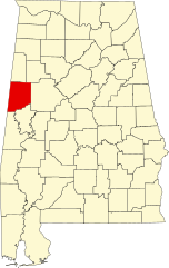
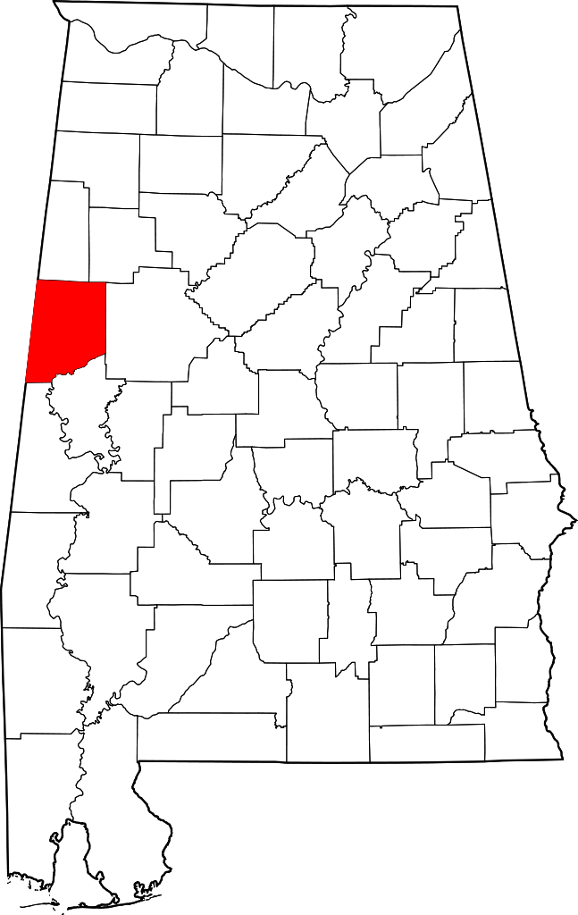
English: This is a locator map showing Pickens County in Alabama. |
| Source | Own work |
| Author | David Benbennick made this map. For more information, see Commons:United States county locator maps. |
| I, the copyright holder of this work, release this work into the public domain. This applies worldwide. In some countries this may not be legally possible; if so: I grant anyone the right to use this work for any purpose, without any conditions, unless such conditions are required by law. |
File history
Click on a date/time to view the file as it appeared at that time.
| Date/Time | Thumbnail | Dimensions | User | Comment | |
|---|---|---|---|---|---|
| current | 09:53, 12 February 2006 | | 3,379 × 5,346 (94 KB) | David Benbennick | {{subst:User:Dbenbenn/clm|county=Pickens County|state=Alabama}} |
File usage
The following pages on the English Wikipedia use this file (pages on other projects are not listed):
- Aliceville, Alabama
- Aliceville Elementary and High School
- Beards Mill, Alabama
- Benevola, Alabama
- Carrollton, Alabama
- Coal Fire, Alabama
- Cochrane, Alabama
- Dancy, Alabama
- Ethelsville, Alabama
- Gordo, Alabama
- Hugh Wilson Hill House
- Liberty, Pickens County, Alabama
- List of census-designated places in Alabama
- List of counties in Alabama
- Lubbub, Alabama
- Macedonia, Alabama
- McMullen, Alabama
- McShan, Alabama
- Memphis, Alabama
- Montgomery (snagboat)
- National Register of Historic Places listings in Pickens County, Alabama
- Old Jail (Gordo, Alabama)
- Olney, Alabama
- Palmetto, Alabama
- Parks E. Ball House
- Pickens County, Alabama
- Pickens County Courthouse (Alabama)
- Pickensville, Alabama
- Reform, Alabama
- Sapps, Alabama
- Stewart–Blanton House
- Vienna, Alabama
- Zion, Alabama
- User:Nyttend/County templates/AL
- Template:NRHP in Pickens County, Alabama
- Template:Pickens County, Alabama
- Category:Populated places in Pickens County, Alabama
Global file usage
The following other wikis use this file:
- Usage on ar.wikipedia.org
- Usage on az.wikipedia.org
- Usage on bg.wikipedia.org
- Usage on bpy.wikipedia.org
- Usage on ca.wikipedia.org
- Usage on cdo.wikipedia.org
- Usage on ceb.wikipedia.org
- Usage on ce.wikipedia.org
- Usage on cy.wikipedia.org
- Usage on de.wikipedia.org
- Usage on es.wikipedia.org
- Usage on et.wikipedia.org
- Usage on eu.wikipedia.org
- Usage on fa.wikipedia.org
- Usage on frr.wikipedia.org
- Usage on fr.wikipedia.org
View more global usage of this file.