
Size of this preview: 461 × 599 pixels. Other resolutions: 185 × 240 pixels | 369 × 480 pixels | 591 × 768 pixels | 788 × 1,024 pixels | 1,738 × 2,258 pixels.
Original file (1,738 × 2,258 pixels, file size: 2.05 MB, MIME type: image/jpeg)
| This is a file from the Wikimedia Commons. Information from its description page there is shown below. Commons is a freely licensed media file repository. You can help. |
Summary
| Description |
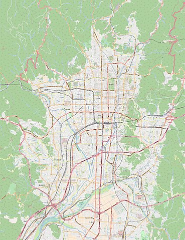
This map of Kyoto was created from OpenStreetMap project data, collected by the community. This map may be incomplete, and may contain errors. Don't rely solely on it for navigation. |
|||||||||
| Date | (see file history) | |||||||||
| Source | openstreetmap.org | |||||||||
| Creator |
OpenStreetMap contributors |
|||||||||
| Permission (Reusing this file) |
OpenStreetMap data and maps are licensed under the Creative Commons Attribution-ShareAlike 2.0 license (CC-BY-SA 2.0). This file is licensed under the Creative Commons Attribution-Share Alike 2.0 Generic license.
|
|||||||||
| Geotemporal data | ||||||||||
| Bounding box |
|
|||||||||
| Georeferencing | If inappropriate please set warp_status = skip to hide. | |||||||||
Licensing
I, the copyright holder of this work, hereby publish it under the following licenses:

|
Permission is granted to copy, distribute and/or modify this document under the terms of the GNU Free Documentation License, Version 1.2 or any later version published by the Free Software Foundation; with no Invariant Sections, no Front-Cover Texts, and no Back-Cover Texts. A copy of the license is included in the section entitled GNU Free Documentation License. |
This file is licensed under the Creative Commons Attribution-Share Alike 4.0 International, 3.0 Unported, 2.5 Generic, 2.0 Generic and 1.0 Generic license.
- You are free:
- to share – to copy, distribute and transmit the work
- to remix – to adapt the work
- Under the following conditions:
- attribution – You must give appropriate credit, provide a link to the license, and indicate if changes were made. You may do so in any reasonable manner, but not in any way that suggests the licensor endorses you or your use.
- share alike – If you remix, transform, or build upon the material, you must distribute your contributions under the same or compatible license as the original.
You may select the license of your choice.
File history
Click on a date/time to view the file as it appeared at that time.
| Date/Time | Thumbnail | Dimensions | User | Comment | |
|---|---|---|---|---|---|
| current | 14:34, 1 May 2018 | | 1,738 × 2,258 (2.05 MB) | Barsaka2 | 2018/05/01時点のOpenStreetMapに更新 |
| 16:34, 25 June 2012 |  | 1,739 × 2,258 (1.15 MB) | XIIIfromTOKYO | {{Information |Description ={{en|1=Map of Kyoto, Japan}} {{fr|1=Carte de Kyoto, Japon}} |Source ={{openstreetmap}} |Author =OpenStreetMap contributors |Date = |Permission = |other_versions = }} [[Category:Maps of Kyoto... |
File usage
The following pages on the English Wikipedia use this file (pages on other projects are not listed):
- Agency for Cultural Affairs
- Arashiyama Station (Hankyu)
- Fushimi Inari-taisha
- Iwatayama Monkey Park
- Kitaōji Station
- Kyoto International Conference Center
- Kyoto Municipal Museum of Art
- Kyoto National Museum
- Kyoto Railway Museum
- Kyōto Station
- National Museum of Modern Art, Kyoto
- ROHM Theatre Kyoto
- Rakusaiguchi Station
- Rozan-ji
- Ryōan-ji
- Tsukiyomi Shrine (Kyoto)
- Yodo Station
- Module:Location map/data/Japan Kyoto
- Module:Location map/data/Japan Kyoto city
- Module:Location map/data/Japan Kyoto city/doc
Global file usage
The following other wikis use this file:
- Usage on ar.wikipedia.org
- Usage on bcl.wikipedia.org
- Usage on ceb.wikipedia.org
- Usage on es.wikipedia.org
- Usage on eu.wikipedia.org
- Usage on fa.wikipedia.org
- Usage on fr.wikipedia.org
- Kyoto
- Université de Kyoto
- Kinkaku-ji
- Ryōan-ji
- Byōdō-in
- Kiyomizu-dera
- Château de Nijō
- Enryaku-ji
- Mont Hiei
- Gion
- Daisen-in
- Musée international du manga de Kyoto
- Fushimi Inari-taisha
- Université Dōshisha
- Université de Ritsumeikan
- Nagaoka-kyō
- Ponto-chō
- Gare de Kyoto
- Tour de Kyoto
- Palais Heian
- Université municipale des Arts de Kyoto
- Kyōto-gosho
- Université d'éducation de Kyoto
- Université des arts et techniques de Kyoto
- Daigo-ji
- Château de Fushimi
- Université Ōtani
- Musée national de Kyoto
- Kitano Tenman-gū
- Lycée français international de Kyoto
- Nishi-Hongan-ji
- Sanjō Ōhashi
- Rébellion des portes Hamaguri
- Gare de Yamazaki (Kyōto)
- Gare de Katsuragawa (Kyōto)
- Gare de Nishiōji
View more global usage of this file.