Size of this preview: 748 × 599 pixels. Other resolutions: 300 × 240 pixels | 599 × 480 pixels | 958 × 768 pixels | 1,278 × 1,024 pixels | 1,611 × 1,291 pixels.
Original file (1,611 × 1,291 pixels, file size: 549 KB, MIME type: image/jpeg)
| This is a file from the Wikimedia Commons. Information from its description page there is shown below. Commons is a freely licensed media file repository. You can help. |
Summary
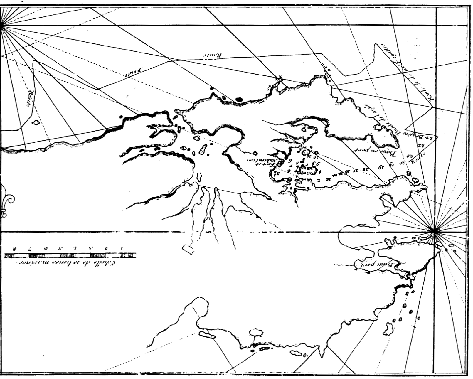
| Description | Map of northeastern East Falkland, Falkland Islands (Dom Pernety, 1769). The originally South-Up map is turned upside down here for an easier coastline recognition. |
| Date | |
| Source |
Bibliothèque nationale de France |
| Author | Antoine-Joseph Pernety |
Licensing
|
This is a faithful photographic reproduction of a two-dimensional, public domain work of art. The work of art itself is in the public domain for the following reason:
The official position taken by the Wikimedia Foundation is that "faithful reproductions of two-dimensional public domain works of art are public domain".
This photographic reproduction is therefore also considered to be in the public domain in the United States. In other jurisdictions, re-use of this content may be restricted; see Reuse of PD-Art photographs for details. | ||||
File history
Click on a date/time to view the file as it appeared at that time.
| Date/Time | Thumbnail | Dimensions | User | Comment | |
|---|---|---|---|---|---|
| current | 10:29, 24 November 2007 | | 1,611 × 1,291 (549 KB) | Apcbg | == Summary == {{Information |Description=Map of northeastern East Falkland, Falkland Islands (Dom Pernety, 1769). |Source=http://gallica.bnf.fr/ark:/12148/bpt6k821758.pdf |Date=1769 |Author=Antoine-Joseph Pernety |Permission= |other_versions= }} == Licen |
File usage
The following pages on the English Wikipedia use this file (pages on other projects are not listed):
Global file usage
The following other wikis use this file:
- Usage on es.wikipedia.org
- Usage on fr.wikipedia.org
- Usage on ru.wikipedia.org