
Size of this preview: 800 × 439 pixels. Other resolutions: 320 × 176 pixels | 640 × 351 pixels | 1,024 × 562 pixels | 1,280 × 703 pixels | 2,560 × 1,406 pixels | 7,877 × 4,325 pixels.
Original file (7,877 × 4,325 pixels, file size: 52.46 MB, MIME type: image/png)
| This is a file from the Wikimedia Commons. Information from its description page there is shown below. Commons is a freely licensed media file repository. You can help. |
Summary
| Description |
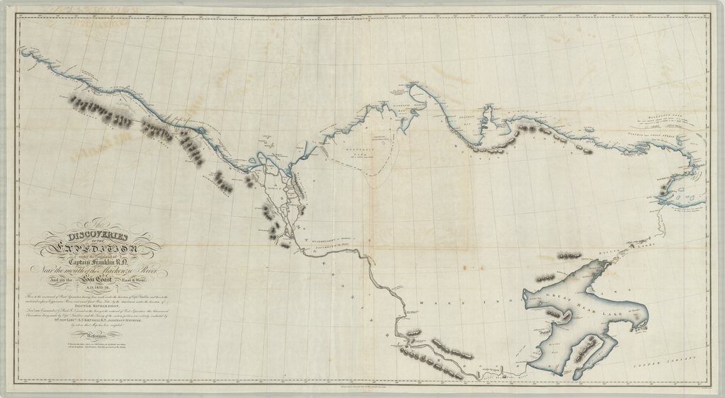
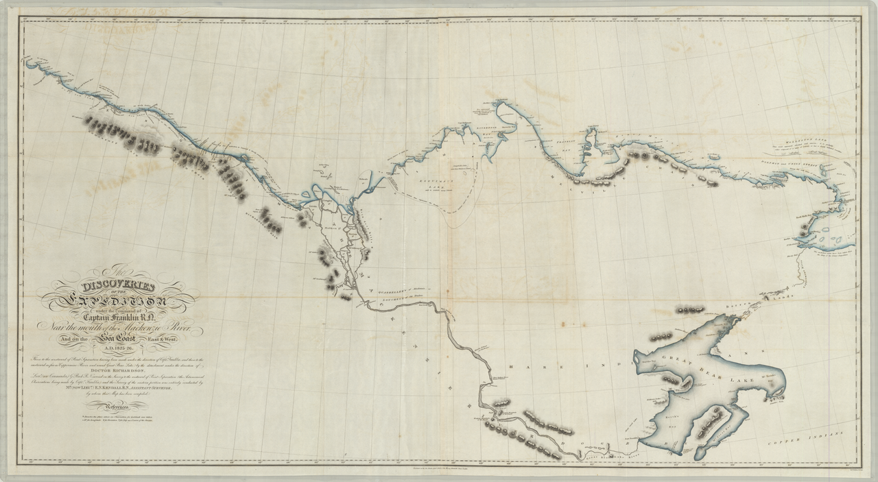
English: Discoveries of expeditions under the command of Captain Franklin near the mouth of the Mackenzie River |
| Date | |
| Source | https://libweb5.princeton.edu/visual_materials/maps/websites/northwest-passage/maps.htm |
| Author | John Franklin |
Licensing
|
This work is in the public domain in its country of origin and other countries and areas where the copyright term is the author's life plus 70 years or fewer. This work is in the public domain in the United States because it was published (or registered with the U.S. Copyright Office) before January 1, 1929. | |
| This file has been identified as being free of known restrictions under copyright law, including all related and neighboring rights. | |
File history
Click on a date/time to view the file as it appeared at that time.
| Date/Time | Thumbnail | Dimensions | User | Comment | |
|---|---|---|---|---|---|
| current | 05:01, 3 March 2019 | | 7,877 × 4,325 (52.46 MB) | SaltedSturgeon | User created page with UploadWizard |
File usage
The following pages on the English Wikipedia use this file (pages on other projects are not listed):
Global file usage
The following other wikis use this file:
- Usage on en.wikivoyage.org
- Usage on fr.wikipedia.org
- Usage on www.wikidata.org