Size of this preview: 800 × 594 pixels. Other resolutions: 320 × 238 pixels | 640 × 476 pixels | 1,024 × 761 pixels | 1,280 × 951 pixels | 2,304 × 1,712 pixels.
Original file (2,304 × 1,712 pixels, file size: 1.26 MB, MIME type: image/jpeg)
| This is a file from the Wikimedia Commons. Information from its description page there is shown below. Commons is a freely licensed media file repository. You can help. |
Summary
| Camera location | | View this and other nearby images on: OpenStreetMap |
|---|
| Description |
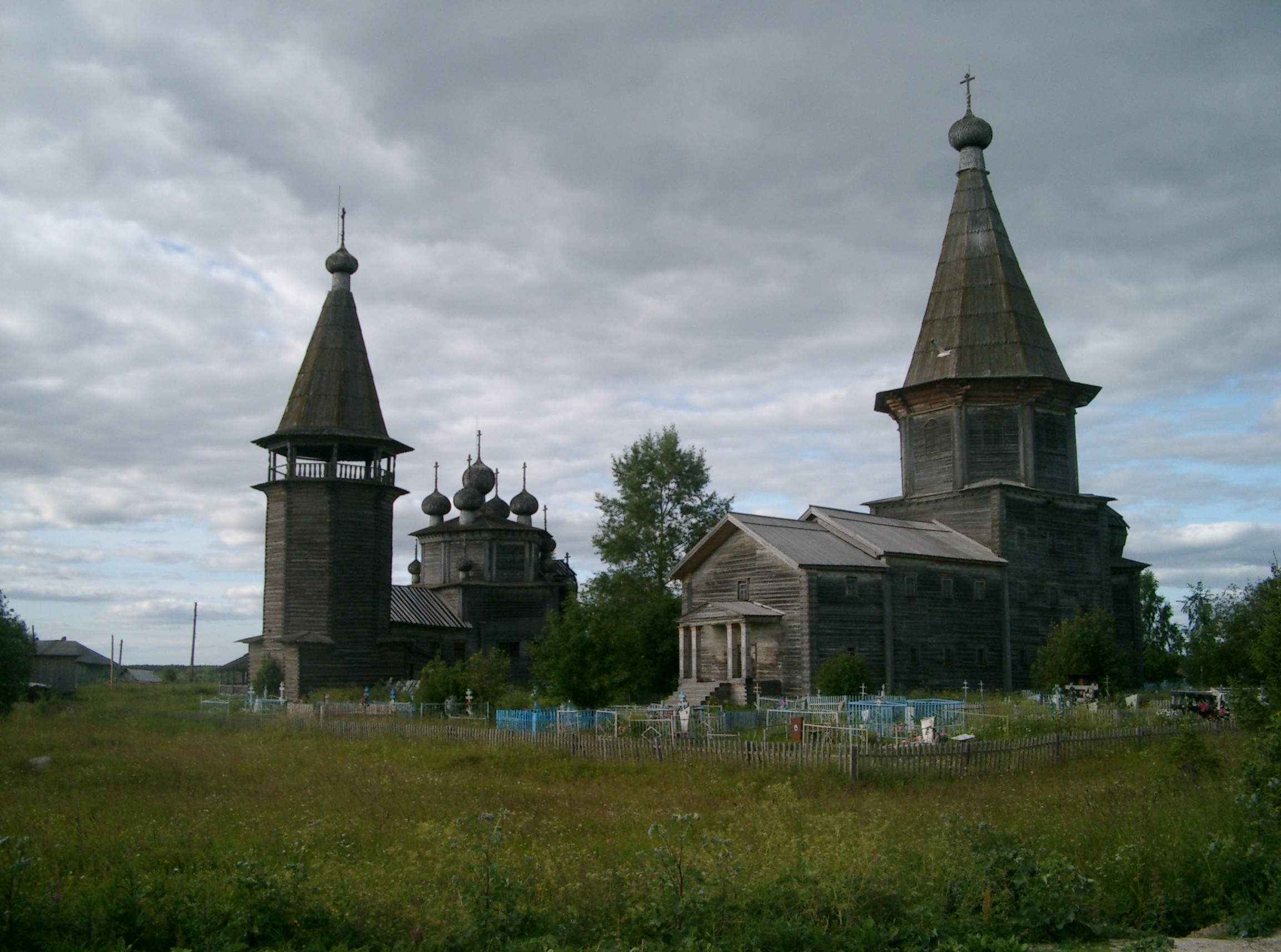
English: The triple ensemble of Lyadiny. Left to right: the bell-tower (1820), the Church of the Protection of the Theotokos (1693), the Intercession Church (1761). In 2013, the bell tower and the Intercession Church burned down. Русский: Тройной ансамбль в Лядинах. Слева направо: колокольня (1820), Богоявленская церковь (1693), Покрово-Власьевская церковь (1761). В 2013 году, Покровская церковь и колокольня сгорели.
|
||||||||||||
| Date | |||||||||||||
| Source | Own work | ||||||||||||
| Author | Ymblanter |
Licensing
I, the copyright holder of this work, hereby publish it under the following license:
This file is licensed under the Creative Commons Attribution-Share Alike 3.0 Unported license.
- You are free:
- to share – to copy, distribute and transmit the work
- to remix – to adapt the work
- Under the following conditions:
- attribution – You must give appropriate credit, provide a link to the license, and indicate if changes were made. You may do so in any reasonable manner, but not in any way that suggests the licensor endorses you or your use.
- share alike – If you remix, transform, or build upon the material, you must distribute your contributions under the same or compatible license as the original.
File history
Click on a date/time to view the file as it appeared at that time.
| Date/Time | Thumbnail | Dimensions | User | Comment | |
|---|---|---|---|---|---|
| current | 12:13, 25 January 2015 | | 2,304 × 1,712 (1.26 MB) | Ymblanter | bigger version |
| 21:52, 10 June 2011 |  | 800 × 594 (409 KB) | Ymblanter |
File usage
The following pages on the English Wikipedia use this file (pages on other projects are not listed):
Global file usage
The following other wikis use this file:
- Usage on ce.wikipedia.org
- Usage on crh.wikipedia.org
- Usage on frr.wikipedia.org
- Usage on fr.wikipedia.org
- Usage on hy.wikipedia.org
- Usage on ru.wikipedia.org
- Usage on uk.wikipedia.org
- Usage on www.wikidata.org