
Size of this preview: 721 × 600 pixels. Other resolutions: 289 × 240 pixels | 577 × 480 pixels | 924 × 768 pixels | 1,232 × 1,024 pixels | 1,442 × 1,199 pixels.
Original file (1,442 × 1,199 pixels, file size: 355 KB, MIME type: image/png)
| This is a file from the Wikimedia Commons. Information from its description page there is shown below. Commons is a freely licensed media file repository. You can help. |
Summary
| Description |
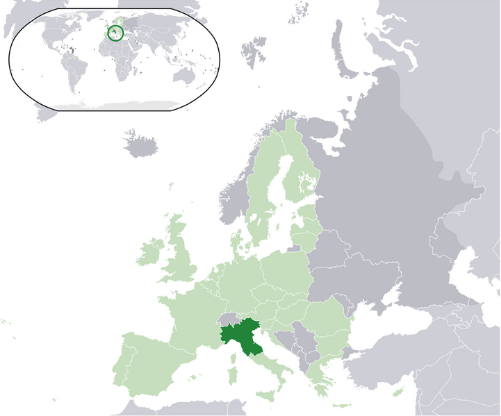
English: Map of the proposed state of Padania (advocated by Northern League)
Italiano: Mappa della Padania, come proposta dalla Lega Nord. |
| Date | |
| Source | Own work |
| Author | Pattyone |
Licensing
| I, the copyright holder of this work, release this work into the public domain. This applies worldwide. In some countries this may not be legally possible; if so: I grant anyone the right to use this work for any purpose, without any conditions, unless such conditions are required by law. |
File history
Click on a date/time to view the file as it appeared at that time.
| Date/Time | Thumbnail | Dimensions | User | Comment | |
|---|---|---|---|---|---|
| current | 15:17, 16 January 2016 | | 1,442 × 1,199 (355 KB) | Tromber | Croatia is a member of the European Union. The country is now marked in light green. |
| 15:16, 16 January 2016 |  | 1,442 × 1,199 (355 KB) | Tromber | Croatia is a member of the European Union. The country is now marked in light green. | |
| 15:14, 16 January 2016 |  | 1,442 × 1,199 (355 KB) | Tromber | Croatia is a member of the European Union. The country is now marked in light green. | |
| 10:08, 27 August 2009 |  | 2,056 × 1,710 (193 KB) | Pattyone | {{Information |Description={{en|1=Map of the proposed state of Padania}} |Source=Own work by uploader |Author=Pattyone |Date=2009-08-27 |Permission= |other_versions= }} Category:Padania |
File usage
The following pages on the English Wikipedia use this file (pages on other projects are not listed):
Global file usage
The following other wikis use this file:
- Usage on ast.wikipedia.org
- Usage on de.wikipedia.org
- Usage on es.wikipedia.org
- Usage on et.wikipedia.org
- Usage on fa.wikipedia.org
- Usage on fr.wikipedia.org
- Usage on hr.wikipedia.org
- Usage on hu.wikipedia.org
- Usage on id.wikipedia.org
- Usage on is.wikipedia.org
- Usage on it.wikipedia.org
- Usage on pt.wikipedia.org
- Usage on ro.wikipedia.org
- Usage on tr.wikipedia.org
- Usage on vec.wikipedia.org
- Usage on www.wikidata.org
- Usage on zh.wikipedia.org