Size of this preview: 752 × 600 pixels. Other resolutions: 301 × 240 pixels | 602 × 480 pixels | 963 × 768 pixels | 1,280 × 1,021 pixels | 1,600 × 1,276 pixels.
Original file (1,600 × 1,276 pixels, file size: 351 KB, MIME type: image/png)
| This is a file from the Wikimedia Commons. Information from its description page there is shown below. Commons is a freely licensed media file repository. You can help. |
| Description |
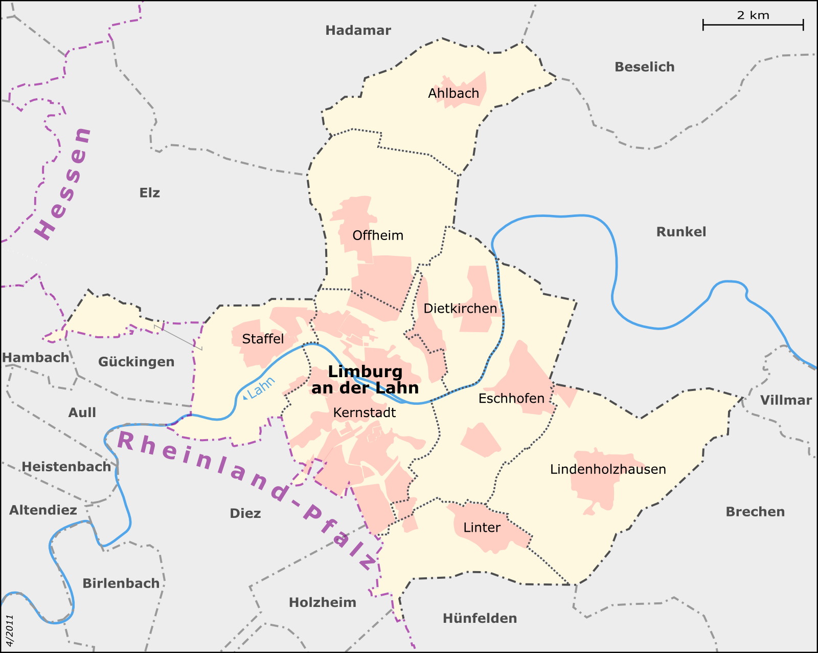
English: Map of Limburg an der Lahn's city districts Deutsch: Karte der Limburger Stadtteile
This map was created from OpenStreetMap project data, collected by the community.This map may be incomplete, and may contain errors. Don't rely solely on it for navigation. |
| Date | |
| Source |
Deutsch: Eigene Arbeit, basierend auf English: Own work, based on
|
| Author | Muns |
| Permission (Reusing this file) |
OpenStreetMap data and maps are Creative Commons "CC-BY-SA 2.0" licensed This file is licensed under the Creative Commons Attribution-Share Alike 2.0 Generic license.
|
| Other versions |
|


|
This map has been made or improved in the German Kartenwerkstatt (Map Lab). You can propose maps to improve as well.
|
File history
Click on a date/time to view the file as it appeared at that time.
| Date/Time | Thumbnail | Dimensions | User | Comment | |
|---|---|---|---|---|---|
| current | 21:00, 27 April 2011 | | 1,600 × 1,276 (351 KB) | Muns | Stadteilgrenzen korrigiert, Grenzdarstellung, vgl. Diskussion in der Kartenwerkstatt |
| 21:32, 17 April 2011 |  | 1,790 × 1,428 (441 KB) | Muns | Ländernamen etwas abgetönt | |
| 21:28, 17 April 2011 |  | 1,801 × 1,436 (446 KB) | Muns | Grenzen vereinheitlicht, Platzierung Kernstadt | |
| 13:01, 16 April 2011 |  | 1,800 × 1,436 (429 KB) | Muns | {{Information |Description={{en|1=Map of Limburg an der Lahn's city districts}} {{de|1=Karte der Limburger Stadtteile}} This map was created from OpenStreetMap project data, collected by the community.<br/><small>This map may be incomplete, and may |
File usage
The following pages on the English Wikipedia use this file (pages on other projects are not listed):
Global file usage
The following other wikis use this file:
- Usage on azb.wikipedia.org
- Usage on da.wikipedia.org
- Usage on de.wikipedia.org
- Usage on eo.wikipedia.org
- Usage on fr.wikipedia.org
- Usage on id.wikipedia.org
- Usage on it.wikipedia.org
- Usage on ja.wikipedia.org
- Usage on la.wikipedia.org
- Usage on li.wikipedia.org
- Usage on nl.wikipedia.org
- Usage on simple.wikipedia.org
- Usage on sl.wikipedia.org
- Usage on sv.wikipedia.org