
Size of this preview: 651 × 599 pixels. Other resolutions: 261 × 240 pixels | 521 × 480 pixels | 834 × 768 pixels | 1,112 × 1,024 pixels | 2,224 × 2,048 pixels | 3,156 × 2,906 pixels.
Original file (3,156 × 2,906 pixels, file size: 5.99 MB, MIME type: image/jpeg)
| This is a file from the Wikimedia Commons. Information from its description page there is shown below. Commons is a freely licensed media file repository. You can help. |
Summary
| Description |
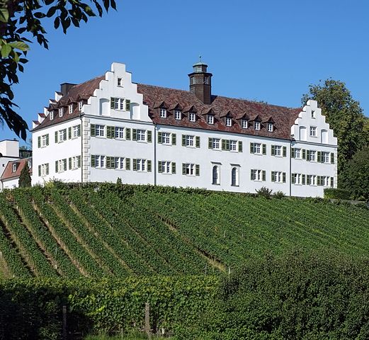
English: Manor House Hersberg, Immenstaad, district Bodenseekreis, Baden-Württemberg, Germany
Deutsch: Schloss Hersberg, Immenstaad, Bodenseekreis, Baden-Württemberg Deutschland |
| Date | |
| Source | Own work |
| Author | Dietrich Krieger |
| Object location | | View this and other nearby images on: OpenStreetMap |
|---|
| Camera location | | View this and other nearby images on: OpenStreetMap |
|---|
Licensing
Dietrich Krieger, the copyright holder of this work, hereby publishes it under the following license:
This file is licensed under the Creative Commons Attribution-Share Alike 3.0 Unported license.
Attribution: Dietrich Krieger
- You are free:
- to share – to copy, distribute and transmit the work
- to remix – to adapt the work
- Under the following conditions:
- attribution – You must give appropriate credit, provide a link to the license, and indicate if changes were made. You may do so in any reasonable manner, but not in any way that suggests the licensor endorses you or your use.
- share alike – If you remix, transform, or build upon the material, you must distribute your contributions under the same or compatible license as the original.
This image has been assessed using the Quality image guidelines and is considered a Quality image.
|
File history
Click on a date/time to view the file as it appeared at that time.
| Date/Time | Thumbnail | Dimensions | User | Comment | |
|---|---|---|---|---|---|
| current | 11:38, 19 February 2017 | | 3,156 × 2,906 (5.99 MB) | DKrieger | WB |
| 11:51, 22 September 2012 |  | 3,228 × 2,987 (7.21 MB) | DKrieger | Grünstich entfernt | |
| 21:34, 18 September 2012 |  | 3,228 × 2,987 (7.36 MB) | DKrieger | Winkel korrigiert, aus RAW entwickelt | |
| 19:15, 17 September 2012 |  | 3,205 × 3,225 (6.18 MB) | DKrieger |
File usage
The following pages on the English Wikipedia use this file (pages on other projects are not listed):
Global file usage
The following other wikis use this file:
- Usage on ceb.wikipedia.org
- Usage on fr.wikipedia.org
- Usage on ms.wikipedia.org
- Usage on vi.wikipedia.org
- Usage on www.wikidata.org
- Usage on zh.wikipedia.org