
Size of this preview: 586 × 599 pixels. Other resolutions: 235 × 240 pixels | 469 × 480 pixels | 662 × 677 pixels.
Original file (662 × 677 pixels, file size: 144 KB, MIME type: image/jpeg)
| This is a file from the Wikimedia Commons. Information from its description page there is shown below. Commons is a freely licensed media file repository. You can help. |
Summary
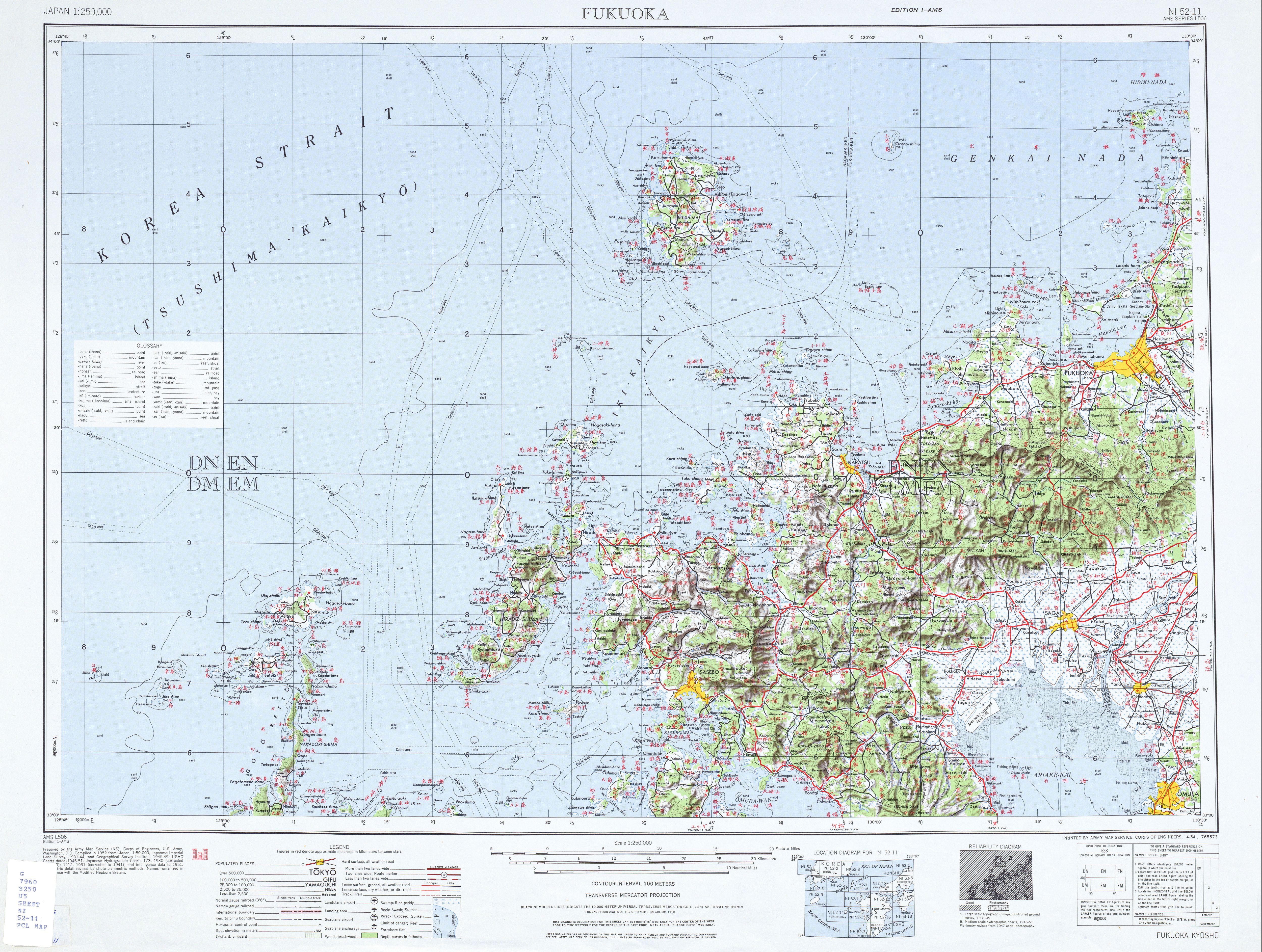
| Description | topographic map of Iki Island |
| Date | |
| Source | http://www.lib.utexas.edu/maps/ams/japan/txu-oclc-6900707-ni52-11.jpg |
| Author | Army Map Service, Corps of Engineers, U.S. Army |
Licensing
This file is a work of a U.S. Army soldier or employee, taken or made as part of that person's official duties. As a work of the U.S. federal government, it is in the public domain in the United States.
|
 |
File history
Click on a date/time to view the file as it appeared at that time.
| Date/Time | Thumbnail | Dimensions | User | Comment | |
|---|---|---|---|---|---|
| current | 20:20, 8 November 2012 | | 662 × 677 (144 KB) | Mps2 | {{Information |Description=topographic map of Iki Island |Source=http://www.lib.utexas.edu/maps/ams/japan/txu-oclc-6900707-ni52-11.jpg |Date=1952 |Author=Army Map Service, Corps of Engineers, U.S. Army |Permission= |other_versions= }} [[Category:Topog... |
File usage
The following pages on the English Wikipedia use this file (pages on other projects are not listed):
Global file usage
The following other wikis use this file:
- Usage on ckb.wikipedia.org
- Usage on de.wikipedia.org
- Usage on fr.wikipedia.org
- Usage on ja.wikipedia.org
- Usage on tr.wikipedia.org