Size of this preview: 800 × 413 pixels. Other resolutions: 320 × 165 pixels | 640 × 331 pixels | 1,024 × 529 pixels | 1,500 × 775 pixels.
Original file (1,500 × 775 pixels, file size: 56 KB, MIME type: image/png)
| This is a file from the Wikimedia Commons. Information from its description page there is shown below. Commons is a freely licensed media file repository. You can help. |

|
This map image could be re-created using vector graphics as an SVG file. This has several advantages; see Commons:Media for cleanup for more information. If an SVG form of this image is available, please upload it and afterwards replace this template with
{{vector version available|new image name}}.
It is recommended to name the SVG file “GaWC World Cities.svg”—then the template Vector version available (or Vva) does not need the new image name parameter. |
Summary
| Description |
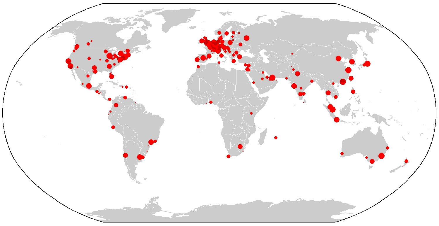
English: A map showing the distribution of GaWC-ranked "world cities." |
| Date | |
| Source | Own work |
| Author | Interchange88 |
Licensing
I, the copyright holder of this work, hereby publish it under the following license:
| This file is made available under the Creative Commons CC0 1.0 Universal Public Domain Dedication. | |
| The person who associated a work with this deed has dedicated the work to the public domain by waiving all of their rights to the work worldwide under copyright law, including all related and neighboring rights, to the extent allowed by law. You can copy, modify, distribute and perform the work, even for commercial purposes, all without asking permission.
|
File history
Click on a date/time to view the file as it appeared at that time.
| Date/Time | Thumbnail | Dimensions | User | Comment | |
|---|---|---|---|---|---|
| current | 20:48, 19 December 2011 | | 1,500 × 775 (56 KB) | Interchange88 | Totally new map for 2010 data |
| 00:41, 16 September 2011 |  | 1,480 × 625 (131 KB) | AlexCovarrubias | Minor update accordingly with 2010 GaWC studies | |
| 00:54, 27 July 2011 |  | 1,480 × 625 (39 KB) | Interchange88 | {{Information |Description ={{en|1=A map showing the distribution of GaWC-ranked "world cities."}} |Source ={{own}} |Author =Interchange88 |Date =2011-07-26 |Permission = |other_versions = }} [[Cate |
File usage
No pages on the English Wikipedia use this file (pages on other projects are not listed).
Global file usage
The following other wikis use this file:
- Usage on ar.wikipedia.org
- Usage on ast.wikipedia.org
- Usage on bh.wikipedia.org
- Usage on bn.wikipedia.org
- Usage on ca.wikipedia.org
- Usage on de.wikipedia.org
- Usage on eo.wikipedia.org
- Usage on es.wikipedia.org
- Usage on et.wikipedia.org
- Usage on fr.wikipedia.org
- Usage on fr.wikiversity.org
- Usage on hak.wikipedia.org
- Usage on he.wikipedia.org
- Usage on he.wikivoyage.org
- Usage on it.wikipedia.org
- Usage on ka.wikipedia.org
- Usage on ko.wikipedia.org
- Usage on ml.wikipedia.org
- Usage on pl.wikipedia.org
- Usage on pl.wiktionary.org
- Usage on pt.wikipedia.org
- Usage on ro.wikipedia.org
- Usage on sr.wikipedia.org
- Usage on te.wikipedia.org
- Usage on uk.wikipedia.org
- Usage on vi.wikipedia.org
- Usage on zh.wikipedia.org