
Original file (SVG file, nominally 939 × 1,536 pixels, file size: 1.19 MB)
| This is a file from the Wikimedia Commons. Information from its description page there is shown below. Commons is a freely licensed media file repository. You can help. |
Summary
| Description |
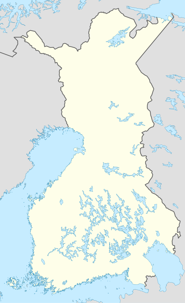
Deutsch: Positionskarte von Finnland (1920-1940)
Quadratische Plattkarte, N-S-Streckung 210 %. Geographische Begrenzung der Karte:
English: Location map of Finland (1920-1940)
Equirectangular projection, N/S stretching 210 %. Geographic limits of the map:
|
|
| Date | ||
| Source |
own work, using
|
|
| Author | NordNordWest | |
| Permission (Reusing this file) |
This file is licensed under the Creative Commons Attribution-Share Alike 3.0 Germany license.
 This file is licensed under the Creative Commons Attribution-Share Alike 3.0 Germany license.
|

_location_map.svg)
_location_map.svg&action=edit&redlink=1)
_location_map.svg)

|
This map has been made or improved in the German Kartenwerkstatt (Map Lab). You can propose maps to improve as well.
|
File history
Click on a date/time to view the file as it appeared at that time.
| Date/Time | Thumbnail | Dimensions | User | Comment | |
|---|---|---|---|---|---|
| current | 18:45, 16 February 2010 | | 939 × 1,536 (1.19 MB) | NordNordWest | = {{int:filedesc}} == {{Information |Description= {{de|Positionskarte von Finnland (1920-1940)}} Quadratische Plattkarte, N-S-Streckung 210 %. Geographische Begrenzung der Karte: * N: 70.4° N * S: 59.5° N * W: 19° O * O: 33° O {{en|Lo |
File usage
Global file usage
The following other wikis use this file:
- Usage on da.wikipedia.org
- Usage on de.wikipedia.org
- Yleisradio
- Mestaruussarja 1930
- Mestaruussarja 1931
- Mestaruussarja 1932
- Mestaruussarja 1933
- Mestaruussarja 1934
- Mestaruussarja 1935
- Mestaruussarja 1936
- Mestaruussarja 1937
- Mestaruussarja 1938
- Mestaruussarja 1939
- Wikipedia:Kartenwerkstatt/Positionskarten/Europa
- Vorlage:Positionskarte Finnland (1920–1940)
- Benutzer:Oevi/Vorlagen
- B-sarja 1930
- B-sarja 1931
- B-sarja 1932
- B-sarja 1933
- B-sarja 1934
- B-sarja 1935
- Itä-Länsi-sarja 1936
- Itä-Länsi-sarja 1937
- Itä-Länsi-sarja 1938
- Itä-Länsi-sarja 1939
- Usage on es.wikipedia.org
- Usage on fi.wikipedia.org
- Tarton rauha
- Jääpallon SM-sarja 1933
- Jalkapallon A-sarjan kausi 1931
- Jalkapallon A-sarjan kausi 1932
- Jalkapallon A-sarjan kausi 1933
- Jalkapallon Mestaruussarjan kausi 1936
- Jalkapallon Mestaruussarjan kausi 1938
- Jalkapallon A-sarjan kausi 1930
- Jalkapallon A-sarjan kausi 1934
- Jalkapallon A-sarjan kausi 1935
- Jalkapallon Itä–Länsi-sarjan kausi 1936
- Jalkapallon Mestaruussarjan kausi 1940–1941
- Jalkapallon Mestaruussarjan kausi 1937
- Jalkapallon Mestaruussarjan kausi 1939
- Jalkapallon Itä–Länsi-sarjan kausi 1937
- Jääpallon SM-sarja 1932
- Jääpallon SM-sarja 1931
- Jääpallon SM-sarja 1936
- Jääpallon SM-sarja 1938
- Jääpallon SM-sarja 1934
- Jääpallon SM-sarja 1935
- Jääpallon SM-sarja 1937
- Jääpallon SM-sarja 1939
- Jalkapallon Itä–Länsi-sarjan kausi 1938
View more global usage of this file.
_location_map.svg)
_location_map.svg)