Size of this preview: 800 × 574 pixels. Other resolutions: 320 × 230 pixels | 640 × 459 pixels | 1,024 × 735 pixels | 1,280 × 918 pixels | 2,560 × 1,837 pixels | 2,976 × 2,135 pixels.
Original file (2,976 × 2,135 pixels, file size: 2.36 MB, MIME type: image/jpeg)
| This is a file from the Wikimedia Commons. Information from its description page there is shown below. Commons is a freely licensed media file repository. You can help. |
Summary
| Description |
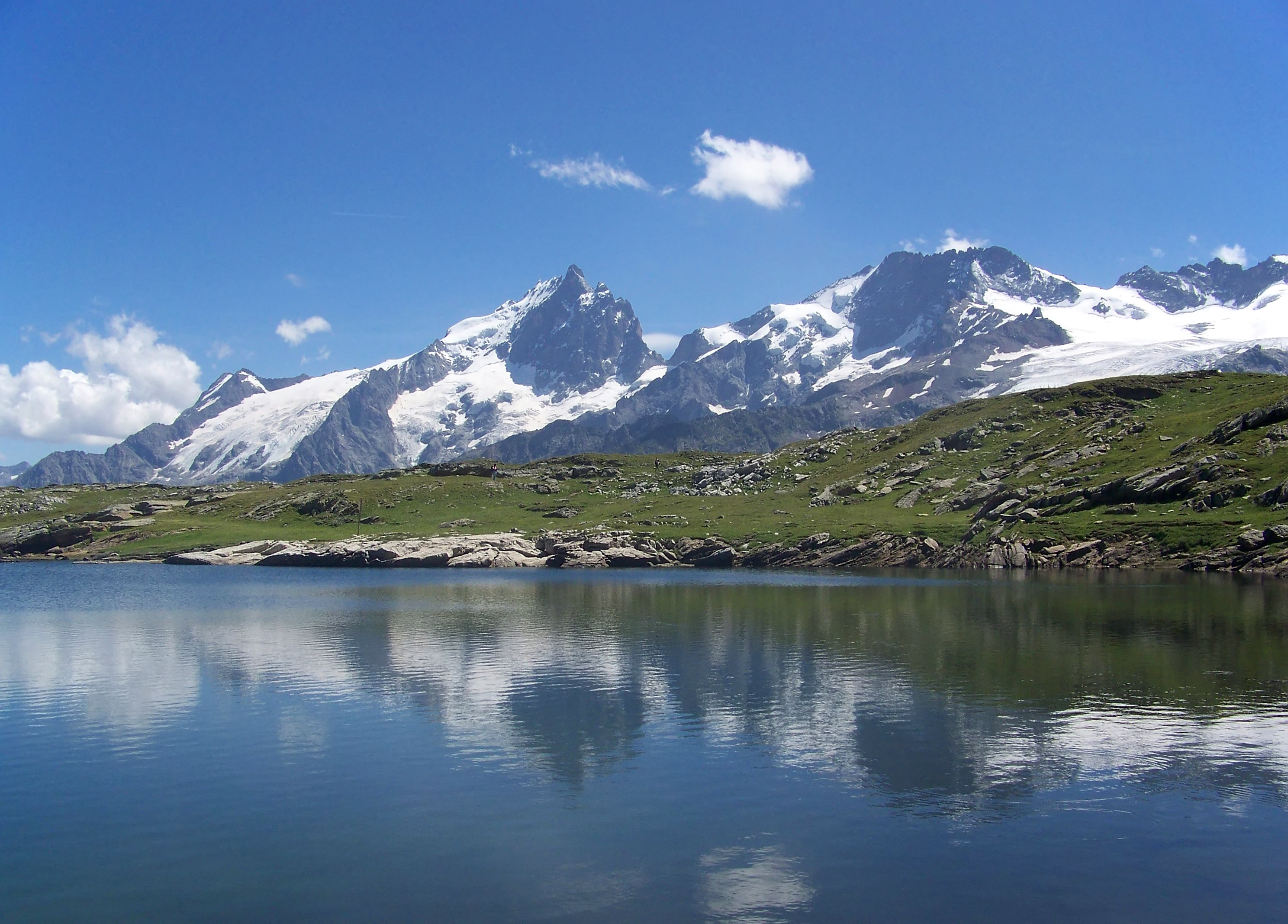
English: La Meije massif from Lac Noir, on the Emparis plateau (French Alps). In the background, from the left: Tabuchet Glacier, Grand Pic de la Meije (main summit on the picture) and Meije glacier, Râteau glacier, le Râteau (wider summit), Girose glacier.
Français : Le massif de la Meije depuis le Lac Noir, sur le plateau d'Emparis (Alpes françaises). À l'arrière-plan, de gauche à droite : le glacier du Tabuchet, le Grand Pic de la Meije (sommet principal sur la photo) et le glacier de la Meije, le glacier du Râteau, le Râteau (sommet plus large), glacier de la Girose. |
|
| Date | ||
| Source | Own work | |
| Author |
| |
| Attribution (required by the license) | © Guillaume Piolle / | |
| Camera location | | View this and other nearby images on: OpenStreetMap |
|---|
| Annotations | This image is annotated: View the annotations at Commons |
|


|
This image has been assessed under the valued image criteria and is considered the most valued image on Commons within the scope: Lac Lérié. You can see its nomination here. |
Licensing
I, the copyright holder of this work, hereby publish it under the following licenses:

|
Permission is granted to copy, distribute and/or modify this document under the terms of the GNU Free Documentation License, Version 1.2 or any later version published by the Free Software Foundation; with no Invariant Sections, no Front-Cover Texts, and no Back-Cover Texts. A copy of the license is included in the section entitled GNU Free Documentation License. |
This file is licensed under the Creative Commons Attribution 3.0 Unported license.
- You are free:
- to share – to copy, distribute and transmit the work
- to remix – to adapt the work
- Under the following conditions:
- attribution – You must give appropriate credit, provide a link to the license, and indicate if changes were made. You may do so in any reasonable manner, but not in any way that suggests the licensor endorses you or your use.
You may select the license of your choice.
File history
Click on a date/time to view the file as it appeared at that time.
| Date/Time | Thumbnail | Dimensions | User | Comment | |
|---|---|---|---|---|---|
| current | 06:26, 4 September 2008 | | 2,976 × 2,135 (2.36 MB) | Eusebius | |
| 18:04, 1 September 2008 |  | 2,976 × 2,135 (3.08 MB) | Eusebius | {{Information |Description={{en|1=La Meije massif from Lac Lérié, on the Emparis plateau (French Alps). In the background, from the left: Tabuchet Glacier, Grand Pic de la Meije (main summit on the picture) and Meije glacier, Râteau glacier, le Râteau |
File usage
The following pages on the English Wikipedia use this file (pages on other projects are not listed):
Global file usage
The following other wikis use this file:
- Usage on ar.wikipedia.org
- Usage on az.wikipedia.org
- Usage on da.wikipedia.org
- Usage on de.wikipedia.org
- Usage on fi.wikipedia.org
- Usage on fr.wikipedia.org
- Usage on hak.wikipedia.org
- Usage on hy.wikipedia.org
- Usage on it.wikipedia.org
- Usage on mk.wikipedia.org
- Usage on no.wikipedia.org
- Usage on os.wikipedia.org
- Usage on pl.wikivoyage.org