.jpg)
.jpg&action=edit&redlink=1)
Size of this preview: 800 × 600 pixels. Other resolutions: 320 × 240 pixels | 640 × 480 pixels | 1,024 × 768 pixels | 1,280 × 960 pixels | 2,560 × 1,920 pixels | 3,264 × 2,448 pixels.
Original file (3,264 × 2,448 pixels, file size: 2.6 MB, MIME type: image/jpeg)
| This is a file from the Wikimedia Commons. Information from its description page there is shown below. Commons is a freely licensed media file repository. You can help. |
.jpg)
Summary
| Description |
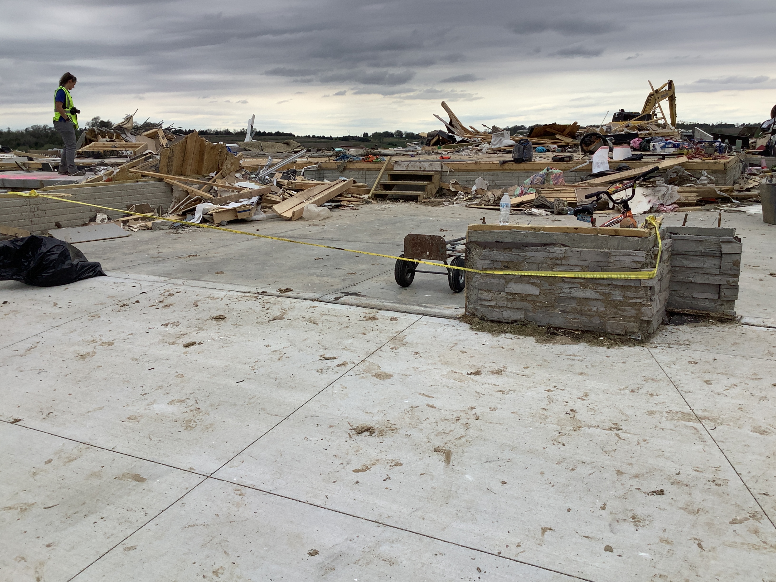
English: A home that was destroyed at low-end EF4 intensity on north side of Elkhorn, Nebraska.
"All walls collapsed. Foundation was swept clean of debris. Vehicles thrown in this location. Home built and inspected within past 2 years. Primary connector from floor to walls were nails. Sill plate bolted to poured foundation." |
| Date | |
| Source | https://services.dat.noaa.gov/arcgis/rest/services/nws_damageassessmenttoolkit/DamageViewer/FeatureServer/0/3978418/attachments/2392985 |
| Author | National Weather Service Omaha/Valley NE |
| Camera location | | View this and other nearby images on: OpenStreetMap |
|---|
.jpg¶ms=041.301951_N_-096.248135_E_globe:Earth_type:camera_heading:198.51&language=en)
Licensing
This file is in the public domain in the United States because it was solely created by employees of the National Weather Service or National Severe Storms Laboratory using the Damage Assessment Toolkit (DAT), an interactive map and database.
|
File history
Click on a date/time to view the file as it appeared at that time.
| Date/Time | Thumbnail | Dimensions | User | Comment | |
|---|---|---|---|---|---|
| current | 17:02, 28 July 2024 | | 3,264 × 2,448 (2.6 MB) | ChessEric | Uploaded a work by National Weather Service Omaha/Valley NE from https://services.dat.noaa.gov/arcgis/rest/services/nws_damageassessmenttoolkit/DamageViewer/FeatureServer/0/3978418/attachments/2392985 with UploadWizard |
File usage
The following pages on the English Wikipedia use this file (pages on other projects are not listed):
.jpg)