
Size of this preview: 706 × 600 pixels. Other resolutions: 283 × 240 pixels | 565 × 480 pixels | 904 × 768 pixels | 1,206 × 1,024 pixels | 2,362 × 2,006 pixels.
Original file (2,362 × 2,006 pixels, file size: 373 KB, MIME type: image/png)
| This is a file from the Wikimedia Commons. Information from its description page there is shown below. Commons is a freely licensed media file repository. You can help. |
| Description |
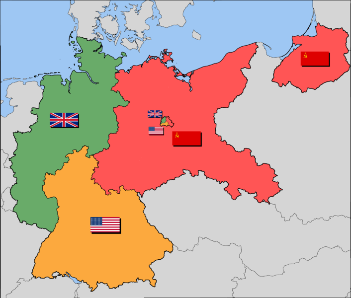
English: Occupation zone borders in Germany, 1944. |
| Date | (UTC) |
| Source | |
| Author |
|
| This is a retouched picture, which means that it has been digitally altered from its original version. The original can be viewed here: Map-Germany-1947-2.png:
|
I, the copyright holder of this work, hereby publish it under the following license:
This file is licensed under the Creative Commons Attribution-Share Alike 2.5 Generic license.
- You are free:
- to share – to copy, distribute and transmit the work
- to remix – to adapt the work
- Under the following conditions:
- attribution – You must give appropriate credit, provide a link to the license, and indicate if changes were made. You may do so in any reasonable manner, but not in any way that suggests the licensor endorses you or your use.
- share alike – If you remix, transform, or build upon the material, you must distribute your contributions under the same or compatible license as the original.
Original upload log
This image is a derivative work of the following images:
- File:Map-Germany-1947-2.png licensed with Cc-by-sa-2.5
- 2009-05-14T21:57:29Z Yumyum73 3492x2966 (423725 Bytes) {{Information |Description={{en|1=Occupation zone borders in Germany, 1944. The territories east of the [[:en:Oder-Neisse line|Oder-Neisse line]], under Polish and Soviet administration/annexation, are shown as white. Berlin
Uploaded with derivativeFX
File history
Click on a date/time to view the file as it appeared at that time.
| Date/Time | Thumbnail | Dimensions | User | Comment | |
|---|---|---|---|---|---|
| current | 07:14, 24 September 2015 | | 2,362 × 2,006 (373 KB) | Webcyss | Korrektur von Einzelheiten |
| 17:08, 28 March 2011 |  | 2,362 × 2,006 (320 KB) | Geowesen | Flagge der Sowjetunion in Ostpreussen hinzugefügt. | |
| 17:05, 28 March 2011 |  | 2,362 × 2,006 (319 KB) | Geowesen | {{Information |Description={{en|1=Occupation zone borders in Germany, 1944.}} |Source=*File:Map-Germany-1947-2.png |Date=2011-03-28 17:03 (UTC) |Author=*File:Map-Germany-1947-2.png: *_Map-Germany-1947.svg: [[Use |
File usage
The following pages on the English Wikipedia use this file (pages on other projects are not listed):
Global file usage
The following other wikis use this file:
- Usage on de.wikipedia.org
- Usage on sv.wikipedia.org