Size of this preview: 800 × 261 pixels. Other resolutions: 320 × 104 pixels | 640 × 208 pixels | 1,024 × 334 pixels | 3,070 × 1,000 pixels.
Original file (3,070 × 1,000 pixels, file size: 4.05 MB, MIME type: image/png)
| This is a file from the Wikimedia Commons. Information from its description page there is shown below. Commons is a freely licensed media file repository. You can help. |
Summary
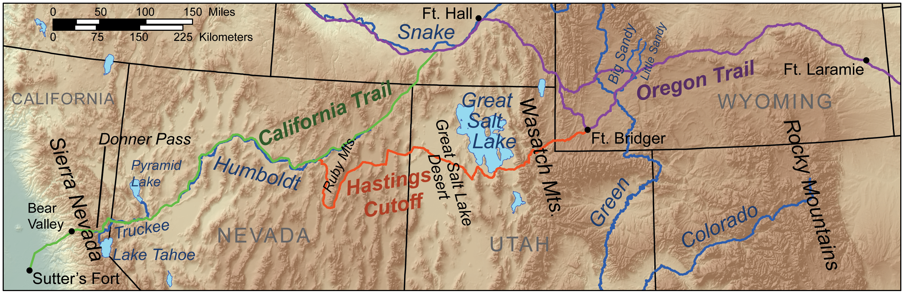
| Description | Map showing the route taken by the Donner Party. |
| Date | |
| Source | Own work, Elevation data from SRTM, Trails data from the NPS [1], all other features from the National Atlas. |
| Author | Kmusser (talk · contribs) |
| Other versions |
Licensing
I, the copyright holder of this work, hereby publish it under the following license:
This file is licensed under the Creative Commons Attribution-Share Alike 3.0 Unported license.
- You are free:
- to share – to copy, distribute and transmit the work
- to remix – to adapt the work
- Under the following conditions:
- attribution – You must give appropriate credit, provide a link to the license, and indicate if changes were made. You may do so in any reasonable manner, but not in any way that suggests the licensor endorses you or your use.
- share alike – If you remix, transform, or build upon the material, you must distribute your contributions under the same or compatible license as the original.
File history
Click on a date/time to view the file as it appeared at that time.
| Date/Time | Thumbnail | Dimensions | User | Comment | |
|---|---|---|---|---|---|
| current | 16:59, 29 March 2010 | 3,070 × 1,000 (4.05 MB) | Kmusser | added cutoff | |
| 15:11, 22 March 2010 | 3,070 × 1,000 (4.05 MB) | Kmusser | added scale bar | ||
| 13:19, 19 March 2010 | 3,070 × 1,000 (4.05 MB) | Kmusser | {{Information |Description=Map showing the route taken by the w:Donner Party. |Source={{own}}, Elevation data from SRTM, Trails data from the NPS [http://www.nps.gov/cali/planyourvi |
File usage
The following pages on the English Wikipedia use this file (pages on other projects are not listed):
Global file usage
The following other wikis use this file:
- Usage on ca.wikipedia.org
- Usage on cs.wikipedia.org
- Usage on es.wikipedia.org
- Usage on fa.wikipedia.org
- Usage on hu.wikipedia.org
- Usage on it.wikipedia.org
- Usage on ja.wikipedia.org
- Usage on nl.wikipedia.org
- Usage on no.wikipedia.org
- Usage on pl.wikipedia.org
- Usage on pt.wikipedia.org
- Usage on ro.wikipedia.org
- Usage on ru.wikipedia.org
- Usage on zh.wikipedia.org