Size of this preview: 800 × 600 pixels. Other resolutions: 320 × 240 pixels | 640 × 480 pixels | 1,024 × 768 pixels | 1,280 × 960 pixels | 2,560 × 1,920 pixels.
Original file (2,560 × 1,920 pixels, file size: 1.16 MB, MIME type: image/jpeg)
| This is a file from the Wikimedia Commons. Information from its description page there is shown below. Commons is a freely licensed media file repository. You can help. |
Summary
| Description |
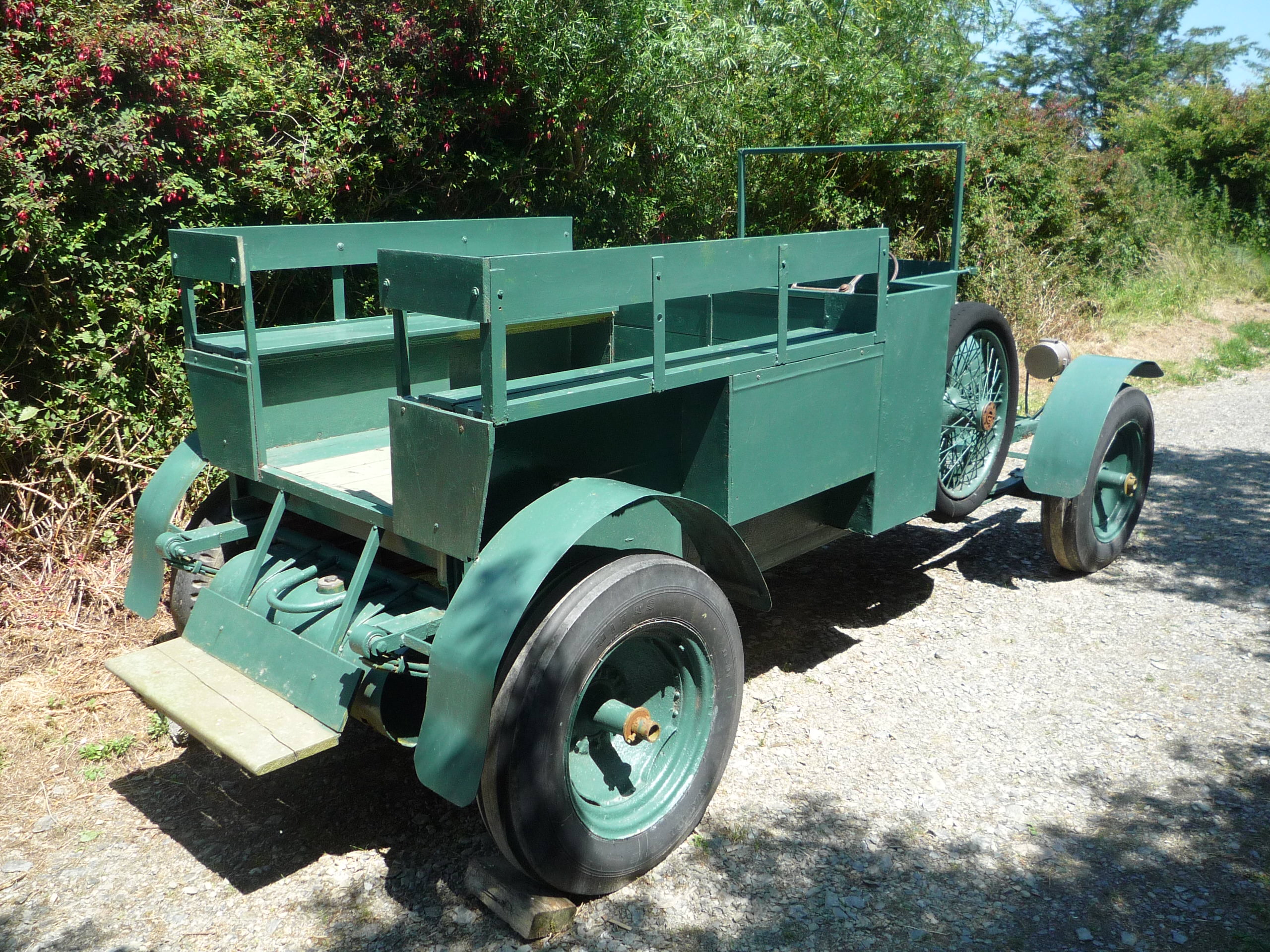
English: A somewhat crude replica of a Crossley Tender link on display at the Michael Collins Centre between Clonakilty and Timoleague, County Cork, Ireland. It stands on a bit of road built to simulate the point at Béal na Bláth where Collins was killed. A few yards away is a replica of the armoured car which was also in the convoy.
At this centre you get a very detailed, step by step description of Collins' death. The article here on the same subject stresses the uncertainty that exists about the incident. |
| Date | |
| Source | Own work |
| Author | RHaworth |
| Other versions |
.jpg) |
| Camera location | | View this and other nearby images on: OpenStreetMap |
|---|
Licensing
Roger W. Haworth, the copyright holder of this work, hereby publishes it under the following licenses:

|
Permission is granted to copy, distribute and/or modify this document under the terms of the GNU Free Documentation License, Version 1.2 or any later version published by the Free Software Foundation; with no Invariant Sections, no Front-Cover Texts, and no Back-Cover Texts. A copy of the license is included in the section entitled GNU Free Documentation License. |
This file is licensed under the Creative Commons Attribution-Share Alike 4.0 International license.
Attribution: Roger W. Haworth
- You are free:
- to share – to copy, distribute and transmit the work
- to remix – to adapt the work
- Under the following conditions:
- attribution – You must give appropriate credit, provide a link to the license, and indicate if changes were made. You may do so in any reasonable manner, but not in any way that suggests the licensor endorses you or your use.
- share alike – If you remix, transform, or build upon the material, you must distribute your contributions under the same or compatible license as the original.
You may select the license of your choice.
File history
Click on a date/time to view the file as it appeared at that time.
| Date/Time | Thumbnail | Dimensions | User | Comment | |
|---|---|---|---|---|---|
| current | 09:54, 23 August 2014 | | 2,560 × 1,920 (1.16 MB) | RHaworth | {{Information |Description= |Source={{own}} |Date= |Author= RHaworth |Permission= |other_versions= }} {{user:RHaworth/mylic}} |
File usage
The following pages on the English Wikipedia use this file (pages on other projects are not listed):