
No higher resolution available.
Contrasting_Ridges_in_Virginia_-_Labeled.jpg (720 × 480 pixels, file size: 206 KB, MIME type: image/jpeg)
| This is a file from the Wikimedia Commons. Information from its description page there is shown below. Commons is a freely licensed media file repository. You can help. |
Summary
| Description |
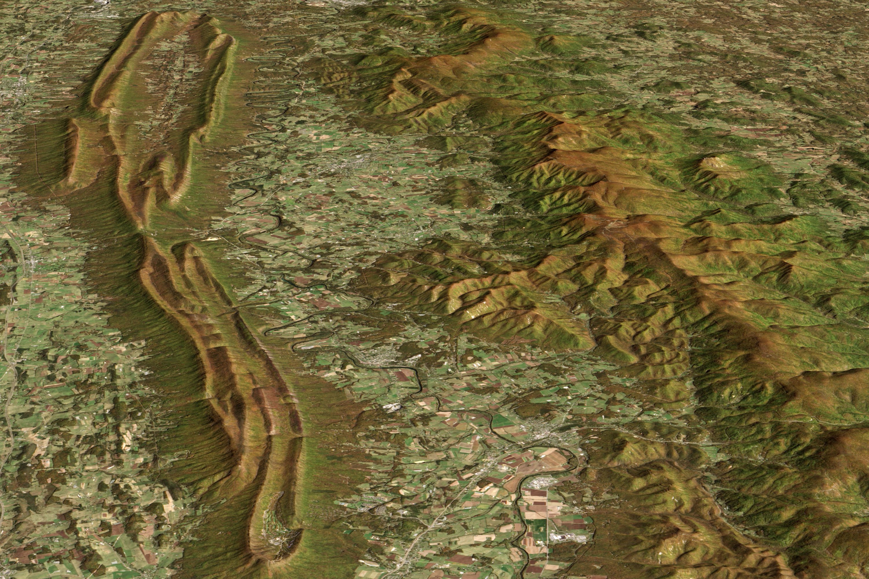
English: Image displaying the topographical differences between two roughly parallel ridges along Virginia's western border: one is the backbone of Shenandoah National Park, and the other is part of George Washington National Forest, both rise above the Shenandoah Valley's rolling lowlands. |
| Date | |
| Source |
https://www.earthobservatory.nasa.gov/IOTD/view.php?id=89843&eocn=related_to&eoci=related_image https://eoimages.gsfc.nasa.gov/images/imagerecords/89000/89843/shenandoah_oli_2013294_lrg.jpg |
| Author |
NASA Earth Observatory image by Jesse Allen, using Landsat data from the U.S. Geological Survey and ASTER GDM2 terrain data from NASA/GSFC/METI/ERSDAC/JAROS, and U.S./Japan ASTER Science Team. Caption by Adam Voiland. Instrument(s): Terra - ASTER Landsat 8 - OLI |
Licensing
| This file is in the public domain in the United States because it was solely created by NASA. NASA copyright policy states that "NASA material is not protected by copyright unless noted". (See Template:PD-USGov, NASA copyright policy page or JPL Image Use Policy.) | ||
 |
Warnings:
|
File history
Click on a date/time to view the file as it appeared at that time.
| Date/Time | Thumbnail | Dimensions | User | Comment | |
|---|---|---|---|---|---|
| current | 22:24, 27 November 2017 | | 720 × 480 (206 KB) | Jalbertbowdenii | User created page with UploadWizard |
File usage
The following pages on the English Wikipedia use this file (pages on other projects are not listed):