
Size of this preview: 800 × 370 pixels. Other resolutions: 320 × 148 pixels | 640 × 296 pixels | 1,357 × 628 pixels.
Original file (1,357 × 628 pixels, file size: 49 KB, MIME type: image/png)
| This is a file from the Wikimedia Commons. Information from its description page there is shown below. Commons is a freely licensed media file repository. You can help. |

|
This map image could be re-created using vector graphics as an SVG file. This has several advantages; see Commons:Media for cleanup for more information. If an SVG form of this image is available, please upload it and afterwards replace this template with
{{vector version available|new image name}}.
It is recommended to name the SVG file “Cetacea range map Sperm Whale 4.svg”—then the template Vector version available (or Vva) does not need the new image name parameter. |
Extracted from the English Wikipedia.
| Description |
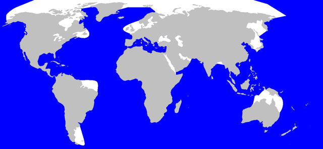
Geographic distribution of Spermwhale v4 Português: Distribuição geográfica da Cachalote |
| Date | |
| Source | en:Image:Cetacea_range_map_Sperm_Whale_4.PNG |
| Author | en:User:Vardion, en:User:Pcb21 and en:User:Chris huh |
| Permission (Reusing this file) |
GFDL |
Licensing

|
Permission is granted to copy, distribute and/or modify this document under the terms of the GNU Free Documentation License, Version 1.2 or any later version published by the Free Software Foundation; with no Invariant Sections, no Front-Cover Texts, and no Back-Cover Texts. A copy of the license is included in the section entitled GNU Free Documentation License. |
| This file is licensed under the Creative Commons Attribution-Share Alike 3.0 Unported license. | ||
| ||
| This licensing tag was added to this file as part of the GFDL licensing update. |
User:Pcb21 after User:Vardion, Sperm Whale range map v.4
See also: Wikipedia:WikiProject Cetaceans#Range maps
File history
Click on a date/time to view the file as it appeared at that time.
| Date/Time | Thumbnail | Dimensions | User | Comment | |
|---|---|---|---|---|---|
| current | 21:52, 7 December 2010 | | 1,357 × 628 (49 KB) | Totodu74 | error |
| 21:51, 7 December 2010 |  | 1,357 × 628 (35 KB) | Totodu74 | not in the Black Sea | |
| 13:44, 14 September 2006 |  | 1,357 × 628 (35 KB) | Stigmj | {{Information |Description=Geographic distribution of Spermwhale v4 |Source=en:Image:Cetacea_range_map_Sperm_Whale_4.PNG |Date=17. June 2006 |Author=en:User:Vardion, en:User:Pcb21 and en:User:Chris huh |Permission=GFDL }} | |
| 15:38, 26 March 2005 |  | 1,357 × 628 (35 KB) | David.gaya | Extracted from the English Wikipedia. {{GFDL}} User:Pcb21 after User:Vardion, Sperm Whale range map v.4 See also: Wikipedia:WikiProject Cetaceans#Range maps |
File usage
The following pages on the English Wikipedia use this file (pages on other projects are not listed):
Global file usage
The following other wikis use this file:
- Usage on af.wikipedia.org
- Usage on ar.wikipedia.org
- Usage on be-tarask.wikipedia.org
- Usage on bg.wikipedia.org
- Usage on br.wikipedia.org
- Usage on ceb.wikipedia.org
- Usage on cs.wikipedia.org
- Usage on da.wikipedia.org
- Usage on de.wikipedia.org
- Usage on es.wikipedia.org
- Usage on et.wikipedia.org
- Usage on fa.wikipedia.org
- Usage on fo.wikipedia.org
- Usage on fr.wikipedia.org
- Usage on gl.wikipedia.org
- Usage on hr.wikipedia.org
- Usage on hu.wikipedia.org
- Usage on is.wikipedia.org
- Usage on jv.wikipedia.org
- Usage on kk.wikipedia.org
- Usage on ko.wikipedia.org
- Usage on lv.wikipedia.org
- Usage on ml.wikipedia.org
- Usage on mn.wikipedia.org
- Usage on nl.wikipedia.org
- Usage on no.wikipedia.org
- Usage on nv.wikipedia.org
- Usage on pl.wikipedia.org
- Usage on pt.wikipedia.org
- Usage on sh.wikipedia.org
- Usage on sk.wikipedia.org
- Usage on sl.wikipedia.org
- Usage on sq.wikipedia.org
- Usage on sr.wikipedia.org
- Usage on sv.wikipedia.org
- Usage on th.wikipedia.org
- Usage on tr.wikipedia.org
- Usage on uk.wikipedia.org
- Usage on vi.wikipedia.org
- Usage on zh-min-nan.wikipedia.org
- Usage on zh-yue.wikipedia.org