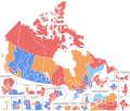
Size of this PNG preview of this SVG file: 767 × 600 pixels. Other resolutions: 307 × 240 pixels | 614 × 480 pixels | 982 × 768 pixels | 1,280 × 1,001 pixels | 2,560 × 2,002 pixels | 1,046 × 818 pixels.
Original file (SVG file, nominally 1,046 × 818 pixels, file size: 1.42 MB)
File history
Click on a date/time to view the file as it appeared at that time.
| Date/Time | Thumbnail | Dimensions | User | Comment | |
|---|---|---|---|---|---|
| current | 17:11, 8 July 2022 |  | 1,046 × 818 (1.42 MB) | Politicsfan4 | Reverted to version as of 22:22, 21 December 2017 (UTC) |
| 17:09, 8 July 2022 |  | 1,046 × 818 (1.29 MB) | Politicsfan4 | removed excess code | |
| 22:22, 21 December 2017 |  | 1,046 × 818 (1.42 MB) | DrRandomFactor | Additional information added. | |
| 17:29, 30 October 2017 |  | 1,046 × 818 (1.36 MB) | DrRandomFactor | Fixed error with Gaspésie—Les Îles-de-la-Madeleine. The islands were incorrectly grouped with Manicougan, this has been fixed. | |
| 20:27, 24 October 2017 |  | 1,046 × 818 (1.36 MB) | DrRandomFactor | Fixed formatting issues with the Toronto inset. | |
| 06:20, 19 October 2017 |  | 1,046 × 818 (1.36 MB) | DrRandomFactor | Fixed formatting errors in inset boundaries. | |
| 06:09, 19 October 2017 |  | 1,046 × 818 (1.35 MB) | DrRandomFactor | New format | |
| 21:19, 5 August 2017 |  | 3,254 × 2,768 (926 KB) | DrRandomFactor | Added party names and seat count numbers. | |
| 19:49, 3 May 2017 |  | 3,254 × 2,768 (881 KB) | DrRandomFactor | Adjusted boundaries in the Ottawa region for viewing purposes. | |
| 17:23, 2 April 2017 |  | 3,254 × 2,768 (888 KB) | DrRandomFactor | Fixed boundary issues between Brampton North and Centre in Mississauga. |
File usage
The following pages on the English Wikipedia use this file (pages on other projects are not listed):
Global file usage
The following other wikis use this file:
- Usage on es.wikipedia.org
- Usage on fa.wikipedia.org
- Usage on fi.wikipedia.org