
Size of this PNG preview of this SVG file: 448 × 599 pixels. Other resolutions: 179 × 240 pixels | 359 × 480 pixels | 574 × 768 pixels | 765 × 1,024 pixels | 1,531 × 2,048 pixels | 536 × 717 pixels.
Original file (SVG file, nominally 536 × 717 pixels, file size: 30 KB)
| This is a file from the Wikimedia Commons. Information from its description page there is shown below. Commons is a freely licensed media file repository. You can help. |
Summary
| Description |
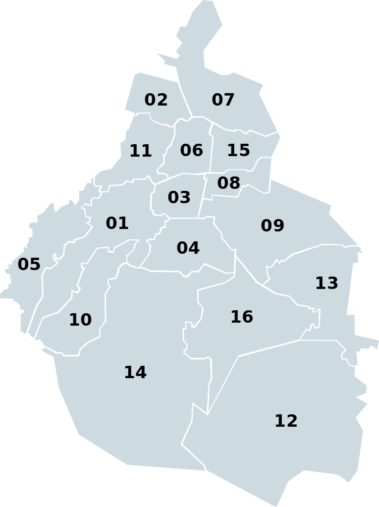
English: Federal Distric in Mexico with boroughs numbered.
Español: Distrito Federal en México con las delegaciones numeradas. |
| Date | |
| Source | Image:Mexico map, MX-DFE.svg |
| Author | EOZyo |
| SVG development |
Licensing
| I, the copyright holder of this work, release this work into the public domain. This applies worldwide. In some countries this may not be legally possible; if so: I grant anyone the right to use this work for any purpose, without any conditions, unless such conditions are required by law. |
File history
Click on a date/time to view the file as it appeared at that time.
| Date/Time | Thumbnail | Dimensions | User | Comment | |
|---|---|---|---|---|---|
| current | 09:06, 18 September 2008 | | 536 × 717 (30 KB) | EOZyo | {{Information |Description={{en|1=Federal Distric in Mexico with boroughs numbered.}} {{es|1=Distrito Federal en México con las delegaciones numeradas.}} |Source=Image:Mexico map, MX-DFE.svg |Author=EOZyo |Date=2008-09-18 |Permission= |oth |
File usage
The following pages on the English Wikipedia use this file (pages on other projects are not listed):
Global file usage
The following other wikis use this file:
- Usage on ba.wikipedia.org
- Usage on bg.wikipedia.org
- Usage on bxr.wikipedia.org
- Usage on ca.wikipedia.org
- Usage on eo.wikipedia.org
- Usage on eu.wikipedia.org
- Usage on fi.wikipedia.org
- Usage on ia.wikipedia.org
- Usage on ja.wikipedia.org
- Usage on ms.wikipedia.org
- Usage on ru.wikipedia.org
- Usage on sl.wikipedia.org
- Usage on sv.wikipedia.org
- Usage on vi.wikipedia.org
- Usage on www.wikidata.org