
Size of this preview: 519 × 599 pixels. Other resolutions: 208 × 240 pixels | 416 × 480 pixels | 665 × 768 pixels | 887 × 1,024 pixels | 1,459 × 1,685 pixels.
Original file (1,459 × 1,685 pixels, file size: 56 KB, MIME type: image/png)
| This is a file from the Wikimedia Commons. Information from its description page there is shown below. Commons is a freely licensed media file repository. You can help. |
| This work has been released into the public domain by its author, SPUI. This applies worldwide. In some countries this may not be legally possible; if so: |
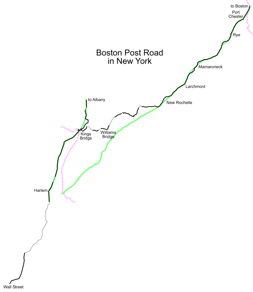
A map of the Boston Post Road in New York. The original road is in black; later realignments are in green. Dotted lines represent roads that no longer exist.
File history
Click on a date/time to view the file as it appeared at that time.
| Date/Time | Thumbnail | Dimensions | User | Comment | |
|---|---|---|---|---|---|
| current | 14:33, 23 January 2005 | | 1,459 × 1,685 (56 KB) | SPUI~commonswiki | |
| 09:42, 23 January 2005 |  | 1,152 × 1,152 (44 KB) | SPUI~commonswiki | {{spuimap}}A map of the Boston Post Road from Manhattan to Connecticut. The original road is in black; later realignments are in green.category:Boston Post Roadcategory:road maps |
File usage
The following pages on the English Wikipedia use this file (pages on other projects are not listed):
Global file usage
The following other wikis use this file:
- Usage on de.wikipedia.org
- Usage on ja.wikipedia.org