No higher resolution available.
Aubange_Luxembourg_Belgium_Map.png (220 × 290 pixels, file size: 7 KB, MIME type: image/png)
| This is a file from the Wikimedia Commons. Information from its description page there is shown below. Commons is a freely licensed media file repository. You can help. |

|
This locator map image could be re-created using vector graphics as an SVG file. This has several advantages; see Commons:Media for cleanup for more information. If an SVG form of this image is available, please upload it and afterwards replace this template with
{{vector version available|new image name}}.
It is recommended to name the SVG file “Aubange Luxembourg Belgium Map.svg”—then the template Vector version available (or Vva) does not need the new image name parameter. |
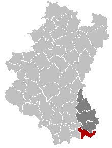
English: Map of the Belgian Luxembourg province showing Aubange municipality in red, and Arlon arrondissement in dark
Français : Carte indiquant la localisation de la commune belge d'Aubange (en rouge) dans la province de Luxembourg, avec l'arrondissement d'Arlon en gris foncé
Walon : Mape des comenes del province do Lussimbork, avou Åbindje e rodje eyet l' arondixhmint d' Årlon e gris foncé.
| This work has been released into the public domain by its author, LennartBolks. This applies worldwide. In some countries this may not be legally possible; if so: |
File history
Click on a date/time to view the file as it appeared at that time.
| Date/Time | Thumbnail | Dimensions | User | Comment | |
|---|---|---|---|---|---|
| current | 09:12, 20 November 2005 | | 220 × 290 (7 KB) | Srtxg | new version with arrondissement in dark |
| 11:48, 26 February 2005 |  | 220 × 290 (5 KB) | Nicnac25~commonswiki | Map, municipality belgium Aubange |
File usage
No pages on the English Wikipedia use this file (pages on other projects are not listed).
Global file usage
The following other wikis use this file:
- Usage on br.wikipedia.org
- Usage on eo.wikipedia.org
- Usage on fa.wikipedia.org
- Usage on fr.wiktionary.org
- Usage on it.wikipedia.org
- Usage on li.wikipedia.org
- Usage on pt.wikipedia.org
- Usage on ro.wikipedia.org
- Usage on ru.wikipedia.org
- Usage on sk.wikipedia.org
- Usage on uk.wikipedia.org
- Usage on vi.wikipedia.org
- Usage on wa.wikipedia.org