
Original file (4,441 × 2,961 pixels, file size: 8.84 MB, MIME type: image/jpeg)
| This is a file from the Wikimedia Commons. Information from its description page there is shown below. Commons is a freely licensed media file repository. You can help. |
| Camera location | | View this and other nearby images on: OpenStreetMap |
|---|
| Description |
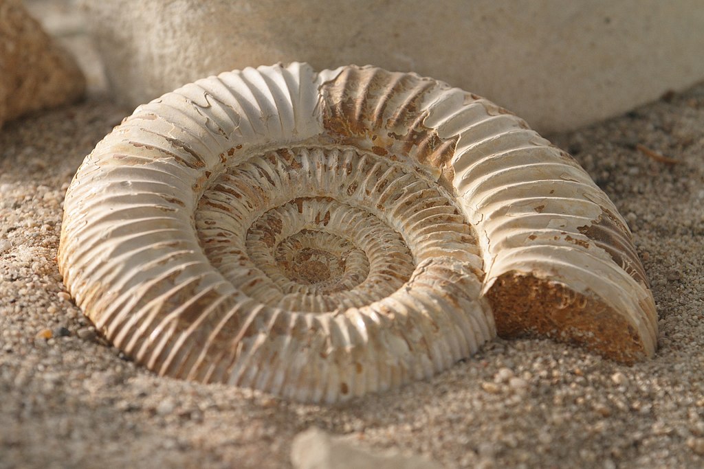
English: Highly probable Perisphinctes sp. from Oxfordian age |
||
| Date | |||
| Source | Own work | ||
| Author | |||
| Permission (Reusing this file) |
Deutsch: Lizenz: CC BY-SA 3.0 oder LAL.
Ich würde mich sehr über die Zusendung eines Belegexemplares bzw. der Angabe der Internetseite, wo das Foto benutzt wird, freuen. Vielen Dank! Kontakt: photos@spacebirdy.org English: Licence: CC BY-SA 3.0 or FAL.
I would be happy to receive a specimen copy or the URL of the website where the image is used, kind thanks. Contact: photos@spacebirdy.org Español: Licencia: CC BY-SA 3.0 o LAL.
Me alegraría si me mande un ejemplar de prueba o me deje saber dónde está usando la imagen, muchas gracias. Contacto: photos@spacebirdy.org Français : Licence: CC BY-SA 3.0 ou LAL.
Naturellement je serais trés heureuse de recevoir un exemplaire justificatif ou être informée d'où la photo est utilisée sur l'internet. Merci beaucoup! Contact: photos@spacebirdy.org Íslenska: Leyfi: CC BY-SA 3.0 eða FAL.
Það væri svo frábært að senda mér sýnisútgáfu eða að láta mig vita á hvaða vefsíðu þú ert að nota myndina, takk fyrir. Hafa samband: photos@spacebirdy.org I, the copyright holder of this work, hereby publish it under the following licenses: This file is licensed under the Creative Commons Attribution-Share Alike 3.0 Unported license.
You may select the license of your choice. |
||
| Other versions | User:Spacebirdy/Myndir |
File history
Click on a date/time to view the file as it appeared at that time.
| Date/Time | Thumbnail | Dimensions | User | Comment | |
|---|---|---|---|---|---|
| current | 13:30, 17 November 2012 | | 4,441 × 2,961 (8.84 MB) | Spacebirdy | {{Location|48|11|5.49|N|16|18|6.10|E}} {{Information | Description = {{de|Ein Ammonit im Wüstenhaus.}} | Source = own | Date = 2012-11-17 | Author = {{User:Spacebirdy/geimfuglinn}} | Permiss... |
File usage
Global file usage
The following other wikis use this file:
- Usage on an.wikipedia.org
- Usage on ast.wikipedia.org
- Usage on en.wikiversity.org
- Usage on es.wikipedia.org
- Usage on fr.wikipedia.org
- Usage on gl.wikipedia.org
- Usage on vi.wikipedia.org