
Original file (4,000 × 4,000 pixels, file size: 12.09 MB, MIME type: image/jpeg)
| This is a file from the Wikimedia Commons. Information from its description page there is shown below. Commons is a freely licensed media file repository. You can help. |
Summary
| Description |
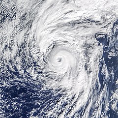
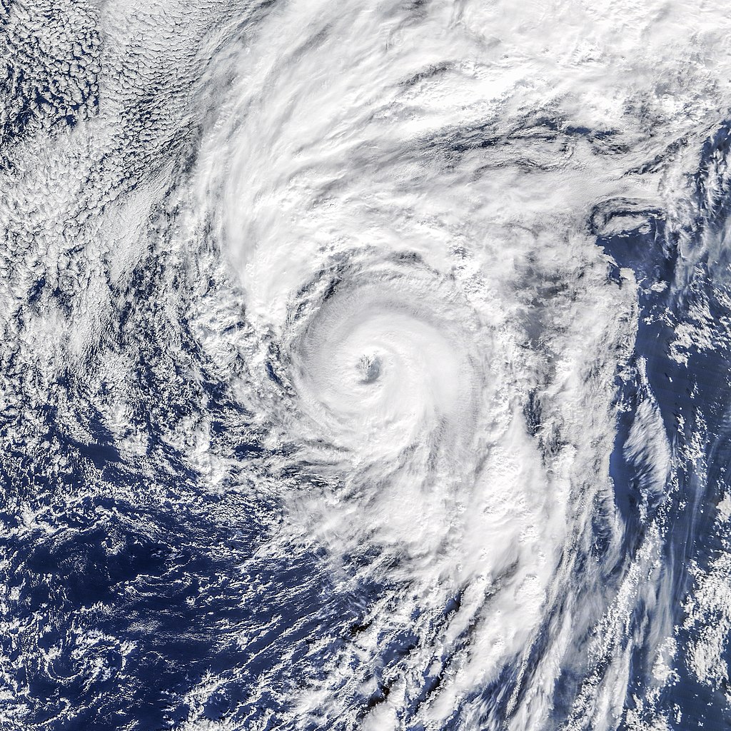
English: Hurricanes have arrived early this year in the northern hemisphere. Just days after hurricane Pali became the earliest Central Pacific hurricane on record, the Atlantic basin spun up its own unusual storm. On January 14, 2016, a tropical depression in the eastern Atlantic evolved into hurricane Alex; it became the earliest hurricane in the basin since 1938 and just the fourth January hurricane in 150 years of records.
At 11:00 a.m. Azores time (13:00 Universal Time) on January 14, the Moderate Resolution Imaging Spectroradiometer (MODIS) on NASA’s Terra satellite captured this view of hurricane Alex. Two hours after the image was acquired, the storm was reported to have sustained winds of 75 knots (85 miles or 140 kilometers per hour) and a central pressure of 981 millibars. The storm was about 800 kilometers (500 miles) south of the Azores, which it is predicted to pass over in the coming days. Alex is not just unusual for being a hurricane in the dead of winter; it is also unusual as just the second storm on record to form so far north and east in the Atlantic (north of 30 degrees North latitude, east of 30 degrees West longitude). The map below shows the track of Alex relative to the tracks of all reported storms in NOAA’s record from 1842 to 2015. Hurricanes do not typically form when sea surface temperatures are below 26° Celsius (78.8 degrees Fahrenheit), so it seemed uncanny for Alex to form when water temperatures in the northeast Atlantic were roughly 22°C. But as NASA research meteorologist Scott Braun pointed out, the water temperatures were 0.5 to 1.0 degrees above normal. More importantly, a low-pressure trough in the upper atmosphere meant air temperatures aloft were quite cool compared to the water below. “The decrease in temperature from the surface to upper levels was strong enough to create convective instability,” Braun said. “The thunderstorm activity gradually caused upper level warming such that the system transitioned from an extra-tropical to a tropical cyclone.” According to Jason Samenow of The Washington Post, the first named Atlantic storm usually forms on July 9. Only 0.5 percent of tropical storm activity in the Atlantic has occurred before June 1. |
| Date | |
| Source | https://earthobservatory.nasa.gov/NaturalHazards/view.php?id=87324 |
| Author | NASA image (top) by Jeff Schmaltz, LANCE/EOSDIS Rapid Response. NASA Earth Observatory map (bottom) by Joshua Stevens, using data from NOAA and Unisys Weather. Caption by Mike Carlowicz. |
| Other versions |
|


.jpg)
.jpg&action=edit&redlink=1)
.jpg)
Licensing
| This file is in the public domain in the United States because it was solely created by NASA. NASA copyright policy states that "NASA material is not protected by copyright unless noted". (See Template:PD-USGov, NASA copyright policy page or JPL Image Use Policy.) | ||
 |
Warnings:
|
File history
Click on a date/time to view the file as it appeared at that time.
| Date/Time | Thumbnail | Dimensions | User | Comment | |
|---|---|---|---|---|---|
| current | 00:51, 23 May 2018 | | 4,000 × 4,000 (12.09 MB) | Nino Marakot | User created page with UploadWizard |
File usage
Global file usage
The following other wikis use this file:
- Usage on es.wikipedia.org
- Usage on fa.wikipedia.org
- Usage on zh.wikipedia.org
.jpg)