
Size of this preview: 800 × 450 pixels. Other resolutions: 320 × 180 pixels | 640 × 360 pixels | 1,024 × 575 pixels | 1,280 × 719 pixels | 3,000 × 1,686 pixels.
Original file (3,000 × 1,686 pixels, file size: 1.55 MB, MIME type: image/jpeg)
| This is a file from the Wikimedia Commons. Information from its description page there is shown below. Commons is a freely licensed media file repository. You can help. |
Summary
| Description |
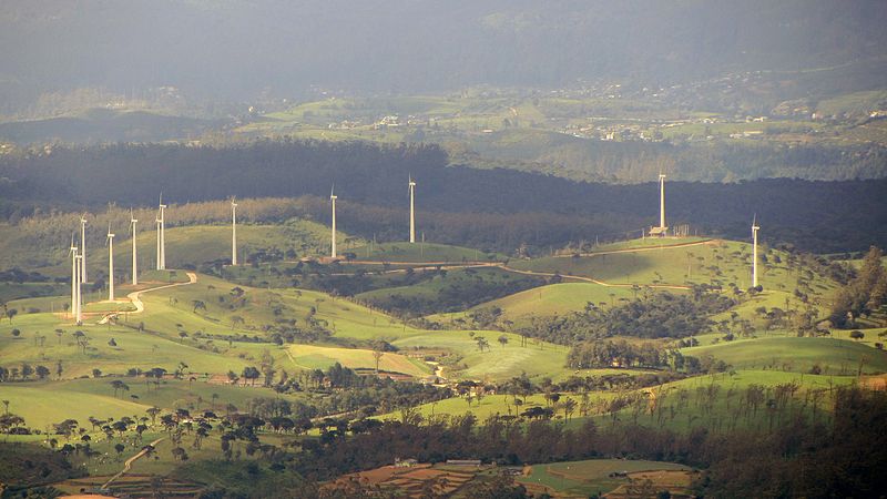
English: Wind turbines of the 3-megawatt Aitken Spence Wind Farm in Ambewela. |
| Date | |
| Source | Own work |
| Author | Rehman Abubakr |
| Camera location | | View this and other nearby images on: OpenStreetMap |
|---|
Licensing

|
This image has been assessed under the valued image criteria and is considered the most valued image on Commons within the scope: Ambewela Aitken Spence Wind Farm. You can see its nomination here. |
File history
Click on a date/time to view the file as it appeared at that time.
| Date/Time | Thumbnail | Dimensions | User | Comment | |
|---|---|---|---|---|---|
| current | 05:13, 7 October 2012 | | 3,000 × 1,686 (1.55 MB) | Rehman | User created page with UploadWizard |
File usage
The following pages on the English Wikipedia use this file (pages on other projects are not listed):
Global file usage
The following other wikis use this file:
- Usage on fr.wikipedia.org
- Usage on hu.wikipedia.org
- Usage on si.wikipedia.org
- Usage on www.wikidata.org