File:7th - 9th century Surang tila mandapa before shrines, Sirpur monuments Chhattisgarh.jpg
Size of this preview: 800 × 600 pixels. Other resolutions: 320 × 240 pixels | 640 × 480 pixels | 1,024 × 768 pixels | 1,280 × 960 pixels | 2,560 × 1,920 pixels | 4,032 × 3,024 pixels.
Original file (4,032 × 3,024 pixels, file size: 3.33 MB, MIME type: image/jpeg)
| This is a file from the Wikimedia Commons. Information from its description page there is shown below. Commons is a freely licensed media file repository. You can help. |
Summary
| Description |
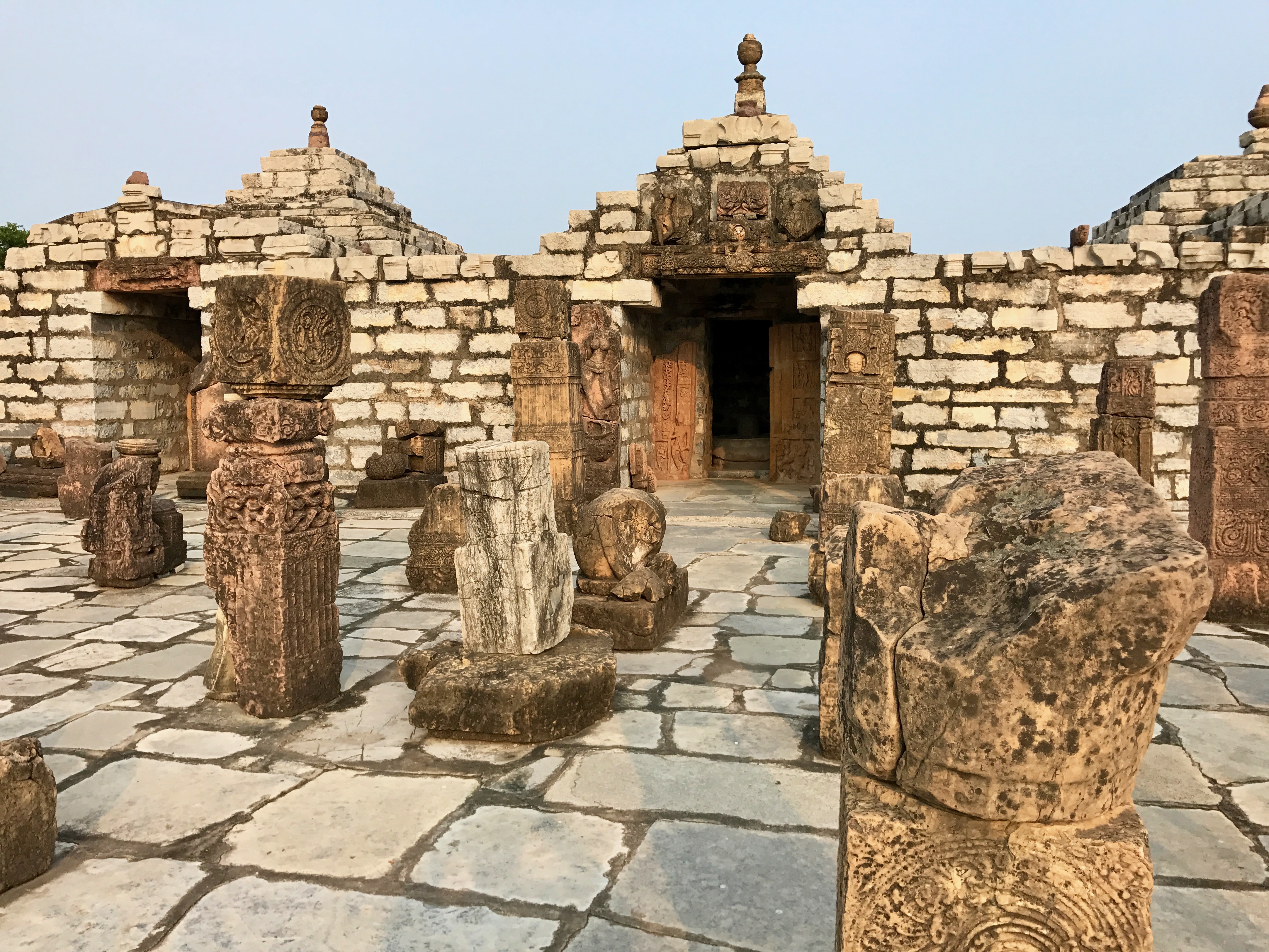
English: Sirpur, also referred in medieval era texts as Shripur (city of wealth), is a town on the banks of Mahanadi in Chhattisgarh. The site became archaeologically significant after a visit and report on a Laxman (Lakshmana) temple in 1872 by Alexander Cunningham, a colonial British India official. Sirpur is mentioned in the memoirs of the Chinese traveler Hieun Tsang as a location of monasteries and temples. The site has been significant for its temple ruins of Rama and Lakshmana of the Ramayana fame.
The site excavations after 1960, particularly after 2003, have yielded 22 Shiva temples, 5 Vishnu temples, 10 Buddha Viharas, 3 Jain Viharas, a 6th/7th century market and snana-kund (bath house). The site shows extensive syncretism, where Buddhist and Jain statues or motifs intermingle with Shiva, Vishnu and Devi temples. The region was conquered and plundered by the armies of Delhi Sultanate and later Deccan Sultanates. The town and temples were damaged in the wars and were abandoned. Dense vegetation grew over it and floods deposited silt. There is also evidence of possible earthquake damage or soil / ground underneath a structure caving in / sinkhole subsidence. 20th and 21st century excavations have unearthed many monuments. The site is large and artwork stick out of farmlands and dirt roads in and near Sirpur. |
| Date | |
| Source | Own work |
| Author | Ms Sarah Welch |
| Camera location | | View this and other nearby images on: OpenStreetMap |
|---|
Licensing
I, the copyright holder of this work, hereby publish it under the following license:
This file is licensed under the Creative Commons Attribution-Share Alike 4.0 International license.
- You are free:
- to share – to copy, distribute and transmit the work
- to remix – to adapt the work
- Under the following conditions:
- attribution – You must give appropriate credit, provide a link to the license, and indicate if changes were made. You may do so in any reasonable manner, but not in any way that suggests the licensor endorses you or your use.
- share alike – If you remix, transform, or build upon the material, you must distribute your contributions under the same or compatible license as the original.
File history
Click on a date/time to view the file as it appeared at that time.
| Date/Time | Thumbnail | Dimensions | User | Comment | |
|---|---|---|---|---|---|
| current | 18:36, 29 September 2017 | | 4,032 × 3,024 (3.33 MB) | Ms Sarah Welch | User created page with UploadWizard |
File usage
The following pages on the English Wikipedia use this file (pages on other projects are not listed):