
Size of this PNG preview of this SVG file: 508 × 600 pixels. Other resolutions: 203 × 240 pixels | 406 × 480 pixels | 650 × 768 pixels | 867 × 1,024 pixels | 1,734 × 2,048 pixels | 553 × 653 pixels.
Original file (SVG file, nominally 553 × 653 pixels, file size: 182 KB)
| This is a file from the Wikimedia Commons. Information from its description page there is shown below. Commons is a freely licensed media file repository. You can help. |
Summary
| Description |
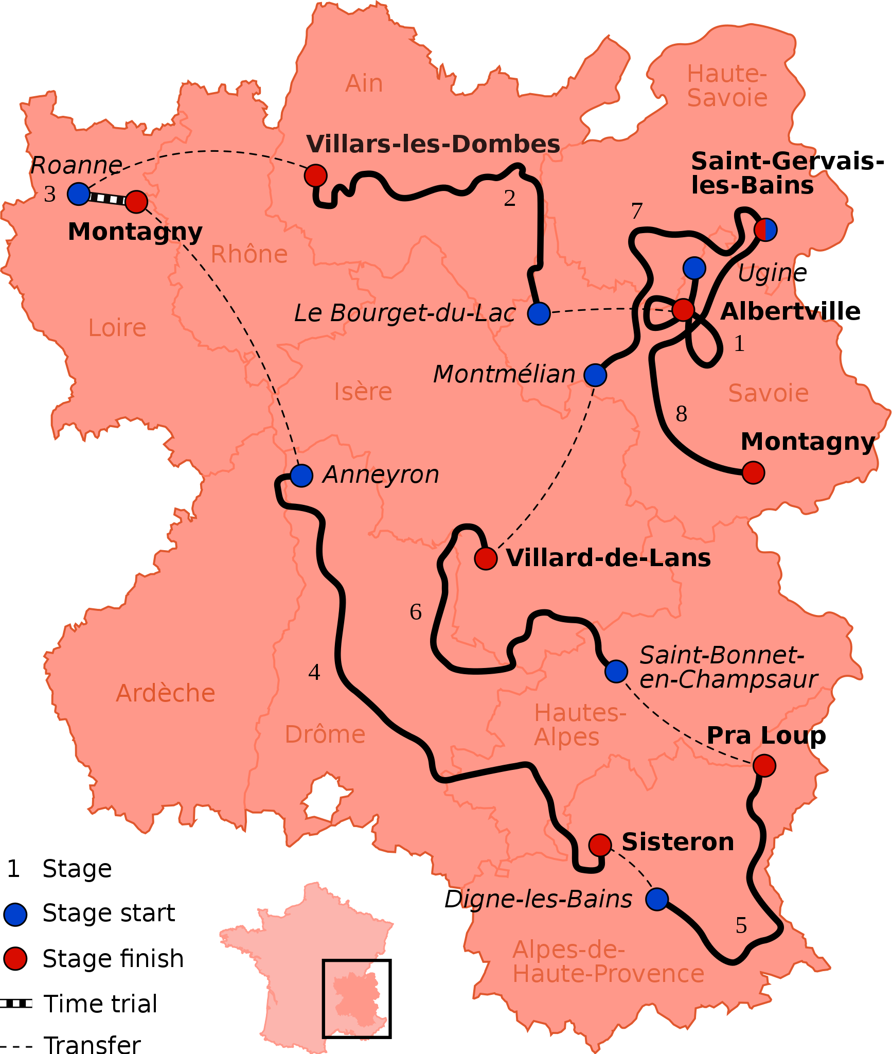
English: Route map of the 2015 Critérium du Dauphiné. |
| Date | |
| Source | |
| Author | |
| SVG | W3C-validity not checked. |

|
This SVG file contains embedded text that can be translated into your language, using any capable SVG editor, text editor or the SVG Translate tool. For more information see: About translating SVG files. |
Licensing
I, the copyright holder of this work, hereby publish it under the following licenses:
| Copyleft: This work of art is free; you can redistribute it and/or modify it according to terms of the Free Art License. You will find a specimen of this license on the Copyleft Attitude site as well as on other sites. |
This file is licensed under the Creative Commons Attribution-Share Alike 4.0 International, 3.0 Unported, 2.5 Generic, 2.0 Generic and 1.0 Generic license.
- You are free:
- to share – to copy, distribute and transmit the work
- to remix – to adapt the work
- Under the following conditions:
- attribution – You must give appropriate credit, provide a link to the license, and indicate if changes were made. You may do so in any reasonable manner, but not in any way that suggests the licensor endorses you or your use.
- share alike – If you remix, transform, or build upon the material, you must distribute your contributions under the same or compatible license as the original.
You may select the license of your choice.
File history
Click on a date/time to view the file as it appeared at that time.
| Date/Time | Thumbnail | Dimensions | User | Comment | |
|---|---|---|---|---|---|
| current | 13:54, 29 October 2015 | | 553 × 653 (182 KB) | BaldBoris | == {{int:filedesc}} == {{Information |Description={{en|Route map of the 2015 Critérium du Dauphiné.}} |Source= * {{f|France location map-Regions and departements 1975-2014.svg}} by Eric Gaba ({u|Sting}}) * {{url|h... |
File usage
The following pages on the English Wikipedia use this file (pages on other projects are not listed):
Global file usage
The following other wikis use this file:
- Usage on ar.wikipedia.org
- Usage on es.wikipedia.org
- Usage on fr.wikipedia.org
- Usage on lb.wikipedia.org
- Usage on pt.wikipedia.org
- Usage on ru.wikipedia.org
- Usage on sv.wikipedia.org
- Usage on www.wikidata.org