Size of this preview: 759 × 600 pixels. Other resolutions: 304 × 240 pixels | 607 × 480 pixels | 972 × 768 pixels | 1,280 × 1,012 pixels | 1,661 × 1,313 pixels.
Original file (1,661 × 1,313 pixels, file size: 169 KB, MIME type: image/png)
| This is a file from the Wikimedia Commons. Information from its description page there is shown below. Commons is a freely licensed media file repository. You can help. |
Summary
| Description |
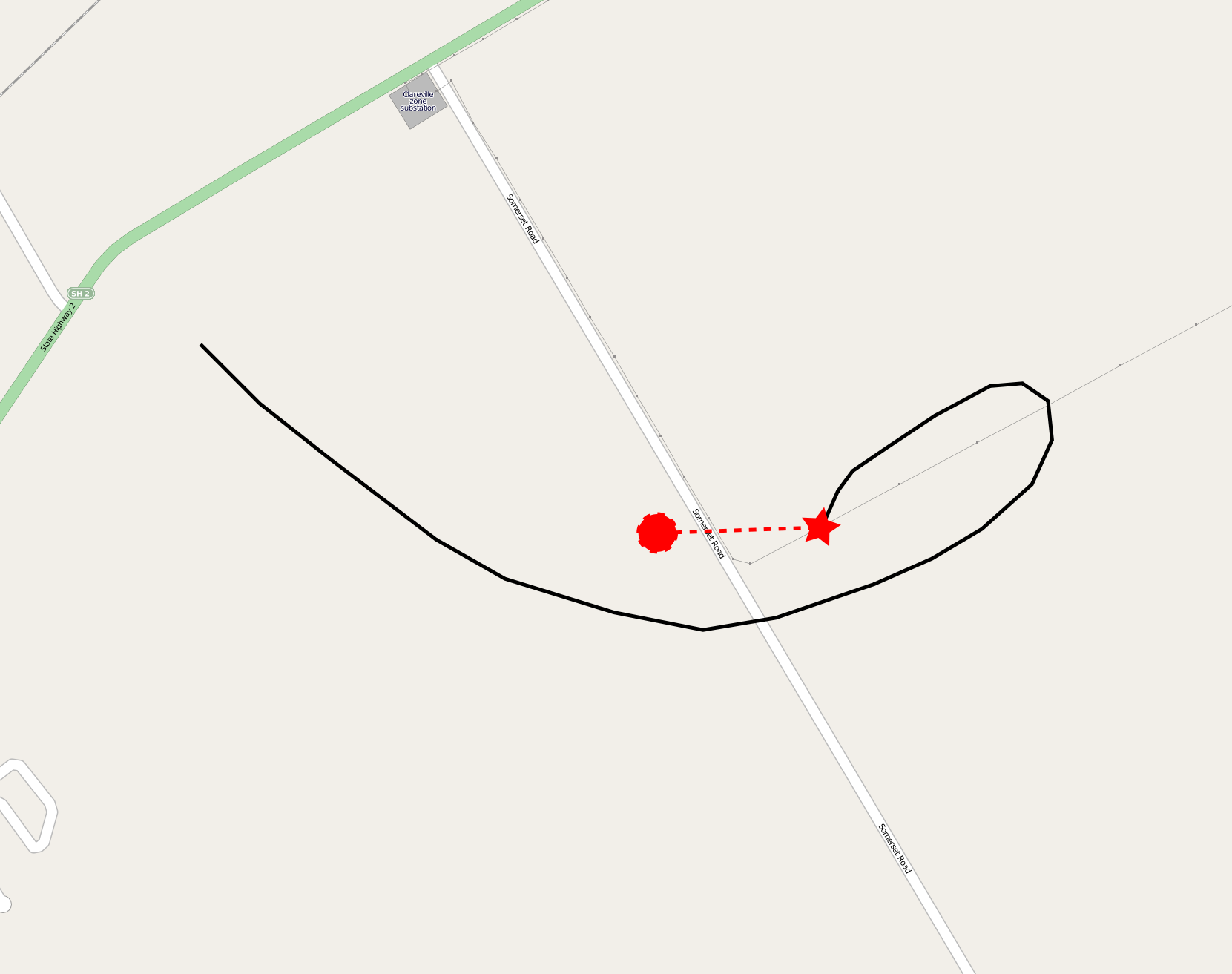
English: A map showing the route of the Cameron A210 hot air ballon ZK-XXF over Somerset Road, Carterton, New Zealand before it crashed in the 2012 Carterton hot air balloon crash, killing all eleven on board. The red star is the point where the balloon came in to contact with the 33 kV power line, and the red circle is where the wreckage was found. |
|||
| Date | ||||
| Source | Own work, using OpenStreetMap data | |||
| Author | Lcmortensen | |||
| Permission (Reusing this file) |
|
Licensing
I, the copyright holder of this work, hereby publish it under the following license:
This file is licensed under the Creative Commons Attribution-Share Alike 3.0 Unported license.
- You are free:
- to share – to copy, distribute and transmit the work
- to remix – to adapt the work
- Under the following conditions:
- attribution – You must give appropriate credit, provide a link to the license, and indicate if changes were made. You may do so in any reasonable manner, but not in any way that suggests the licensor endorses you or your use.
- share alike – If you remix, transform, or build upon the material, you must distribute your contributions under the same or compatible license as the original.
File history
Click on a date/time to view the file as it appeared at that time.
| Date/Time | Thumbnail | Dimensions | User | Comment | |
|---|---|---|---|---|---|
| current | 03:01, 31 December 2012 | | 1,661 × 1,313 (169 KB) | Lcmortensen | {{Information |Description ={{en|1=A map showing the route of the Cameron A210 hot air ballon ZK-XXF over Somerset Road, Carterton, New Zealand before it crashed in the [[w:2012 Carterton hot air balloon crash|2012 Carterton hot air ... |
File usage
The following pages on the English Wikipedia use this file (pages on other projects are not listed):
Global file usage
The following other wikis use this file:
- Usage on www.wikidata.org