Size of this preview: 429 × 599 pixels. Other resolutions: 172 × 240 pixels | 344 × 480 pixels | 550 × 768 pixels | 733 × 1,024 pixels | 1,466 × 2,048 pixels | 3,580 × 5,000 pixels.
Original file (3,580 × 5,000 pixels, file size: 5.56 MB, MIME type: image/jpeg)
| This is a file from the Wikimedia Commons. Information from its description page there is shown below. Commons is a freely licensed media file repository. You can help. |
| Japan | ||||||
|---|---|---|---|---|---|---|
| Artist | ||||||
| Title |
Japan |
|||||
| Description |
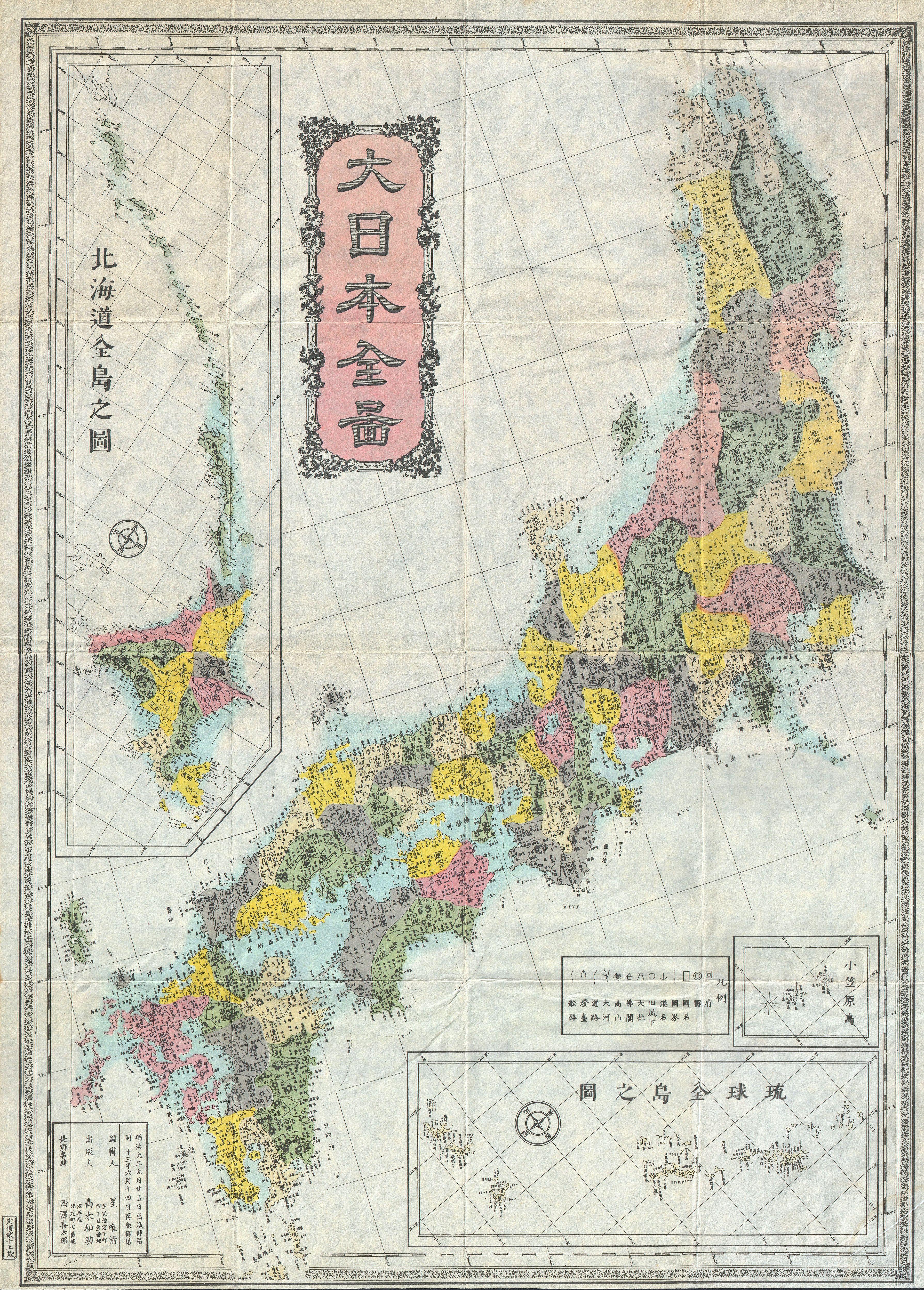
English: This is a rare c.1880s late Meiji period map of Japan. Issued by the Japanese in the Japanese style. Insets of Hokkaido in the upper left quadrant and other Japanese islands in the lower right quadrant. Surrounded by a decorative border. All text in Japanese.
日本語: 明治初期の令制国の配置図(1880年頃)。千島列島は日本に属していました。 |
|||||
| Date | circa 1880(undated) | |||||
| Dimensions | height: 27 in (68.5 cm); width: 19.2 in (48.8 cm) | |||||
| Accession number |
Geographicus link: Japan-meiji-1880 |
|||||
| Source/Photographer |
|
|||||
| Permission (Reusing this file) |
|
|||||
File history
Click on a date/time to view the file as it appeared at that time.
| Date/Time | Thumbnail | Dimensions | User | Comment | |
|---|---|---|---|---|---|
| current | 19:44, 16 March 2011 | | 3,580 × 5,000 (5.56 MB) | BotMultichill | {{subst:User:Multichill/Geographicus |link=http://www.geographicus.com/P/AntiqueMap/Japan-meiji-1880 |product_name=1880s Meiji Japanese Folding Map of Japan |map_title=Japan |description=This is a rare c.1880s late Meiji period map of Japan. Issued by th |
File usage
The following pages on the English Wikipedia use this file (pages on other projects are not listed):
Global file usage
The following other wikis use this file:
- Usage on de.wikipedia.org
- Usage on ja.wikipedia.org
- Usage on pl.wikipedia.org