
Size of this preview: 800 × 600 pixels. Other resolutions: 320 × 240 pixels | 640 × 480 pixels | 1,024 × 768 pixels | 1,280 × 960 pixels | 2,560 × 1,920 pixels | 3,648 × 2,736 pixels.
Original file (3,648 × 2,736 pixels, file size: 2.06 MB, MIME type: image/jpeg)
| This is a file from the Wikimedia Commons. Information from its description page there is shown below. Commons is a freely licensed media file repository. You can help. |
Summary
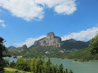
| Description | 玉甑峰全貌 | ||
| Date | Taken on 13 October 2013 | ||
| Source | https://web.archive.org/web/20161027163301/http://www.panoramio.com/photo/97686757 | ||
| Author | 江上清风1961 | ||
| Permission (Reusing this file) |
This file is licensed under the Creative Commons Attribution 3.0 Unported license. Attribution: 江上清风1961
|
||
| Tags (from Panoramio photo page) | Wenzhou, best, 浙江省温州市乐清及雁荡山 |
| Camera location | | View this and other nearby images on: OpenStreetMap |
|---|
File history
Click on a date/time to view the file as it appeared at that time.
| Date/Time | Thumbnail | Dimensions | User | Comment | |
|---|---|---|---|---|---|
| current | 09:35, 21 March 2017 | | 3,648 × 2,736 (2.06 MB) | Panoramio upload bot | == {{int:filedesc}} == {{Information |description=玉甑峰全貌 |date={{Taken on|2013-10-13}} |source=http://www.panoramio.com/photo/97686757 |author=[http://www.panoramio.com/user/1400530?with_photo_id=97686757 江上清风1961] |permission={{cc-by-... |
File usage
The following pages on the English Wikipedia use this file (pages on other projects are not listed):
Global file usage
The following other wikis use this file:
- Usage on es.wikipedia.org
- Usage on hr.wikipedia.org
- Usage on id.wikipedia.org
- Usage on io.wikipedia.org
- Usage on is.wikipedia.org
- Usage on ja.wikipedia.org
- Usage on mn.wikipedia.org
- Usage on ne.wikipedia.org
- Usage on ro.wikipedia.org
- Usage on sd.wikipedia.org
- Usage on sw.wikipedia.org
- Usage on th.wikipedia.org
- Usage on vec.wikipedia.org
- Usage on zh.wikipedia.org