
Size of this preview: 800 × 533 pixels. Other resolutions: 320 × 213 pixels | 640 × 426 pixels | 1,024 × 682 pixels | 1,280 × 853 pixels | 2,560 × 1,706 pixels | 3,194 × 2,128 pixels.
Original file (3,194 × 2,128 pixels, file size: 1.54 MB, MIME type: image/jpeg)
| This is a file from the Wikimedia Commons. Information from its description page there is shown below. Commons is a freely licensed media file repository. You can help. |
Summary
| Description |
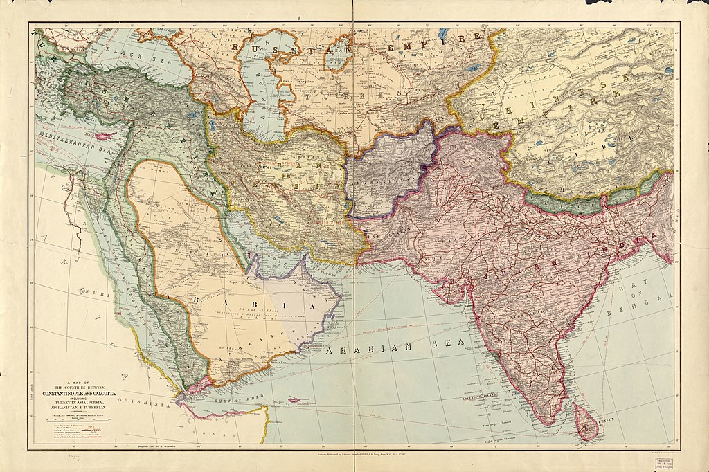
Русский: Политическая карта Азии начало XX века
English: Political map of Asia in the early XX century |
||
| Date | |||
| Source |
|
||
| Author | Edward Stanford Ltd. | ||
| Other versions | File:A map of the countries between Constantinople and Calcutta including Turkey in Asia, Persia, Afghanistan and Turkestan.tif |

Licensing
|
This work is in the public domain in its country of origin and other countries and areas where the copyright term is the author's life plus 70 years or fewer. This work is in the public domain in the United States because it was published (or registered with the U.S. Copyright Office) before January 1, 1929. | |
| This file has been identified as being free of known restrictions under copyright law, including all related and neighboring rights. | |
File history
Click on a date/time to view the file as it appeared at that time.
| Date/Time | Thumbnail | Dimensions | User | Comment | |
|---|---|---|---|---|---|
| current | 16:26, 2 February 2022 | | 3,194 × 2,128 (1.54 MB) | Ориенталист | Uploaded a work by Edward Stanford Ltd. from {{LOC-map|id=g7420.ct001442|division=gmd}} with UploadWizard |
File usage
The following pages on the English Wikipedia use this file (pages on other projects are not listed):
Global file usage
The following other wikis use this file:
- Usage on ar.wikipedia.org
- Usage on ast.wikipedia.org
- Usage on ckb.wikipedia.org
- Usage on cy.wikipedia.org
- Usage on ru.wikipedia.org
- Usage on www.wikidata.org