Plaza de la Constitución (Spanish for 'Constitution Square'), also known as Plaza Matriz, is the oldest city square in Montevideo, Uruguay.
| Plaza Matriz | |
 | |
| Native name | Spanish: Plaza de la Constitución |
|---|---|
| Location | Ciudad Vieja, Montevideo |
| Construction | |
| Inauguration | 1726 |
Located in barrio Ciudad Vieja, since 1726 was the plaza mayor of the Fortress City of San Felipe and Santiago of Montevideo, in which it was the only open public space.[1] It is the center of the city's historic district, and is surrounded by important buildings, such as the Metropolitan Cathedral and the Cabildo. It is, therefore, one of the most important tourist sites.
History edit

Founded in 1726, two years after the founding of Montevideo, the square was a dusty plain until the end of the 18th century, when buildings were built around it.[2] From that moment on, official events and celebrations, both civil and military, were held in the space, as well as bullfights, since a bullring was located in the square.[3]
In 1851, the square was structured in a centralized way with diagonal paths lined with trees, paved and equipped with benches and lanterns.

In 1868, construction began on a steam pumping plant and a 60 km pipeline to supply the city with water.[4] In addition, a fountain was built in the square to receive the water. On May 13, 1871, the water pumped from the Santa Lucía River to the Plaza Constitución arrived for the first time;[5] Finally, the fountain was formally inaugurated by President Lorenzo Batlle y Grau on July 18.[6] The fountain is a design by architect Juan Manuel Ferrari, and is composed of a circular pool with an ornate column at its center that takes the form of three dishes that open in decreasing size. In the center there are four griffins alternated with various symbolic elements, such as the National Coat of Arms.[7]
In 2011 the central fountain was restored.[8] It is currently the tourist and commercial axis of the barrio together with the Peatonal Sarandí. Nearby are offices, government buildings, banks, clothing stores, and cultural institutions.[9][10]
Geography edit
Surrounding the square are the Montevideo Metropolitan Cathedral, main Roman Catholic in the city to the west, and the Cabildo to the east.[11] Also on the east is Casa Vaeza, headquarters of the National Party.[12] To the south is the Peatonal Sarandí and Club Uruguay, while the headquarters of the Ministry of Transport and Public Works are to the north.[13][14]
Gallery edit
-
 Characteristic kiosk of the city
 -
 Square name sign
 -
 Building that housed the Pyramides Hotel
 -
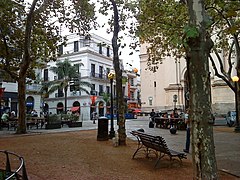
 View of the square from the southwest side
 -
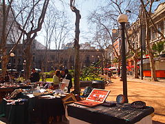 Flea market in the square


References edit
- ^ "Plaza de la Constitución - Matriz | Municipio B". 2022-03-07. Archived from the original on 2022-03-07. Retrieved 2023-01-09.
- ^ "Plaza Matriz | Intendencia de Montevideo". 2022-08-22. Archived from the original on 2022-08-22. Retrieved 2023-01-09.
- ^ "Aquél Montevideo taurino | Viajes". 2019-04-14. Archived from the original on 2019-04-14. Retrieved 2023-01-09.
- ^ "Museo del Agua (Usina Vieja de Aguas Corrientes)". www.museos.gub.uy (in European Spanish). Retrieved 2022-01-11.
- ^ "Historia del agua corriente en Uruguay: Fynn, Lanús y Lezica". 2022-06-02. Archived from the original on 2022-06-02. Retrieved 2023-01-09.
- ^ "Historia del agua corriente en Uruguay: Fynn, Lanús y Lezica". www.ose.com.uy. Retrieved 2022-01-11.
- ^ "Nuestra primera fuente y un baño imprevisto para ilustres | Viajes". 2022-01-27. Archived from the original on 2022-01-27. Retrieved 2023-01-09.
- ^ "Reinauguración de la fuente central de la Plaza Constitución". Uruguay Presidencia (in Spanish). Retrieved 2023-01-09.
- ^ "Ciudad Vieja | Municipio B". 2022-07-06. Archived from the original on 2022-07-06. Retrieved 2023-01-09.
- ^ "Se "aceleró definitivamente" el éxodo de oficinas desde Ciudad Vieja al este de Montevideo". El Observador. Retrieved 2023-01-09.
- ^ "Historia | Museo Histórico Cabildo". 2022-03-07. Archived from the original on 2022-03-07. Retrieved 2023-01-09.
- ^ "Casa Vaeza - Ocampo - Sede del Partido Nacional | Municipio B". municipiob.montevideo.gub.uy. Retrieved 2023-01-09.
- ^ "Club Uruguay | Municipio B". 2022-08-09. Archived from the original on 2022-08-09. Retrieved 2023-01-09.
- ^ "Dependencias del | Ministerio de Transporte y Obras Públicas". 2021-08-01. Archived from the original on 2021-08-01. Retrieved 2023-01-09.