Cegléd (Hungarian: Ceglédi járás) is a district in south-eastern part of Pest County. Cegléd is also the name of the town where the district seat is found. The district is located in the Central Hungary Statistical Region.
Cegléd District
Ceglédi járás | |
|---|---|
 Coat of arms | |
 Cegléd District within Hungary and Pest County. | |
| Country | |
| County | Pest |
| District seat | Cegléd |
| Area | |
| • Total | 886.30 km2 (342.20 sq mi) |
| • Rank | 1st in Pest |
| Population (2011 census) | |
| • Total | 88,952 |
| • Rank | 4th in Pest |
| • Density | 100/km2 (300/sq mi) |
Geography edit
Cegléd District borders with Nagykáta District to the north, Szolnok District (Jász-Nagykun-Szolnok County) to the east, Tiszakécske District (Bács-Kiskun County) and Nagykőrös District to the south, Kecskemét District (Bács-Kiskun County) to the southwest, Dabas District to the west, Monor District to the northwest. The number of the inhabited places in Cegléd District is 12.
Municipalities edit
The district has 3 towns and 9 villages. (ordered by population, as of 1 January 2013)[1]
- Abony (14,769)
- Albertirsa (12,181)
- Cegléd (36,384) – district seat
- Ceglédbercel (4,364)
- Csemő (4,166)
- Dánszentmiklós (3,103)
- Jászkarajenő (2,724)
- Kőröstetétlen (904)
- Mikebuda (681)
- Tápiószőlős (2,928)
- Törtel (4,383)
- Újszilvás (2,674)
The bolded municipalities are cities.
Demographics edit
Religion in Cegléd District (2011 census)
In 2011, it had a population of 88,952 and the population density was 100/km².
| Year | County population[2] | Change |
|---|---|---|
| 2011 | 88,952 | n/a |
Ethnicity edit
Besides the Hungarian majority, the main minorities are the Roma (approx. 1,800), German (950) and Romanian (300).
Total population (2011 census): 88,952
Ethnic groups (2011 census):[3] Identified themselves: 79,369 persons:
- Hungarians: 75,431 (95.04%)
- Gypsies: 1,837 (2.31%)
- Germans: 966 (1.22%)
- Others and indefinable: 1,135 (1.43%)
Approx. 9,500 persons in Cegléd District did not declare their ethnic group at the 2011 census.
Religion edit
Religious adherence in the county according to 2011 census:[4]
- Catholic – 32,171 (Roman Catholic – 31,892; Greek Catholic – 268);
- Reformed – 10,632;
- Evangelical – 3,987;
- other religions – 1,257;
- Non-religious – 14,304;
- Atheism – 781;
- Undeclared – 25,820.
Gallery edit
-
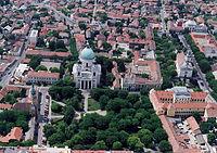 Cegléd, the district seat
 -
 Millennium Monument in Kőröstetétlen
 -
 Aerial view of Dánszentmiklós
 -
 Roman Catholic Church in Abony


.jpg)
See also edit
References edit
- ^ A KSH 2013. évi helységnévkönyve
- ^ népesség.com, "Ceglédi járás népessége"
- ^ 4.1.6.1 A népesség nemzetiség szerint, 2011, (in Hungarian) [1]
- ^ 4.1.7.1 A népesség vallás, felekezet szerint, 2011, (in Hungarian) [2]
External links edit
47°11′00″N 19°48′00″E / 47.1833°N 19.8000°E
This Pest County location article is a stub. You can help Wikipedia by expanding it. |