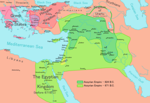
Bit-Istar was an Assyrian town and a local kingdom (c. 12th century BC - c. 710 BC) at western Zagros that according to inscriptions of Tiglath Pileser III and Sargon II. It was located close to the source of a river to the east of Dyala.
Stronach and Calmeyer proposed Ravansar as a possible candidate for the place of Bit-Istar. Recent surveys by Y. Hassanzadeh led to discovery of new evidence indicating presence of rich 1st-millennium remains close to the spring of Ravansar (34°43′0″N 46°40′0″W / 34.71667°N 46.66667°W).
The ruler of this town during reign of Sargon II was Burburazu who brought his tributes to Sargon during his campaign to the region in 714 BC. A column base at the edge of Ravansar spring could belong to a temple that was built for Ishtar near "Water hole".
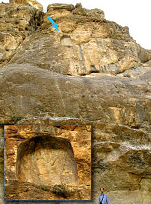
Tang-i Var, famous Assyrian inscription from reign of Sargon II is located about 30 km to north of Ravansar.


References edit
- Hassanzadeh, Y., M. Karami, F. Bahrol’oloomi, K. Taheri, A. Tahmasbi, A. Moradi Bisetouni and F. Biglari (2010) Khanileh: "New evidence of Chalcolithic and Early Historic occupations from northwest of the Kermanshah Plain, Central Zagros", Iranian Journal of Archaeology and History.
- Parpola, S. & M. Porter (2001)
The Helsinki Atlas of the Near East in the Neo-Assyrian Period, Edited by: Simo Parpola & Michael Porter, The Casco Bay Assyriological Institute The Neo-Assyrian Text Corpus Project, Finland.
- Radner, K., (2003) "A Median Sanctuary at Bit-Ištar". In G.B. Lanfranchi, M. Roaf & R. Rollinger (ed.), Continuity of Empire: Assyria, Media, Persia. History of the Ancient Near East Monographs 5 (Padova 2003) 119-130.